Area Overview for CR9 2LQ
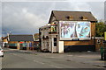
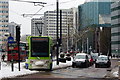
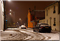
Photos of CR9 2LQ

Area Information
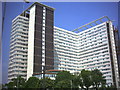
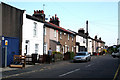
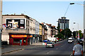
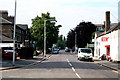
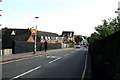
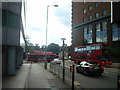
CR9 2LQ lies at the heart of Croydon’s town centre, a small residential cluster within the Fairfield electoral ward. With a population of 1,628, it reflects the character of a mature urban community, shaped by its proximity to retail, office, and cultural hubs. The area’s history is rooted in Croydon’s Fair Field, once a site of annual fairs and later a railway corridor, now home to Fairfield Halls—a modernist arts and conference venue redeveloped in recent years. Daily life here is defined by easy access to Croydon’s commercial core, with nearby tram stops, rail stations, and a mix of retail outlets. The ward’s boundaries were adjusted in 2018, separating it from housing areas, leaving it focused on town-centre dynamics. Residents benefit from a blend of urban convenience and cultural landmarks, though the area’s compact size means it is best suited for those prioritising accessibility over expansive green spaces.
- Area Type
- Postcode
- Area Size
- Not available
- Population
- Not available
- Population Density
- Not available
CR9 2LQ is a rental-dominated area, with only 14% of properties owned by residents. The housing stock is largely composed of flats, a typical feature of urban centres. This suggests a market where property ownership is less common, and rental demand is high. The small area’s limited housing stock means buyers must consider nearby zones for more options. Flats in this area are likely to be smaller, prioritising convenience over space. For those seeking to buy, the proximity to Croydon’s retail and office core may be a draw, though the area’s compact size means competition for available properties is likely.
House Prices in CR9 2LQ
No properties found in this postcode.
Energy Efficiency in CR9 2LQ
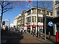
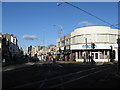
CR9 2LQ offers a mix of retail, dining, and cultural amenities within practical reach. Nearby shops include Co-op Croydon, Tesco Croydon, and M&S Croydon, providing everyday convenience. The area’s proximity to Croydon town centre means residents can access a wide range of services, from cafes to larger supermarkets. Cultural landmarks like Fairfield Halls add to the area’s appeal, offering events and entertainment. The presence of multiple tram stops and rail stations enhances mobility, making it easy to explore the surrounding region. While green spaces are limited, the urban setting is compensated by the vibrancy of Croydon’s retail and cultural offerings.
Amenities
Schools
The nearest school to CR9 2LQ is St Mary’s Catholic Infant School, which serves as both a primary school and an academy with a good Ofsted rating. This dual designation suggests it caters to younger children with a structured educational approach. The school’s rating indicates a reliable standard of teaching, which is important for families prioritising academic outcomes. However, no secondary schools are listed in the data, so parents may need to look beyond the immediate area for comprehensive schooling. The presence of a well-rated primary school is a key asset for families in CR9 2LQ.
| Rank | School | Type | Entry gender | Ages |
|---|
Explore more schools in this area
Go to Schools tabDemographics
The population of CR9 2LQ has a median age of 47, with the majority of residents falling within the 30–64 age range. This indicates a community of established adults, likely drawn to the area for its urban amenities and transport links. Home ownership is low, at 14%, suggesting that most residents are renters, a trend common in central London boroughs. The predominant accommodation type is flats, reflecting the area’s compact residential character. The predominant ethnic group is White, though no further breakdown is provided. The low home ownership rate may impact community stability, but the mature age profile suggests a settled, experienced population.
Household Size
Accommodation Type
Tenure
Ethnic Group
Religion
Household Composition
Age
Household Deprivation
NS-SEC
Explore more demographic insights in this area
Go to Demographics tabPlanning
Planning Constraints
- Flood RiskPremium
- Ramsar Wetland SitesPremium
- Area of Outstanding Natural BeautyPremium
- Protected Nature ReservePremium
- Protected WoodlandPremium