Area Overview for CR9 2LL
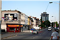
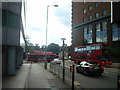
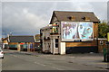
Photos of CR9 2LL


Area Information
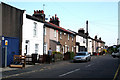
Living in CR9 2LL means being part of a small, tightly knit residential cluster in the London Borough of Croydon. With a population of 2,350, this area offers a quiet, community-focused lifestyle just south-east of Charing Cross. Historically rooted in Surrey, Selhurst’s name derives from Old English, reflecting its long-standing connection to woodland and settlement. The area’s proximity to Croydon’s transport hubs and retail centres makes it practical for commuters, while its modest size fosters a sense of familiarity. Daily life here is shaped by its residential character, with a focus on local amenities and schools. The presence of multiple primary schools and accessible rail links underscores its appeal for families. Though small, CR9 2LL sits within a broader network of services, balancing suburban tranquillity with urban connectivity. For those seeking a manageable, well-served neighbourhood, this postcode offers a blend of historical charm and modern convenience.
- Area Type
- Postcode
- Area Size
- Not available
- Population
- Not available
- Population Density
- Not available
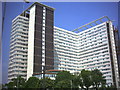
CR9 2LL’s property market is characterised by a low home ownership rate of 36%, with flats making up the majority of housing stock. This suggests a rental-dominated market, where demand for flats may be driven by commuters seeking affordable, manageable living spaces. The small area’s limited size means property choices are constrained, with little scope for expansion. For buyers, this implies a focus on existing flats rather than new builds, though the area’s proximity to Croydon’s transport links could make it attractive to investors. The low ownership rate also indicates that many residents may be renting long-term, possibly due to the area’s role as a commuter suburb. Prospective buyers should consider the limited inventory and the potential for competition in a niche market.
House Prices in CR9 2LL
No properties found in this postcode.
Energy Efficiency in CR9 2LL
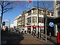
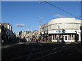
The lifestyle in CR9 2LL is shaped by its proximity to retail, dining, and transport hubs. Nearby shops include Co-op Selhurst, Tesco Croydon, and Lidl Selhurst, providing essential services and grocery options. The area’s rail and metro stations, such as Selhurst and East Croydon, offer seamless access to London’s broader network, facilitating both daily commutes and weekend excursions. While specific parks or leisure facilities are not listed, the availability of multiple retail and transport points suggests a focus on convenience over expansive green spaces. The mix of local amenities and connectivity ensures residents can meet daily needs without venturing far, fostering a practical, community-oriented way of life.
Amenities
Schools
CR9 2LL is served by several primary schools, including Broadmead Junior School, Broadmead Nursery and Infant School, and Broadmead Primary School. One of these, Broadmead Primary School, holds an Ofsted rating of ‘good’, reflecting a standard of education that meets expectations. The concentration of primary schools in the area makes it particularly appealing for families with young children, offering multiple options for early education. The presence of multiple schools also suggests a focus on localised schooling, reducing the need for long commutes. While no secondary schools are listed, the primary options available provide a solid foundation for families prioritising convenience and established educational infrastructure.
| Rank | School | Type | Entry gender | Ages |
|---|
Explore more schools in this area
Go to Schools tabDemographics
CR9 2LL’s population skews towards adults aged 30–64, with a median age of 47. This suggests a mature, stable community, likely with established careers and families. Home ownership here is relatively low at 36%, indicating that a significant portion of the housing stock is rented. The predominant accommodation type is flats, reflecting a mix of purpose-built and converted properties. The majority of residents identify as White, though no specific data on other ethnic groups is provided. The age profile and ownership figures suggest a community that prioritises rental flexibility, possibly due to the area’s compact size and proximity to employment centres. While deprivation data is not explicitly stated, the mix of renters and older residents may influence local services and amenities.
Household Size
Accommodation Type
Tenure
Ethnic Group
Religion
Household Composition
Age
Household Deprivation
NS-SEC
Explore more demographic insights in this area
Go to Demographics tabPlanning
Planning Constraints
- Flood RiskPremium
- Ramsar Wetland SitesPremium
- Area of Outstanding Natural BeautyPremium
- Protected Nature ReservePremium
- Protected WoodlandPremium