Area Overview for CR9 2LB
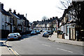
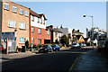
Photos of CR9 2LB


Area Information
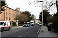
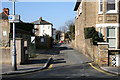
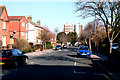
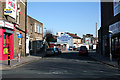
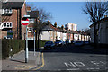
Living in CR9 2LB means inhabiting a small residential cluster in the London Borough of Croydon, historically part of Surrey. With a population of 2,350, this area is compact yet connected to the broader Croydon network. Its name derives from Old English, reflecting centuries of settlement, though modern development has shaped its character. Selhurst, where CR9 2LB lies, is 7.8 miles from Charing Cross, placing it within easy reach of central London. The area benefits from transport links like Selhurst Station, opened in 1865, and nearby tram stops, ensuring accessibility to jobs and services. Daily life here is defined by proximity to retail hubs such as Co-op Selhurst and Tesco Croydon, alongside a mix of primary schools. The community, predominantly adults aged 30–64, reflects a mature demographic with a focus on stability. While not a historic district, its blend of practical amenities and transport options makes it a functional choice for those seeking a balance between suburban comfort and urban connectivity.
- Area Type
- Postcode
- Area Size
- Not available
- Population
- Not available
- Population Density
- Not available
The property market in CR9 2LB is characterised by a high proportion of rented flats, with only 36% of homes owned by residents. This suggests a rental-heavy market, likely driven by the area’s compact size and the prevalence of flats, which are typically more suited to tenants than owner-occupiers. The limited availability of owner-occupied properties may make it challenging for buyers seeking long-term investment or family homes. Flats dominate the housing stock, which could appeal to those prioritising low-maintenance living or proximity to transport. However, the small area’s size means buyers may need to look beyond CR9 2LB itself for larger properties or more varied options. The market’s focus on rental units also implies competitive demand, with potential for steady returns for investors.
House Prices in CR9 2LB
No properties found in this postcode.
Energy Efficiency in CR9 2LB
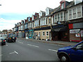
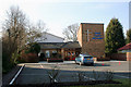
Residents of CR9 2LB enjoy a range of amenities within practical reach. Retail options include Co-op Selhurst, Tesco Croydon, and Co-op 61 Lower, providing everyday shopping convenience. The area’s transport links, including Selhurst Station and nearby tram stops, facilitate access to broader leisure and employment opportunities. While the data does not specify parks or recreational facilities, the proximity to Croydon’s urban centres suggests access to green spaces and cultural amenities. The mix of retail and transport options fosters a practical lifestyle, supporting both daily needs and mobility. The presence of multiple schools and transport hubs further enhances the area’s appeal, creating a self-contained environment for families and commuters alike.
Amenities
Schools
Residents of CR9 2LB have access to four primary schools within proximity: Broadmead Junior School, Broadmead Nursery and Infant School, Broadmead Primary School, and another Broadmead Primary School rated ‘good’ by Ofsted. This concentration of primary schools provides multiple options for families, ensuring flexibility in choosing a school that aligns with their needs. The presence of two schools with the same name may indicate a network of interconnected institutions, possibly serving different age groups or catchment areas. The ‘good’ rating at one school highlights a standard of education that meets official benchmarks, which is reassuring for parents. However, the lack of secondary schools in the data means families may need to look further afield for secondary education. Overall, the primary school options support a family-friendly environment, though broader educational needs require planning.
| Rank | School | Type | Entry gender | Ages |
|---|
Explore more schools in this area
Go to Schools tabDemographics
The community in CR9 2LB is predominantly composed of adults aged 30–64, with a median age of 47. This suggests a population skewed toward middle-aged residents, likely including professionals and families. Home ownership here is relatively low at 36%, indicating that a majority of residents rent their homes. The accommodation type is primarily flats, reflecting a housing stock suited to smaller households or those prioritising convenience over larger properties. The predominant ethnic group is White, though specific data on diversity is not provided. The demographic profile implies a stable, established community with limited generational turnover. For buyers, this suggests a market where rental properties dominate, and flats are the standard offering. The age range also hints at a population less likely to be transient, potentially offering a sense of continuity for new residents.
Household Size
Accommodation Type
Tenure
Ethnic Group
Religion
Household Composition
Age
Household Deprivation
NS-SEC
Explore more demographic insights in this area
Go to Demographics tabPlanning
Planning Constraints
- Flood RiskPremium
- Ramsar Wetland SitesPremium
- Area of Outstanding Natural BeautyPremium
- Protected Nature ReservePremium
- Protected WoodlandPremium