Area Overview for CR9 2HT
Photos of CR9 2HT


Area Information
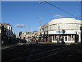
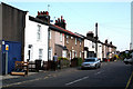
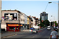
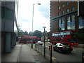
Living in CR9 2HT, a small residential cluster in the London Borough of Croydon, offers a blend of historical roots and modern convenience. With a population of 2,350, this area sits 7.8 miles south-east of Charing Cross, placing it within easy reach of central London while retaining a suburban character. Selhurst, the wider suburb encompassing CR9 2HT, has a history tied to the 19th-century railway network and the Croydon Canal, though its modern identity is defined by proximity to transport hubs and retail. Residents benefit from nearby rail stations, including East Croydon and Selhurst, which link to London and Brighton. The area’s compact size means amenities are within practical reach, from supermarkets to tram stops. While it lacks large-scale attractions, its accessibility to Croydon’s broader offerings—such as cultural venues and green spaces—makes it appealing for those prioritising connectivity over sprawling landscapes. The community here is defined by its proximity to transport, retail, and schools, making it a pragmatic choice for commuters and families.
- Area Type
- Postcode
- Area Size
- Not available
- Population
- Not available
- Population Density
- Not available
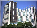
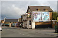
The property market in CR9 2HT is characterised by a high proportion of rental properties, with only 36% of homes owned by residents. This suggests a market skewed towards tenants, possibly due to the area’s role as a commuter hub or its proximity to larger urban centres. The accommodation type is predominantly flats, indicating a housing stock that may include purpose-built blocks, converted buildings, or modern developments. This density could mean limited availability of larger homes, making the area more suitable for single occupants or smaller families. Buyers should consider the small size of the postcode area, which may limit property choices, though nearby Croydon offers broader options. The focus on flats may also reflect planning constraints or historical development patterns, shaping the character of the neighbourhood.
House Prices in CR9 2HT
No properties found in this postcode.
Energy Efficiency in CR9 2HT
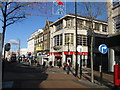
Residents of CR9 2HT have access to a range of amenities within walking or short-travel distance. Retail options include Co-op 61 Lower, Amazon Fresh, and Tesco Croydon, providing grocery and daily necessities. The area’s tram and rail networks connect to Croydon’s broader offerings, including leisure facilities, parks, and cultural attractions. While specific parks or recreational spaces are not listed, the proximity to Croydon suggests opportunities for outdoor activities. The mix of retail and transport infrastructure supports a convenient, practical lifestyle, ideal for those prioritising accessibility over sprawling green spaces. The presence of multiple schools and transport links also makes it suitable for families and commuters.
Amenities
Schools
Residents of CR9 2HT have access to multiple primary schools, including Broadmead Junior School, Broadmead Nursery and Infant School, and Broadmead Primary School. One of these, Broadmead Primary School, holds a ‘good’ Ofsted rating, indicating a reliable standard of education. The concentration of primary schools suggests a focus on early education, which is beneficial for families with young children. However, the absence of secondary schools in the immediate area means students may need to commute to nearby Croydon for higher education. The presence of multiple primary schools could ease pressure on individual institutions but may also reflect a prioritisation of primary-level infrastructure. For families, this mix offers options but requires planning for secondary schooling.
| Rank | School | Type | Entry gender | Ages |
|---|
Explore more schools in this area
Go to Schools tabDemographics
CR9 2HT’s population skews towards adults aged 30–64, with a median age of 47. This suggests a community of established professionals and families, rather than a student or younger demographic. Home ownership here is relatively low at 36%, indicating that a majority of residents are likely to rent. The accommodation type is predominantly flats, reflecting a housing stock shaped by post-war development and modern conversions. The predominant ethnic group is White, though no specific data on diversity or deprivation is provided. The age profile implies a stable, mature population, which may influence local services and social dynamics. With no data on deprivation, it is unclear how economic pressures might affect quality of life, but the low home ownership rate could suggest a reliance on rental markets and potentially higher housing costs.
Household Size
Accommodation Type
Tenure
Ethnic Group
Religion
Household Composition
Age
Household Deprivation
NS-SEC
Explore more demographic insights in this area
Go to Demographics tabPlanning
Planning Constraints
- Flood RiskPremium
- Ramsar Wetland SitesPremium
- Area of Outstanding Natural BeautyPremium
- Protected Nature ReservePremium
- Protected WoodlandPremium