Area Overview for CR9 1LR
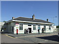
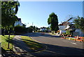
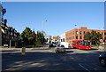
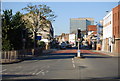
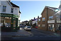
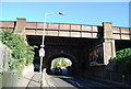
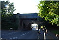
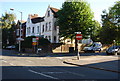
Photos of CR9 1LR
Area Information
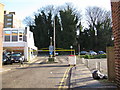
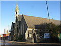
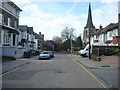
CR9 1LR is a small residential postcode area in the London Borough of Croydon, part of a cluster of homes near Croydon town centre. With a population of just 1,163, it is a compact community positioned within a broader urban context. The area’s character is shaped by its proximity to Croydon’s retail and office core, including landmarks such as Fairfield Halls, a cultural hub opened in 1962. Daily life here is defined by accessibility to transport networks, with multiple tram stops and railway stations within reach. The area is served by schools like Saffron Valley Collegiate and Moving On Pupil Referral Unit, though these are not traditional primary or secondary institutions. Residents benefit from strong digital connectivity, with broadband scores nearing 95 and mobile coverage at 85. While the area lacks large green spaces or protected natural sites, its urban location offers convenience for those prioritising proximity to employment, retail, and public transport. The community is predominantly middle-aged, with a median age of 47, and a mix of flats as the primary housing type. This makes CR9 1LR a practical choice for those seeking a compact, connected urban lifestyle.
- Area Type
- Postcode
- Area Size
- Not available
- Population
- Not available
- Population Density
- Not available
CR9 1LR is a small area with a limited housing stock, characterised by flats as the primary accommodation type. With a home ownership rate of 44%, the area is not heavily dominated by owner-occupied properties, suggesting that a majority of residents live in rental accommodations. This dynamic may reflect a mix of private and social housing, typical of urban centres. The compact nature of the postcode means property availability is constrained, and buyers should consider the broader Croydon area for more options. Flats in CR9 1LR are likely to be part of larger residential developments, possibly linked to nearby retail or office zones. For those seeking a home here, the small size of the area may limit choices, though proximity to transport hubs like South Croydon Station and East Croydon Railway Station could enhance property appeal. Buyers should also note that the area’s character is shaped by its urban setting, with limited green spaces but strong connectivity to Croydon’s town centre.
House Prices in CR9 1LR
No properties found in this postcode.
Energy Efficiency in CR9 1LR
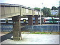
Living in CR9 1LR offers access to a range of amenities within walking or short transit distance. Retail options include major supermarkets like Tesco Croydon, Co-op London, and Sainsburys Croydon, ensuring convenience for shopping. The area’s transport links, including five tram stops and five rail stations, provide easy access to Croydon’s town centre and beyond. For leisure, the nearby Fairfield Halls—a cultural venue with arts and conference facilities—offers entertainment options, though it is not explicitly listed in the main data. Parks and open spaces are less detailed, but the area’s proximity to Croydon’s retail and office core suggests a focus on urban living over natural landscapes. The presence of multiple schools, albeit with unclear educational profiles, indicates a community-oriented environment. Overall, CR9 1LR is practical for those prioritising connectivity, retail, and transport over expansive green spaces.
Amenities
Schools
The schools near CR9 1LR include Saffron Valley Collegiate and Moving On Pupil Referral Unit, both listed as “other” in the data. Saffron Valley Collegiate appears twice in the list, but no Ofsted ratings or specific educational levels are provided. The presence of a pupil referral unit suggests the area may cater to students with additional needs, though it is unclear if this is the primary function of these institutions. Families seeking traditional primary or secondary schools may need to look beyond CR9 1LR, as the listed schools do not indicate a full range of educational options. The lack of detailed school data, such as performance metrics or student demographics, means prospective buyers cannot assess the quality of local education based on this information alone. For families prioritising schools, exploring nearby postcodes or commuting to Croydon’s broader educational offerings may be necessary.
| Rank | School | Type | Entry gender | Ages |
|---|
Explore more schools in this area
Go to Schools tabDemographics
The population of CR9 1LR has a median age of 47, with the most common age range being adults aged 30–64. This suggests a mature, stable community, though the area is not particularly young or elderly. Home ownership is relatively low at 44%, indicating that a significant portion of residents live in rented accommodation. The predominant housing type is flats, reflecting a residential cluster rather than a mix of detached or semi-detached properties. The predominant ethnic group is White, though specific data on diversity or deprivation is not provided. The age profile implies a community with established careers and families, though the lack of younger demographics may affect local schools and amenities. The low home ownership rate could signal a rental market dominated by private landlords or social housing. For prospective buyers, this suggests a limited pool of owner-occupied properties and a need to consider long-term rental viability. The absence of detailed diversity statistics means the area’s social composition remains partially opaque.
Household Size
Accommodation Type
Tenure
Ethnic Group
Religion
Household Composition
Age
Household Deprivation
NS-SEC
Explore more demographic insights in this area
Go to Demographics tabPlanning
Planning Constraints
- Flood RiskPremium
- Ramsar Wetland SitesPremium
- Area of Outstanding Natural BeautyPremium
- Protected Nature ReservePremium
- Protected WoodlandPremium