Area Overview for CR8 9DS
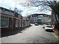
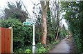
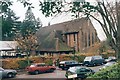
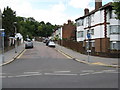
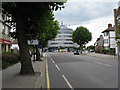
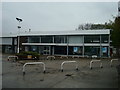
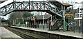
Photos of CR8 9DS


Area Information
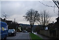
CR8 9DS is a small residential cluster in the London Borough of Croydon, part of the Purley Oaks and Riddlesdown electoral ward established in 2018. With a population of 1,530, it sits at the edge of Purley, bordering areas like Kenley, Coulsdon, and Woodcote. The area blends historical roots—dating back 800 years—with modern infrastructure. Residents benefit from proximity to Riddlesdown Common, a woodland managed by Croydon Council and the John Whitgift Foundation, and the broader Purley area, known for its commuter links and local amenities. Daily life here is shaped by its semi-rural character, with a focus on family homes and a community rooted in long-standing residential patterns. The postcode’s location offers a balance of suburban tranquillity and access to urban services, making it appealing to those seeking a quieter lifestyle within reach of London’s transport networks.
- Area Type
- Postcode
- Area Size
- Not available
- Population
- Not available
- Population Density
- Not available
CR8 9DS is predominantly an owner-occupied area, with 60% of homes owned by residents rather than rented. The accommodation type is primarily houses, suggesting a mix of semi-detached and detached properties typical of suburban Croydon. This contrasts with areas dominated by flats or rental stock, positioning CR8 9DS as a family-friendly zone with stable housing demand. The small size of the postcode means property options are limited, but the proximity to Purley and Sanderstead offers additional choices for buyers. The focus on owner-occupied homes indicates a community of long-term residents, which can influence property values and local character. For buyers, the area’s housing stock is likely to appeal to those prioritising space and a quieter lifestyle, though the limited inventory may require flexibility in location.
House Prices in CR8 9DS
No properties found in this postcode.
Energy Efficiency in CR8 9DS
Residents of CR8 9DS have access to a range of amenities within practical reach. Retail options include major supermarkets like Tesco Sanderstead and Sainsburys Purley, alongside Costco Croydon for larger shopping trips. Public transport is well-served by rail and tram networks, with stations like Purley Oaks and Sanderstead providing easy access to London. The area’s proximity to Riddlesdown Common offers recreational space, though it is managed by private entities and the John Whitgift Foundation. While the immediate vicinity lacks extensive dining or leisure venues, the broader Purley area likely provides additional options. The combination of suburban tranquillity and urban connectivity supports a lifestyle balancing convenience with a quieter environment.
Amenities
Schools
Residents of CR8 9DS have access to two independent schools: The Croydon and District Education Trust (Cadet) and Croydon & District Education Trust. Both are private institutions, offering alternative educational pathways to state schools. The presence of independent schools may attract families seeking fee-paying education, though no Ofsted ratings are provided to assess their performance. The mix of school types in the area—though limited to independent options—could influence choices for parents prioritising specific curricula or facilities. However, the absence of state schools in the immediate vicinity means families may need to travel to nearby wards for public education options.
| Rank | School | Type | Entry gender | Ages |
|---|
Explore more schools in this area
Go to Schools tabDemographics
The population of CR8 9DS has a median age of 47, with the majority of residents aged between 30 and 64. This suggests a community skewed towards established adults, likely including families and professionals. Home ownership is high, at 60%, with houses being the predominant type of accommodation. The predominant ethnic group is White, reflecting the broader demographic trends in Croydon. While no specific data on deprivation is provided, the age profile and home ownership rates indicate a stable, mature population with long-term residential ties. The absence of significant diversity data means the community’s cultural makeup remains less defined, but the area’s history as part of the Purley area—once a Surrey village—hints at a traditional, locally rooted demographic.
Household Size
Accommodation Type
Tenure
Ethnic Group
Religion
Household Composition
Age
Household Deprivation
NS-SEC
Explore more demographic insights in this area
Go to Demographics tabPlanning
Planning Constraints
- Flood RiskPremium
- Ramsar Wetland SitesPremium
- Area of Outstanding Natural BeautyPremium
- Protected Nature ReservePremium
- Protected WoodlandPremium