Area Overview for CR8 3ZQ
Photos of CR8 3ZQ

Area Information
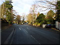
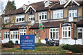
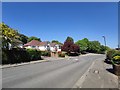
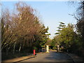
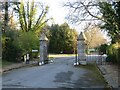
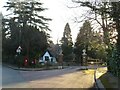
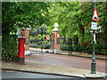
CR8 3ZQ is a small, densely populated residential postcode in the London Borough of Croydon, situated approximately 11.7 miles south of Charing Cross. With 1,644 residents in a compact area, it reflects the suburban character of Purley and Woodcote, where early 20th-century developments blend with modern infrastructure. The area is anchored by Purley High Street and Woodcote Village Green, offering a mix of private estates like the gated Webb Estate—known for its Edwardian homes and garden village ambiance—and contemporary amenities. Historically, the name "Purley" traces back to a 12th-century estate, with the area shaped by events like WWII air raids and the remnants of the Surrey Iron Railway. Today, it balances quiet residential life with proximity to transport hubs, schools, and retail. The population density of 1,406 people per square kilometre suggests a tightly knit community, where daily life revolves around local shops, schools, and green spaces. For buyers, this postcode offers a blend of heritage and practicality, ideal for those seeking a stable, family-oriented environment near London’s expanding transport networks.
- Area Type
- Postcode
- Area Size
- Not available
- Population
- 1644
- Population Density
- 1406 people/km²
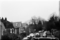
CR8 3ZQ is characterised by a high home ownership rate of 87%, with houses forming the predominant accommodation type. This suggests a market skewed towards owner-occupied properties, particularly family homes, rather than rental units. The concentration of houses implies a stable, long-term housing stock, with properties likely to retain value due to their scarcity in a densely populated area. The small postcode size means buyers must consider surrounding neighbourhoods like Purley Oaks and Riddlesdown for additional options. For those seeking homes in CR8 3ZQ, the market reflects a demand for private, spacious residences, with the Webb Estate’s Edwardian homes exemplifying the area’s architectural heritage. However, the limited number of properties within the postcode may necessitate broader searches, though proximity to transport and amenities ensures strong connectivity for residents. This makes CR8 3ZQ appealing to buyers prioritising security, family-friendly living, and historical charm.
House Prices in CR8 3ZQ
No properties found in this postcode.
Energy Efficiency in CR8 3ZQ
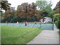
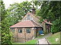
Daily life in CR8 3ZQ is enriched by its mix of suburban tranquillity and accessible amenities. The area’s retail options include major supermarkets like Tesco Purley and Sainsburys Purley, alongside the Co-op in Wallington, ensuring convenience for grocery shopping. For leisure, the Webb Estate offers a gated community with landscaped gardens and private schools, while Woodcote Village Green provides open space for recreation. The nearby Bourne River, though culverted, adds a natural element to the landscape. Transport links are robust, with rail and tram stops facilitating easy access to London and surrounding areas. The character of the area is defined by its blend of historical estates and modern infrastructure, offering both privacy and connectivity. Residents can enjoy a balance of quiet living and proximity to essential services, making it ideal for families and professionals seeking a stable, well-connected environment.
Amenities
Schools
Residents of CR8 3ZQ have access to several educational institutions, including Lodge School, Downside School, Laleham Lea School, and Downside Lodge Preparatory School, all of which are independent. Tudor Lodge School, a special needs institution, provides additional options for families with specific educational requirements. The presence of multiple independent schools suggests a focus on private education, potentially catering to families seeking structured, high-quality schooling. However, the data does not include Ofsted ratings, so performance metrics are not available. The variety of school types indicates a range of choices, from preparatory to specialist provision, though the absence of state schools means public education options are not listed. For families prioritising independent schooling, this area offers a cluster of well-established institutions, though buyers should consider proximity to specific schools when evaluating properties.
| Rank | School | Type | Entry gender | Ages |
|---|---|---|---|---|
| 1 | Lodge School | independent | N/A | N/A |
| 2 | Downside School | independent | N/A | N/A |
| 3 | Laleham Lea School | independent | N/A | N/A |
| 4 | Tudor Lodge School | special | N/A | N/A |
| 5 | Downside Lodge Preparatory School | independent | N/A | N/A |
Explore more schools in this area
Go to Schools tabDemographics
CR8 3ZQ has a median age of 47, with the majority of residents aged 30–64, indicating a mature, established community. Home ownership is high at 87%, reflecting a predominantly owner-occupied area with a focus on long-term residency. The accommodation type is primarily houses, suggesting a mix of family homes and larger properties. The predominant ethnic group is White, though specific diversity metrics are not provided. This demographic profile aligns with a low deprivation profile, as the area’s stability and infrastructure support a quality of life centred on private living and community continuity. The age range suggests a population with strong ties to local institutions, such as schools and amenities, while the high home ownership rate indicates a preference for settled, family-oriented living. The absence of detailed diversity data means broader social dynamics remain less defined, but the data underscores a cohesive, middle-aged demographic with a focus on residential security and suburban convenience.
Household Size
Accommodation Type
Tenure
Ethnic Group
Religion
Household Composition
Age
Household Deprivation
NS-SEC
Explore more demographic insights in this area
Go to Demographics tabPlanning
Planning Constraints
- Flood RiskPremium
- Ramsar Wetland SitesPremium
- Area of Outstanding Natural BeautyPremium
- Protected Nature ReservePremium
- Protected WoodlandPremium
- Crime RiskPremium