Area Overview for CR8 3JB
Photos of CR8 3JB
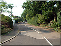
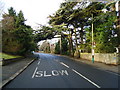
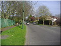
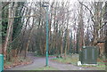
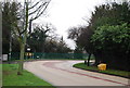
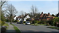
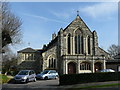
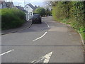
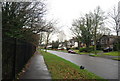
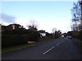
58 photos from this area
Area Information
Key information about the CR8 3JB including its size, population, and administrative classification.
- Area Type
- Postcode
- Area Size
- 2.2 hectares
- Population
- 1644
- Population Density
- 1406 people/km²
House Prices in CR8 3JB
25
Properties
£577,213
Average Sold Price
£100,000
Lowest Price
£1,000,000
Highest Price
Showing 25 properties
| Address | Type | Beds | Baths | Last Sale Price | Last Sale Date | |
|---|---|---|---|---|---|---|
| 17 The Bridle Road, Purley, CR8 3JB | Detached | 5 | 3 | £1,000,000 | Jun 2023 | |
| 25 The Bridle Road, Purley, CR8 3JB | Semi-detached | 1 | 1 | £835,500 | Jun 2021 | |
| 13 The Bridle Road, Purley, CR8 3JB | house | - | - | £901,000 | Jun 2021 | |
| 9A The Bridle Road, Purley, CR8 3JB | Flat | 3 | 2 | £390,000 | Jul 2019 | |
| 7A The Bridle Road, Purley, CR8 3JB | Maisonette | - | - | £255,000 | Nov 2018 | |
| 7 The Bridle Road, Purley, CR8 3JB | Flat | - | - | £100,000 | Nov 2018 | |
| 11 The Bridle Road, Purley, CR8 3JB | house | - | - | £830,000 | Nov 2017 | |
| 29 The Bridle Road, Purley, CR8 3JB | house | - | - | £989,000 | Oct 2016 | |
| 19 The Bridle Road, Purley, CR8 3JB | house | 5 | - | £790,000 | May 2011 | |
| 33 The Bridle Road, Purley, CR8 3JB | house | - | - | £590,000 | May 2011 |
Page 1 of 3
Energy Efficiency in CR8 3JB
Amenities
Schools
| Rank | School | Type | Entry gender | Ages |
|---|
Explore more schools in this area
Go to Schools tabDemographics
Household Size
Family (3-5 people)
most common
Accommodation Type
Houses
most common
Tenure
87
majority
Ethnic Group
White
most common
Religion
N/A
most common
Household Composition
N/A
most common
Age
47
median
Adults (30-64 years)
most common
Household Deprivation
N/A
with no deprivation
NS-SEC
53
in Lower managerial occupations
Explore more demographic insights in this area
Go to Demographics tabPlanning
Planning Constraints
- Flood RiskPremium
- Ramsar Wetland SitesPremium
- Area of Outstanding Natural BeautyPremium
- Protected Nature ReservePremium
- Protected WoodlandPremium