Area Overview for CR7 8LP
Photos of CR7 8LP
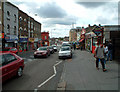
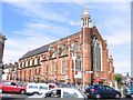
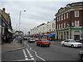
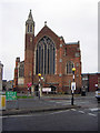
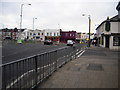
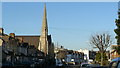
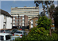
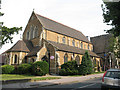
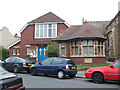


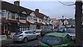
100 photos from this area
Area Information
Key information about the CR7 8LP including its size, population, and administrative classification.
- Area Type
- Postcode
- Area Size
- 4592 m²
- Population
- 1632
- Population Density
- 11666 people/km²
House Prices in CR7 8LP
27
Properties
£360,909
Average Sold Price
£115,000
Lowest Price
£650,000
Highest Price
Showing 27 properties
| Address | Type | Beds | Baths | Last Sale Price | Last Sale Date | |
|---|---|---|---|---|---|---|
| 95 Woodville Road, Thornton Heath, CR7 8LP | house | - | - | £650,000 | Nov 2024 | |
| 93 Woodville Road, Thornton Heath, CR7 8LP | house | - | - | £650,000 | Nov 2024 | |
| 85 Woodville Road, Thornton Heath, CR7 8LP | Semi-detached | 4 | 2 | £540,000 | Feb 2024 | |
| 99 Woodville Road, Thornton Heath, CR7 8LP | Retail | 3 | 1 | £475,000 | Nov 2021 | |
| 117 Woodville Road, Thornton Heath, CR7 8LP | Terraced | 3 | 2 | £460,000 | Oct 2021 | |
| 103 Woodville Road, Thornton Heath, CR7 8LP | Flat | - | - | £240,000 | Nov 2020 | |
| 111 Woodville Road, Thornton Heath, CR7 8LP | Terraced | 3 | 1 | £446,500 | Sep 2017 | |
| 83 Woodville Road, Thornton Heath, CR7 8LP | house | 3 | 1 | £445,000 | Sep 2017 | |
| 91 Woodville Road, Thornton Heath, CR7 8LP | Terraced | 3 | - | £405,000 | May 2017 | |
| 107 Woodville Road, Thornton Heath, CR7 8LP | house | - | - | £231,000 | Jul 2013 |
Page 1 of 3
Energy Efficiency in CR7 8LP
Amenities
Schools
| Rank | School | Type | Entry gender | Ages |
|---|
Explore more schools in this area
Go to Schools tabDemographics
Household Size
Family (3-5 people)
most common
Accommodation Type
Houses
most common
Tenure
64
majority
Ethnic Group
black_total
most common
Religion
N/A
most common
Household Composition
N/A
most common
Age
47
median
Adults (30-64 years)
most common
Household Deprivation
N/A
with no deprivation
NS-SEC
32
in Lower managerial occupations
Explore more demographic insights in this area
Go to Demographics tabPlanning
Planning Constraints
- Flood RiskPremium
- Ramsar Wetland SitesPremium
- Area of Outstanding Natural BeautyPremium
- Protected Nature ReservePremium
- Protected WoodlandPremium