Area Overview for CR7 8JH
Photos of CR7 8JH
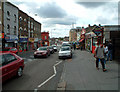
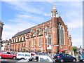
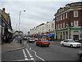
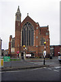
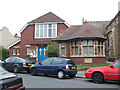
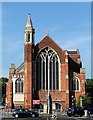
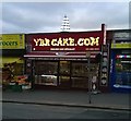
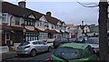
100 photos from this area
Area Information
Key information about the CR7 8JH including its size, population, and administrative classification.
- Area Type
- Postcode
- Area Size
- 1.7 hectares
- Population
- Not available
- Population Density
- Not available
House Prices in CR7 8JH
100
Properties
£310,000
Average Sold Price
£80,000
Lowest Price
£600,000
Highest Price
Showing 100 properties
| Address | Type | Beds | Baths | Last Sale Price | Last Sale Date | |
|---|---|---|---|---|---|---|
| 45 Beulah Road, Thornton Heath, CR7 8JH | Semi-detached | 4 | 2 | £555,000 | Dec 2024 | |
| 13A Beulah Road, Thornton Heath, CR7 8JH | Flat | - | - | £263,000 | Feb 2023 | |
| 53A Beulah Road, Thornton Heath, CR7 8JH | Flat | 2 | - | £315,000 | Nov 2022 | |
| 7 Beulah Road, Thornton Heath, CR7 8JH | Maisonette | 2 | - | £375,000 | Mar 2021 | |
| 53 Beulah Road, Thornton Heath, CR7 8JH | Flat | - | - | £285,000 | Nov 2020 | |
| Beulah Lodge, 51 Beulah Road, Thornton Heath, CR7 8JH | house | - | - | £600,000 | Oct 2017 | |
| 33 Beulah Road, Thornton Heath, CR7 8JH | house | 5 | 3 | £350,000 | Aug 2009 | |
| 39A Beulah Road, Thornton Heath, CR7 8JH | Flat | - | - | £180,000 | Dec 2007 | |
| 13 Beulah Road, Thornton Heath, CR7 8JH | Flat | - | - | £173,000 | Apr 2007 | |
| 57B Beulah Road, Thornton Heath, CR7 8JH | Flat | 1 | 1 | £80,000 | Feb 2007 |
Page 1 of 10
Energy Efficiency in CR7 8JH
Amenities
Schools
| Rank | School | Type | Entry gender | Ages |
|---|
Explore more schools in this area
Go to Schools tabDemographics
Household Size
Family (3-5 people)
most common
Accommodation Type
Houses
most common
Tenure
38
majority
Ethnic Group
black_total
most common
Religion
N/A
most common
Household Composition
N/A
most common
Age
47
median
Adults (30-64 years)
most common
Household Deprivation
N/A
with no deprivation
NS-SEC
22
in Lower managerial occupations
Explore more demographic insights in this area
Go to Demographics tabPlanning
Planning Constraints
- Flood RiskPremium
- Ramsar Wetland SitesPremium
- Area of Outstanding Natural BeautyPremium
- Protected Nature ReservePremium
- Protected WoodlandPremium