Area Overview for CR7 8HE
Photos of CR7 8HE
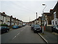
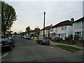
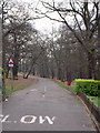
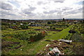
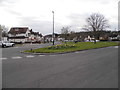
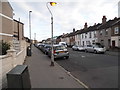
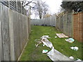
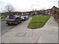
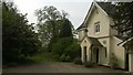
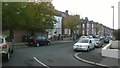
93 photos from this area
Area Information
Key information about the CR7 8HE including its size, population, and administrative classification.
- Area Type
- Postcode
- Area Size
- 7036 m²
- Population
- Not available
- Population Density
- Not available
House Prices in CR7 8HE
34
Properties
£240,418
Average Sold Price
£58,995
Lowest Price
£560,000
Highest Price
Showing 34 properties
| Address | Type | Beds | Baths | Last Sale Price | Last Sale Date | |
|---|---|---|---|---|---|---|
| 4 Windsor Road, Thornton Heath, CR7 8HE | Terraced | 2 | 1 | £340,000 | Jan 2024 | |
| 34 Windsor Road, Thornton Heath, CR7 8HE | Terraced | 4 | 2 | £560,000 | May 2023 | |
| 46 Windsor Road, Thornton Heath, CR7 8HE | house | - | - | £310,000 | Mar 2021 | |
| 12 Windsor Road, Thornton Heath, CR7 8HE | house | 1 | 1 | £335,000 | Jul 2018 | |
| 28 Windsor Road, Thornton Heath, CR7 8HE | house | - | - | £377,000 | Dec 2017 | |
| 14 Windsor Road, Thornton Heath, CR7 8HE | Terraced | 2 | 2 | £380,000 | Sep 2017 | |
| 32 Windsor Road, Thornton Heath, CR7 8HE | Terraced | 2 | - | £350,000 | Apr 2017 | |
| 60 Windsor Road, Thornton Heath, CR7 8HE | Terraced | 2 | - | £326,000 | Mar 2017 | |
| 10 Windsor Road, Thornton Heath, CR7 8HE | Terraced | 3 | 1 | £320,000 | Jul 2016 | |
| 22 Windsor Road, Thornton Heath, CR7 8HE | Terraced | 2 | 2 | £335,000 | Jun 2016 |
Page 1 of 4
Energy Efficiency in CR7 8HE
Amenities
Schools
| Rank | School | Type | Entry gender | Ages |
|---|
Explore more schools in this area
Go to Schools tabDemographics
Household Size
Family (3-5 people)
most common
Accommodation Type
Houses
most common
Tenure
38
majority
Ethnic Group
black_total
most common
Religion
N/A
most common
Household Composition
N/A
most common
Age
47
median
Adults (30-64 years)
most common
Household Deprivation
N/A
with no deprivation
NS-SEC
22
in Lower managerial occupations
Explore more demographic insights in this area
Go to Demographics tabPlanning
Planning Constraints
- Flood RiskPremium
- Ramsar Wetland SitesPremium
- Area of Outstanding Natural BeautyPremium
- Protected Nature ReservePremium
- Protected WoodlandPremium