Area Overview for CR7 8EN
Photos of CR7 8EN

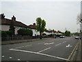
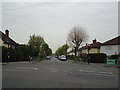
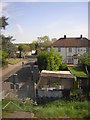
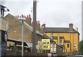


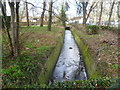

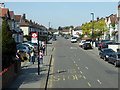
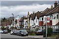
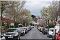
57 photos from this area
Area Information
Key information about the CR7 8EN including its size, population, and administrative classification.
- Area Type
- Postcode
- Area Size
- 1.5 hectares
- Population
- 1852
- Population Density
- 5577 people/km²
House Prices in CR7 8EN
32
Properties
£406,201
Average Sold Price
£96,500
Lowest Price
£835,000
Highest Price
Showing 32 properties
| Address | Type | Beds | Baths | Last Sale Price | Last Sale Date | |
|---|---|---|---|---|---|---|
| 99 Virginia Road, Thornton Heath, CR7 8EN | Semi-detached | 3 | 1 | £560,000 | Jun 2024 | |
| 91 Virginia Road, Thornton Heath, CR7 8EN | Semi-detached | 3 | 1 | £670,000 | Oct 2023 | |
| 75 Virginia Road, Thornton Heath, CR7 8EN | house | - | - | £835,000 | Mar 2021 | |
| 49 Virginia Road, Thornton Heath, CR7 8EN | Semi-detached | 3 | 1 | £495,000 | Feb 2020 | |
| 81 Virginia Road, Thornton Heath, CR7 8EN | Semi-detached | 3 | 1 | £560,000 | Jan 2018 | |
| 89 Virginia Road, Thornton Heath, CR7 8EN | Semi-detached | 5 | - | £620,000 | Jan 2017 | |
| 69 Virginia Road, Thornton Heath, CR7 8EN | Detached | 5 | 3 | £540,000 | Nov 2016 | |
| 105 Virginia Road, Thornton Heath, CR7 8EN | house | - | - | £450,000 | Aug 2016 | |
| 101 Virginia Road, Thornton Heath, CR7 8EN | Semi-detached | 5 | - | £690,000 | Mar 2015 | |
| 51 Virginia Road, Thornton Heath, CR7 8EN | Semi-detached | 5 | 2 | £576,000 | Feb 2015 |
Page 1 of 4
Energy Efficiency in CR7 8EN
Amenities
Schools
| Rank | School | Type | Entry gender | Ages |
|---|
Explore more schools in this area
Go to Schools tabDemographics
Household Size
Family (3-5 people)
most common
Accommodation Type
Houses
most common
Tenure
68
majority
Ethnic Group
White
most common
Religion
N/A
most common
Household Composition
N/A
most common
Age
47
median
Adults (30-64 years)
most common
Household Deprivation
N/A
with no deprivation
NS-SEC
33
in Lower managerial occupations
Explore more demographic insights in this area
Go to Demographics tabPlanning
Planning Constraints
- Flood RiskPremium
- Ramsar Wetland SitesPremium
- Area of Outstanding Natural BeautyPremium
- Protected Nature ReservePremium
- Protected WoodlandPremium