Area Overview for CR7 8BJ
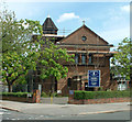
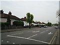
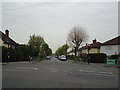
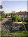
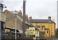
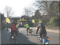
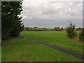
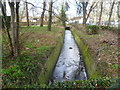
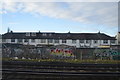
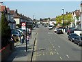
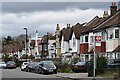
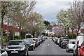
Photos of CR7 8BJ
Area Information
Living in CR7 8BJ means being part of a densely populated, small-scale residential cluster in south London. With a population of 1,739 spread across just 1.0 hectare, the area is compact yet rich in historical and communal layers. Situated near Norbury Park, a public green space with a history dating back to the 16th century, residents benefit from proximity to a well-maintained recreational area. The area’s character is shaped by its mix of older housing stock and proximity to transport hubs, making it a practical choice for those seeking balance between urban convenience and green space. While the population density is exceptionally high—over 172,000 people per square kilometre—the community’s tight-knit nature is evident in its local amenities and schools. CR7 8BJ is not a sprawling suburb but a focused, self-contained neighbourhood where daily life revolves around nearby shops, transport links, and the legacy of Norbury Park’s past as a golf course and later a public space.
- Area Type
- Postcode
- Area Size
- 1.0 hectares
- Population
- 1739
- Population Density
- 5847 people/km²
CR7 8BJ’s property market is defined by a 41% home ownership rate, meaning nearly two-thirds of residents rent. The area is predominantly composed of houses, which are less common in high-density urban zones. This suggests a mix of owner-occupied and rental properties, though the small area size limits the availability of new builds or larger homes. For buyers, this means a constrained market with limited choice, particularly for those seeking spacious or modern properties. The focus on houses may appeal to families, but the high population density could lead to competition for available listings. Proximity to transport links and schools might offset the area’s compact nature, but the lack of newer developments means buyers should consider the age and condition of properties. The market is likely to be competitive, with prices influenced by the area’s proximity to amenities and historical significance.
House Prices in CR7 8BJ
Showing 22 properties
| Address | Type | Beds | Baths | Last Sale Price | Last Sale Date | |
|---|---|---|---|---|---|---|
| 71 Green Lane, Thornton Heath, CR7 8BJ | house | - | - | £505,000 | Dec 2021 | |
| 91 Green Lane, Thornton Heath, CR7 8BJ | Semi-detached | - | - | £210,000 | Oct 2005 | |
| 83 Green Lane, Thornton Heath, CR7 8BJ | Terraced | - | - | £246,000 | Jan 2005 | |
| 73 Green Lane, Thornton Heath, CR7 8BJ | Semi-detached | - | - | £108,000 | Apr 2003 | |
| 85 Green Lane, Thornton Heath, CR7 8BJ | house | - | - | £79,950 | Aug 1997 | |
| 67 Green Lane, Thornton Heath, CR7 8BJ | Semi-detached | - | - | - | - | |
| 61 Green Lane, Thornton Heath, CR7 8BJ | house | - | - | - | - | |
| 69 Green Lane, Thornton Heath, CR7 8BJ | Semi-detached | - | - | - | - | |
| 81 Green Lane, Thornton Heath, CR7 8BJ | house | - | - | - | - | |
| 77 Green Lane, Thornton Heath, CR7 8BJ | Semi-detached | - | - | - | - |
Energy Efficiency in CR7 8BJ
CR7 8BJ’s residents have access to a range of amenities within walking distance. Retail options include Co-op Thornton, Iceland Norbury, and Co-op Norbury, providing essential shopping. The area’s transport links—rail, tram, ferry, and bus—ensure easy access to London’s broader network, while Norbury Park offers green space for recreation. The nearby Norbury Hall, a Grade II listed building, adds historical interest to the local landscape. The mix of shops, transport hubs, and public parks creates a convenient, active lifestyle. However, the high population density means amenities can be busy, and the limited number of leisure venues suggests a focus on practicality over luxury. For those prioritising accessibility and proximity to services, CR7 8BJ offers a compact, functional environment.
Amenities
Schools
CR7 8BJ is served by four primary schools, all named Kensington Avenue Primary School. One of these holds an Ofsted rating of ‘satisfactory’, while the others are not rated. This duplication of names may indicate separate campuses or phased redevelopments, though the data does not clarify. The presence of multiple primary schools within a small area offers families flexibility in choosing education options, though the lack of secondary schools or higher-rated institutions is notable. The ‘satisfactory’ rating suggests a baseline standard of education, but parents seeking higher performance may need to look beyond the immediate vicinity. The clustering of schools reflects the area’s focus on family-friendly infrastructure, though further data on academic outcomes or facilities would be needed to assess their quality comprehensively.
| Rank | School | Type | Entry gender | Ages |
|---|
Explore more schools in this area
Go to Schools tabDemographics
CR7 8BJ’s population skews towards adults aged 30–64, with a median age of 47. This suggests a community of established professionals and families, though the 41% home ownership rate indicates a significant portion of residents rent. The area is predominantly composed of houses, reflecting a more traditional housing stock compared to high-density flats. The predominant ethnic group is Black residents, though no further breakdown of diversity is provided. The high population density—over 172,000 people per square kilometre—means shared spaces and services are in constant use. While this can create a lively, communal atmosphere, it also places pressure on local infrastructure. The demographic profile suggests a stable, mature population, but the lack of data on deprivation levels means it’s unclear how this density impacts access to resources or quality of life.
Household Size
Accommodation Type
Tenure
Ethnic Group
Religion
Household Composition
Age
Household Deprivation
NS-SEC
Explore more demographic insights in this area
Go to Demographics tabPlanning
Planning Constraints
- Flood RiskPremium
- Ramsar Wetland SitesPremium
- Area of Outstanding Natural BeautyPremium
- Protected Nature ReservePremium
- Protected WoodlandPremium