Area Overview for CR7 7RX
Photos of CR7 7RX
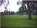
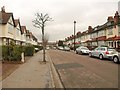

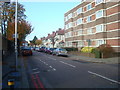
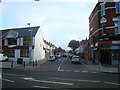
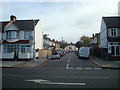
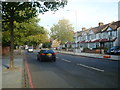
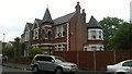
65 photos from this area
Area Information
Key information about the CR7 7RX including its size, population, and administrative classification.
- Area Type
- Postcode
- Area Size
- 2.7 hectares
- Population
- 1493
- Population Density
- 10757 people/km²
House Prices in CR7 7RX
51
Properties
£194,177
Average Sold Price
£65,000
Lowest Price
£435,000
Highest Price
Showing 51 properties
| Address | Type | Beds | Baths | Last Sale Price | Last Sale Date | |
|---|---|---|---|---|---|---|
| 127 Melfort Road, Thornton Heath, CR7 7RX | Maisonette | 3 | 1 | £298,500 | Jun 2018 | |
| 119B Melfort Road, Thornton Heath, CR7 7RX | Flat | 3 | - | £307,000 | Aug 2016 | |
| 107 Melfort Road, Thornton Heath, CR7 7RX | Flat | - | - | £435,000 | Mar 2014 | |
| 103A Melfort Road, Thornton Heath, CR7 7RX | Flat | 4 | 1 | £164,000 | Oct 2012 | |
| 129A Melfort Road, Thornton Heath, CR7 7RX | Flat | - | - | £173,000 | Jul 2008 | |
| 143 Melfort Road, Thornton Heath, CR7 7RX | Flat | 2 | 1 | £142,000 | Apr 2007 | |
| 117 Melfort Road, Thornton Heath, CR7 7RX | Flat | - | - | £140,000 | Nov 2005 | |
| 103 Melfort Road, Thornton Heath, CR7 7RX | Flat | 3 | - | £129,000 | Aug 2005 | |
| 141 Melfort Road, Thornton Heath, CR7 7RX | Terraced | 5 | 2 | £184,950 | Feb 2000 | |
| 135A Melfort Road, Thornton Heath, CR7 7RX | Flat | - | - | £65,000 | Oct 1998 |
Page 1 of 6
Energy Efficiency in CR7 7RX
Amenities
Schools
| Rank | School | Type | Entry gender | Ages |
|---|
Explore more schools in this area
Go to Schools tabDemographics
Household Size
Family (3-5 people)
most common
Accommodation Type
Flats
most common
Tenure
41
majority
Ethnic Group
black_total
most common
Religion
N/A
most common
Household Composition
N/A
most common
Age
47
median
Adults (30-64 years)
most common
Household Deprivation
N/A
with no deprivation
NS-SEC
24
in Lower managerial occupations
Explore more demographic insights in this area
Go to Demographics tabPlanning
Planning Constraints
- Flood RiskPremium
- Ramsar Wetland SitesPremium
- Area of Outstanding Natural BeautyPremium
- Protected Nature ReservePremium
- Protected WoodlandPremium