Area Overview for CR7 7QL
Photos of CR7 7QL

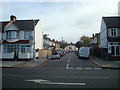
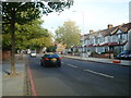
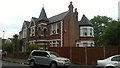
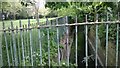
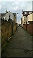
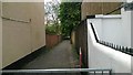
65 photos from this area
Area Information
Key information about the CR7 7QL including its size, population, and administrative classification.
- Area Type
- Postcode
- Area Size
- 7651 m²
- Population
- Not available
- Population Density
- Not available
House Prices in CR7 7QL
41
Properties
£264,436
Average Sold Price
£72,000
Lowest Price
£530,000
Highest Price
Showing 41 properties
| Address | Type | Beds | Baths | Last Sale Price | Last Sale Date | |
|---|---|---|---|---|---|---|
| 65 Stratford Road, Thornton Heath, CR7 7QL | Terraced | 4 | 2 | £475,000 | Jul 2025 | |
| 77 Stratford Road, Thornton Heath, CR7 7QL | Terraced | 3 | 1 | £450,000 | Mar 2025 | |
| 9 Stratford Road, Thornton Heath, CR7 7QL | Terraced | 3 | 1 | £425,000 | Feb 2025 | |
| 61 Stratford Road, Thornton Heath, CR7 7QL | Terraced | 3 | 2 | £530,000 | Aug 2024 | |
| 11 Stratford Road, Thornton Heath, CR7 7QL | house | 3 | 1 | £460,000 | Oct 2022 | |
| 35 Stratford Road, Thornton Heath, CR7 7QL | house | 3 | - | £410,000 | May 2021 | |
| 75 Stratford Road, Thornton Heath, CR7 7QL | house | - | - | £405,000 | Mar 2021 | |
| 45 Stratford Road, Thornton Heath, CR7 7QL | house | - | - | £285,000 | Jun 2020 | |
| 23 Stratford Road, Thornton Heath, CR7 7QL | Terraced | 4 | 2 | £420,000 | Jan 2018 | |
| 37 Stratford Road, Thornton Heath, CR7 7QL | Terraced | 4 | - | £288,500 | Feb 2014 |
Page 1 of 5
Energy Efficiency in CR7 7QL
Amenities
Schools
| Rank | School | Type | Entry gender | Ages |
|---|
Explore more schools in this area
Go to Schools tabDemographics
Household Size
Family (3-5 people)
most common
Accommodation Type
Houses
most common
Tenure
72
majority
Ethnic Group
black_total
most common
Religion
N/A
most common
Household Composition
N/A
most common
Age
47
median
Adults (30-64 years)
most common
Household Deprivation
N/A
with no deprivation
NS-SEC
34
in Lower managerial occupations
Explore more demographic insights in this area
Go to Demographics tabPlanning
Planning Constraints
- Flood RiskPremium
- Ramsar Wetland SitesPremium
- Area of Outstanding Natural BeautyPremium
- Protected Nature ReservePremium
- Protected WoodlandPremium