Area Overview for CR7 7NN
Photos of CR7 7NN
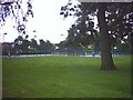
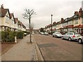

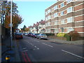
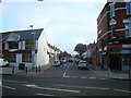
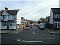
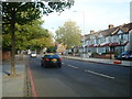


65 photos from this area
Area Information
Key information about the CR7 7NN including its size, population, and administrative classification.
- Area Type
- Postcode
- Area Size
- 1.2 hectares
- Population
- 1591
- Population Density
- 9060 people/km²
House Prices in CR7 7NN
39
Properties
£367,114
Average Sold Price
£92,000
Lowest Price
£710,000
Highest Price
Showing 39 properties
| Address | Type | Beds | Baths | Last Sale Price | Last Sale Date | |
|---|---|---|---|---|---|---|
| 67 Warwick Road, Thornton Heath, CR7 7NN | Detached | 4 | 1 | £710,000 | Feb 2025 | |
| 87 Warwick Road, Thornton Heath, CR7 7NN | Detached | 4 | 1 | £635,000 | Nov 2024 | |
| 77 Warwick Road, Thornton Heath, CR7 7NN | house | 4 | 1 | £565,000 | Aug 2022 | |
| 97 Warwick Road, Thornton Heath, CR7 7NN | Semi-detached | 4 | 2 | £510,000 | Dec 2020 | |
| 75 Warwick Road, Thornton Heath, CR7 7NN | Flat | - | - | £550,000 | Nov 2020 | |
| 79 Warwick Road, Thornton Heath, CR7 7NN | house | - | - | £149,980 | May 2015 | |
| 61 Warwick Road, Thornton Heath, CR7 7NN | Semi-detached | 2 | 1 | £480,000 | Jul 2014 | |
| 65 Warwick Road, Thornton Heath, CR7 7NN | Semi-detached | 4 | - | £370,000 | Sep 2013 | |
| 95 Warwick Road, Thornton Heath, CR7 7NN | Semi-detached | - | - | £369,950 | Sep 2007 | |
| 99 Warwick Road, Thornton Heath, CR7 7NN | Semi-detached | 4 | 2 | £308,000 | Nov 2006 |
Page 1 of 4
Energy Efficiency in CR7 7NN
Amenities
Schools
| Rank | School | Type | Entry gender | Ages |
|---|
Explore more schools in this area
Go to Schools tabDemographics
Household Size
Family (3-5 people)
most common
Accommodation Type
Houses
most common
Tenure
68
majority
Ethnic Group
black_total
most common
Religion
N/A
most common
Household Composition
N/A
most common
Age
47
median
Adults (30-64 years)
most common
Household Deprivation
N/A
with no deprivation
NS-SEC
29
in Lower managerial occupations
Explore more demographic insights in this area
Go to Demographics tabPlanning
Planning Constraints
- Flood RiskPremium
- Ramsar Wetland SitesPremium
- Area of Outstanding Natural BeautyPremium
- Protected Nature ReservePremium
- Protected WoodlandPremium