Area Overview for CR7 7AN
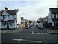
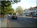
Photos of CR7 7AN


Area Information
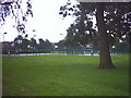
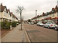
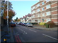
CR7 7AN is a small residential postcode area in south London, nestled within the Thornton Heath district of Croydon. With a population of just 1,499, it is a tight-knit community characterised by its historic roots and proximity to green spaces. The area retains echoes of its medieval past, including the ancient name Benchesham and the legacy of Whitehorse Manor, named after a 14th-century figure. Residents benefit from easy access to Thornton Heath Recreation Ground, a locally listed park acquired by Croydon Corporation in 1884. The area’s highest point, Pollard’s Hill, offers scenic views and tree-lined avenues, blending urban convenience with natural charm. Living here means navigating a compact, family-oriented environment with a mix of housing types and a strong sense of local identity. The postcode’s proximity to rail, tram, and ferry networks ensures connectivity to London’s broader infrastructure, making it a practical choice for those balancing suburban tranquillity with city accessibility.
- Area Type
- Postcode
- Area Size
- Not available
- Population
- 1499
- Population Density
- 14088 people/km²
The property market in CR7 7AN is defined by a 56% home ownership rate, with houses making up the majority of accommodation types. This suggests a predominantly owner-occupied area, likely attracting families and long-term residents. The limited size of the postcode means housing stock is concentrated, with fewer options for buyers compared to larger districts. The prevalence of houses over flats indicates a focus on single-family homes, which may appeal to those prioritising space and privacy. However, the small area size means buyers should consider nearby zones for broader choices. The market’s character is shaped by its historical context and proximity to green spaces, offering a blend of traditional architecture and modern amenities.
House Prices in CR7 7AN
No properties found in this postcode.
Energy Efficiency in CR7 7AN
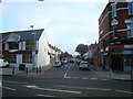
Daily life in CR7 7AN is enriched by accessible amenities. Retail options include Iceland Thornton, Tesco New, and Lidl Thornton, offering convenience for grocery shopping. The Thornton Heath Recreation Ground provides a historic park for leisure, while Pollard’s Hill offers scenic walks. Tram stops like Waddon Marsh and Ampere Way connect residents to nearby leisure spots. The area’s proximity to rail and ferry services enhances its appeal, allowing easy access to cultural hubs and employment centres. This blend of local parks, retail, and transport options creates a balanced lifestyle, supporting both routine needs and recreational activities.
Amenities
Schools
| Rank | School | Type | Entry gender | Ages |
|---|
Explore more schools in this area
Go to Schools tabDemographics
CR7 7AN’s population of 1,499 is predominantly composed of adults aged 30–64, with a median age of 47. This suggests a mature, stable community with established households. Home ownership rates stand at 56%, indicating a mix of owner-occupied properties and rentals. The area’s accommodation is largely houses, reflecting a preference for family homes over flats. The predominant ethnic group is Black, which shapes the cultural fabric of the neighbourhood. While specific data on deprivation is not provided, the demographic profile implies a community with a strong focus on long-term residency and family living. The absence of detailed socioeconomic breakdowns means assumptions about quality of life must be tempered, but the age range and ownership figures suggest a balanced mix of professionals and families seeking stability.
Household Size
Accommodation Type
Tenure
Ethnic Group
Religion
Household Composition
Age
Household Deprivation
NS-SEC
Explore more demographic insights in this area
Go to Demographics tabPlanning
Planning Constraints
- Flood RiskPremium
- Ramsar Wetland SitesPremium
- Area of Outstanding Natural BeautyPremium
- Protected Nature ReservePremium
- Protected WoodlandPremium