Area Overview for CR7 6JW
Photos of CR7 6JW

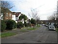
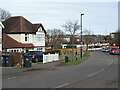
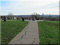
90 photos from this area
Area Information
Key information about the CR7 6JW including its size, population, and administrative classification.
- Area Type
- Postcode
- Area Size
- 1.0 hectares
- Population
- 1299
- Population Density
- 6884 people/km²
House Prices in CR7 6JW
36
Properties
£235,310
Average Sold Price
£60,000
Lowest Price
£507,000
Highest Price
Showing 36 properties
| Address | Type | Beds | Baths | Last Sale Price | Last Sale Date | |
|---|---|---|---|---|---|---|
| 62 Leander Road, Thornton Heath, CR7 6JW | house | - | - | £350,000 | Mar 2024 | |
| 104 Leander Road, Thornton Heath, CR7 6JW | house | - | - | £485,000 | Jun 2023 | |
| 118 Leander Road, Thornton Heath, CR7 6JW | Terraced | 3 | 1 | £507,000 | May 2023 | |
| 116 Leander Road, Thornton Heath, CR7 6JW | Terraced | 3 | 1 | £434,000 | Aug 2021 | |
| 86 Leander Road, Thornton Heath, CR7 6JW | Terraced | 3 | 1 | £378,500 | Jun 2018 | |
| 120 Leander Road, Thornton Heath, CR7 6JW | house | 3 | - | £245,000 | Dec 2011 | |
| 98 Leander Road, Thornton Heath, CR7 6JW | house | - | - | £250,000 | Sep 2011 | |
| 108 Leander Road, Thornton Heath, CR7 6JW | house | 3 | - | £250,000 | May 2007 | |
| 106 Leander Road, Thornton Heath, CR7 6JW | house | - | - | £237,500 | Nov 2006 | |
| 92 Leander Road, Thornton Heath, CR7 6JW | house | 3 | 1 | £220,000 | Dec 2004 |
Page 1 of 4
Energy Efficiency in CR7 6JW
Amenities
Schools
| Rank | School | Type | Entry gender | Ages |
|---|
Explore more schools in this area
Go to Schools tabDemographics
Household Size
Family (3-5 people)
most common
Accommodation Type
Houses
most common
Tenure
70
majority
Ethnic Group
asian_total
most common
Religion
N/A
most common
Household Composition
N/A
most common
Age
47
median
Adults (30-64 years)
most common
Household Deprivation
N/A
with no deprivation
NS-SEC
31
in Lower managerial occupations
Explore more demographic insights in this area
Go to Demographics tabPlanning
Planning Constraints
- Flood RiskPremium
- Ramsar Wetland SitesPremium
- Area of Outstanding Natural BeautyPremium
- Protected Nature ReservePremium
- Protected WoodlandPremium