Area Overview for CR7 6JA
Photos of CR7 6JA


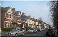
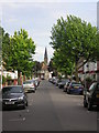
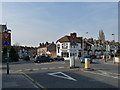
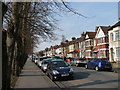
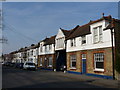
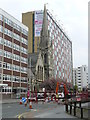
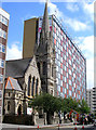
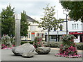
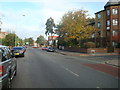
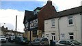
90 photos from this area
Area Information
Key information about the CR7 6JA including its size, population, and administrative classification.
- Area Type
- Postcode
- Area Size
- 2040 m²
- Population
- 1821
- Population Density
- 13479 people/km²
House Prices in CR7 6JA
14
Properties
£144,321
Average Sold Price
£86,500
Lowest Price
£201,000
Highest Price
Showing 14 properties
| Address | Type | Beds | Baths | Last Sale Price | Last Sale Date | |
|---|---|---|---|---|---|---|
| 744A London Road, Thornton Heath, CR7 6JA | Flat | 3 | 1 | £147,750 | Dec 2022 | |
| 746B London Road, Thornton Heath, CR7 6JA | Flat | - | - | £155,000 | Apr 2022 | |
| 746A London Road, Thornton Heath, CR7 6JA | Flat | - | - | £155,000 | Feb 2022 | |
| 750B London Road, Thornton Heath, CR7 6JA | Flat | 2 | 1 | £201,000 | Apr 2019 | |
| 744B London Road, Thornton Heath, CR7 6JA | Maisonette | 3 | 1 | £165,000 | Nov 2017 | |
| 750A London Road, Thornton Heath, CR7 6JA | Flat | - | - | £100,000 | Jul 2003 | |
| 752A London Road, Thornton Heath, CR7 6JA | Maisonette | 3 | 1 | £86,500 | May 2000 | |
| 756A London Road, Thornton Heath, CR7 6JA | Maisonette | - | - | - | - | |
| 748A London Road, Thornton Heath, CR7 6JA | Flat | - | - | - | - | |
| 758A London Road, Thornton Heath, CR7 6JA | Maisonette | - | - | - | - |
Page 1 of 2
Energy Efficiency in CR7 6JA
Amenities
Schools
| Rank | School | Type | Entry gender | Ages |
|---|
Explore more schools in this area
Go to Schools tabDemographics
Household Size
Family (3-5 people)
most common
Accommodation Type
Houses
most common
Tenure
43
majority
Ethnic Group
asian_total
most common
Religion
N/A
most common
Household Composition
N/A
most common
Age
47
median
Adults (30-64 years)
most common
Household Deprivation
N/A
with no deprivation
NS-SEC
24
in Lower managerial occupations
Explore more demographic insights in this area
Go to Demographics tabPlanning
Planning Constraints
- Flood RiskPremium
- Ramsar Wetland SitesPremium
- Area of Outstanding Natural BeautyPremium
- Protected Nature ReservePremium
- Protected WoodlandPremium