Area Overview for CR7 6BT
Photos of CR7 6BT

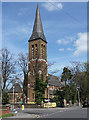
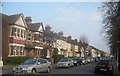
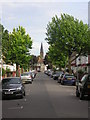
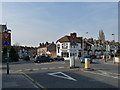
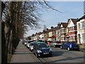
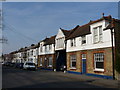
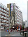
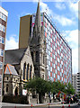
90 photos from this area
Area Information
Key information about the CR7 6BT including its size, population, and administrative classification.
- Area Type
- Postcode
- Area Size
- 6185 m²
- Population
- 1664
- Population Density
- 14533 people/km²
House Prices in CR7 6BT
31
Properties
£265,868
Average Sold Price
£57,000
Lowest Price
£480,000
Highest Price
Showing 31 properties
| Address | Type | Beds | Baths | Last Sale Price | Last Sale Date | |
|---|---|---|---|---|---|---|
| 37 Keston Road, Thornton Heath, CR7 6BT | Terraced | 3 | 1 | £401,000 | Aug 2023 | |
| 13 Keston Road, Thornton Heath, CR7 6BT | Terraced | 4 | 2 | £480,000 | May 2022 | |
| 61 Keston Road, Thornton Heath, CR7 6BT | house | - | - | £415,000 | Aug 2021 | |
| 23 Keston Road, Thornton Heath, CR7 6BT | house | - | - | £420,000 | Jun 2021 | |
| 31 Keston Road, Thornton Heath, CR7 6BT | house | 3 | 1 | £365,000 | Nov 2020 | |
| 51 Keston Road, Thornton Heath, CR7 6BT | Terraced | 3 | 1 | £345,000 | Feb 2019 | |
| 3 Keston Road, Thornton Heath, CR7 6BT | Terraced | 3 | - | £380,000 | Apr 2017 | |
| 59 Keston Road, Thornton Heath, CR7 6BT | house | - | - | £197,000 | Dec 2011 | |
| 21 Keston Road, Thornton Heath, CR7 6BT | house | 3 | - | £193,000 | Jul 2011 | |
| 7 Keston Road, Thornton Heath, CR7 6BT | house | 3 | - | £245,000 | Jul 2010 |
Page 1 of 4
Energy Efficiency in CR7 6BT
Amenities
Schools
| Rank | School | Type | Entry gender | Ages |
|---|
Explore more schools in this area
Go to Schools tabDemographics
Household Size
Family (3-5 people)
most common
Accommodation Type
Houses
most common
Tenure
61
majority
Ethnic Group
asian_total
most common
Religion
N/A
most common
Household Composition
N/A
most common
Age
47
median
Adults (30-64 years)
most common
Household Deprivation
N/A
with no deprivation
NS-SEC
23
in Lower managerial occupations
Explore more demographic insights in this area
Go to Demographics tabPlanning
Planning Constraints
- Flood RiskPremium
- Ramsar Wetland SitesPremium
- Area of Outstanding Natural BeautyPremium
- Protected Nature ReservePremium
- Protected WoodlandPremium