Area Overview for CR6 9AW
Photos of CR6 9AW


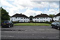
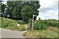
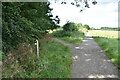
59 photos from this area
Area Information
Key information about the CR6 9AW including its size, population, and administrative classification.
- Area Type
- Postcode
- Area Size
- 1.8 hectares
- Population
- 1503
- Population Density
- 3487 people/km²
House Prices in CR6 9AW
24
Properties
£551,406
Average Sold Price
£60,000
Lowest Price
£3,840,633
Highest Price
Showing 24 properties
| Address | Type | Beds | Baths | Last Sale Price | Last Sale Date | |
|---|---|---|---|---|---|---|
| 233 Tithepit Shaw Lane, Warlingham, CR6 9AW | Flat | 2 | - | £325,000 | Jun 2025 | |
| 207 Tithepit Shaw Lane, Warlingham, CR6 9AW | house | - | - | £540,000 | Jan 2022 | |
| 241 Tithepit Shaw Lane, Warlingham, CR6 9AW | house | - | - | £450,000 | Jun 2021 | |
| 249 Tithepit Shaw Lane, Warlingham, CR6 9AW | Semi-detached | - | - | £3,840,633 | Feb 2018 | |
| 225 Tithepit Shaw Lane, Warlingham, CR6 9AW | Semi-detached | 3 | 1 | £437,000 | Feb 2018 | |
| 215 Tithepit Shaw Lane, Warlingham, CR6 9AW | house | - | - | £460,000 | Nov 2016 | |
| 247 Tithepit Shaw Lane, Warlingham, CR6 9AW | house | - | - | £690,000 | Sep 2015 | |
| 209 Tithepit Shaw Lane, Warlingham, CR6 9AW | Bungalow | 2 | 1 | £282,000 | Nov 2013 | |
| 223 Tithepit Shaw Lane, Warlingham, CR6 9AW | house | - | - | £270,000 | Nov 2012 | |
| 243 Tithepit Shaw Lane, Warlingham, CR6 9AW | house | 4 | - | £346,000 | Mar 2011 |
Page 1 of 3
Energy Efficiency in CR6 9AW
Amenities
Schools
| Rank | School | Type | Entry gender | Ages |
|---|
Explore more schools in this area
Go to Schools tabDemographics
Household Size
Family (3-5 people)
most common
Accommodation Type
Houses
most common
Tenure
81
majority
Ethnic Group
White
most common
Religion
N/A
most common
Household Composition
N/A
most common
Age
47
median
Adults (30-64 years)
most common
Household Deprivation
N/A
with no deprivation
NS-SEC
35
in Lower managerial occupations
Explore more demographic insights in this area
Go to Demographics tabPlanning
Planning Constraints
- Flood RiskPremium
- Ramsar Wetland SitesPremium
- Area of Outstanding Natural BeautyPremium
- Protected Nature ReservePremium
- Protected WoodlandPremium