Area Overview for CR5 3HG
Photos of CR5 3HG

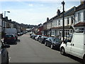
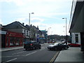

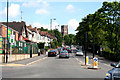
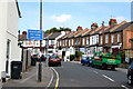


100 photos from this area
Area Information
Key information about the CR5 3HG including its size, population, and administrative classification.
- Area Type
- Postcode
- Area Size
- 1.5 hectares
- Population
- 1349
- Population Density
- 5914 people/km²
House Prices in CR5 3HG
24
Properties
£274,719
Average Sold Price
£85,000
Lowest Price
£550,000
Highest Price
Showing 24 properties
| Address | Type | Beds | Baths | Last Sale Price | Last Sale Date | |
|---|---|---|---|---|---|---|
| 67 St Andrews Road, Coulsdon, CR5 3HG | Semi-detached | 3 | 1 | £550,000 | Jul 2023 | |
| 99A St Andrews Road, Coulsdon, CR5 3HG | Detached | 3 | 1 | £465,000 | Nov 2020 | |
| 61 St Andrews Road, Coulsdon, CR5 3HG | Semi-detached | 3 | 1 | £503,000 | Nov 2018 | |
| 93 St Andrews Road, Coulsdon, CR5 3HG | house | - | - | £329,950 | Nov 2013 | |
| 81 St Andrews Road, Coulsdon, CR5 3HG | Detached | 3 | - | £340,000 | Oct 2013 | |
| 85 St Andrews Road, Coulsdon, CR5 3HG | house | - | - | £270,000 | May 2011 | |
| 97 St Andrews Road, Coulsdon, CR5 3HG | house | - | - | £274,000 | Dec 2009 | |
| 77 St Andrews Road, Coulsdon, CR5 3HG | house | - | - | £250,000 | Nov 2009 | |
| 79 St Andrews Road, Coulsdon, CR5 3HG | house | - | - | £233,500 | Oct 2009 | |
| 87A St Andrews Road, Coulsdon, CR5 3HG | Terraced | - | - | £243,000 | Aug 2009 |
Page 1 of 3
Energy Efficiency in CR5 3HG
Amenities
Schools
| Rank | School | Type | Entry gender | Ages |
|---|
Explore more schools in this area
Go to Schools tabDemographics
Household Size
Family (3-5 people)
most common
Accommodation Type
Houses
most common
Tenure
91
majority
Ethnic Group
White
most common
Religion
N/A
most common
Household Composition
N/A
most common
Age
47
median
Adults (30-64 years)
most common
Household Deprivation
N/A
with no deprivation
NS-SEC
44
in Lower managerial occupations
Explore more demographic insights in this area
Go to Demographics tabPlanning
Planning Constraints
- Flood RiskPremium
- Ramsar Wetland SitesPremium
- Area of Outstanding Natural BeautyPremium
- Protected Nature ReservePremium
- Protected WoodlandPremium