Area Overview for CR5 3AR
Photos of CR5 3AR
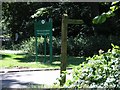
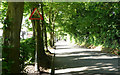
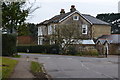
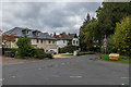
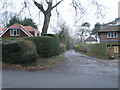
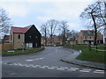
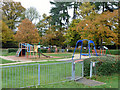
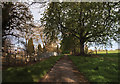
30 photos from this area
Area Information
Key information about the CR5 3AR including its size, population, and administrative classification.
- Area Type
- Postcode
- Area Size
- 3.5 hectares
- Population
- 2910
- Population Density
- 2013 people/km²
House Prices in CR5 3AR
24
Properties
£349,059
Average Sold Price
£94,000
Lowest Price
£702,500
Highest Price
Showing 24 properties
| Address | Type | Beds | Baths | Last Sale Price | Last Sale Date | |
|---|---|---|---|---|---|---|
| 25 Ridgemount Avenue, Coulsdon, CR5 3AR | Semi-detached | 4 | 2 | £650,000 | Feb 2025 | |
| 43 Ridgemount Avenue, Coulsdon, CR5 3AR | Semi-detached | 3 | 3 | £702,500 | May 2024 | |
| 35 Ridgemount Avenue, Coulsdon, CR5 3AR | house | - | - | £425,000 | Aug 2022 | |
| 9 Ridgemount Avenue, Coulsdon, CR5 3AR | Semi-detached | 3 | 1 | £475,000 | Oct 2019 | |
| 41 Ridgemount Avenue, Coulsdon, CR5 3AR | Semi-detached | 4 | - | £532,000 | Aug 2017 | |
| 31 Ridgemount Avenue, Coulsdon, CR5 3AR | house | 4 | 2 | £558,000 | Aug 2016 | |
| 47 Ridgemount Avenue, Coulsdon, CR5 3AR | house | - | - | £330,000 | Oct 2010 | |
| 7 Ridgemount Avenue, Coulsdon, CR5 3AR | Semi-detached | - | - | £345,000 | Jun 2008 | |
| 45 Ridgemount Avenue, Coulsdon, CR5 3AR | Semi-detached | - | - | £295,000 | May 2007 | |
| 19 Ridgemount Avenue, Coulsdon, CR5 3AR | Semi-detached | - | - | £276,000 | Dec 2006 |
Page 1 of 3
Energy Efficiency in CR5 3AR
Amenities
Schools
| Rank | School | Type | Entry gender | Ages |
|---|
Explore more schools in this area
Go to Schools tabDemographics
Household Size
Family (3-5 people)
most common
Accommodation Type
Houses
most common
Tenure
86
majority
Ethnic Group
White
most common
Religion
N/A
most common
Household Composition
N/A
most common
Age
47
median
Adults (30-64 years)
most common
Household Deprivation
N/A
with no deprivation
NS-SEC
54
in Lower managerial occupations
Explore more demographic insights in this area
Go to Demographics tabPlanning
Planning Constraints
- Flood RiskPremium
- Ramsar Wetland SitesPremium
- Area of Outstanding Natural BeautyPremium
- Protected Nature ReservePremium
- Protected WoodlandPremium