Area Overview for CR5 2YJ
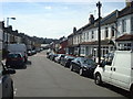
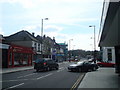
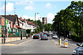
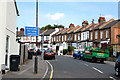
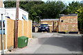
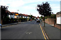
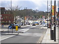
Photos of CR5 2YJ


Area Information
CR5 2YJ is a small residential postcode in the London Borough of Croydon, part of a historically significant area once known as Cuthraedesdune. With a population of 1,340, it is a tightly knit community characterised by low-density housing and a strong sense of local identity. The area’s proximity to Coulsdon Town and its transport links make it a practical choice for commuters, while its historical roots in Surrey add a layer of heritage. Daily life here is shaped by a mix of traditional and modern amenities, from local shops to public transport hubs. The area’s small size means it is easy to navigate on foot or by bike, and its residential focus ensures a quiet, family-friendly atmosphere. For those seeking a balance between suburban comfort and urban accessibility, CR5 2YJ offers proximity to Croydon’s services without the congestion of central London. Its low crime rates and excellent broadband connectivity further enhance its appeal, making it a viable option for buyers prioritising safety and connectivity.
- Area Type
- Postcode
- Area Size
- Not available
- Population
- Not available
- Population Density
- Not available
The property market in CR5 2YJ is dominated by owner-occupied homes, with 84% of properties owned outright. This high home ownership rate indicates a community of long-term residents rather than a rental market. The accommodation type is primarily houses, which is uncommon in many urban areas and suggests a suburban or semi-rural character. This mix of low-density housing and strong ownership ties creates a distinct market dynamic, where properties are likely to retain value due to limited supply. For buyers, this means a focus on individual homes rather than apartments, with potential for long-term investment. The small size of the postcode also means the immediate surroundings are critical—those considering CR5 2YJ should evaluate nearby areas for additional options.
House Prices in CR5 2YJ
No properties found in this postcode.
Energy Efficiency in CR5 2YJ
Living in CR5 2YJ offers access to a range of amenities within walking or short driving distance. Retail options include major supermarkets like Tesco Coulsdon, Aldi Coulsdon, and Waitrose Coulsdon, ensuring convenience for daily shopping. The area’s transport links also grant easy access to parks and leisure spaces, such as Wandle Park and Lloyd Park, which are served by tram stops. The presence of multiple rail and metro stations enhances connectivity to Croydon’s cultural and commercial hubs. This blend of practical retail, green spaces, and efficient transport creates a lifestyle that balances suburban tranquillity with urban accessibility, making it appealing for families and commuters.
Amenities
Schools
Residents of CR5 2YJ have access to two primary schools: Smitham Primary School, which holds a good Ofsted rating, and Purley Girls’ High School, also a primary institution. The presence of two primary schools within reach is a significant advantage for families, offering options for early education. While no secondary schools are listed, the proximity to Croydon’s broader network of schools suggests additional choices are available nearby. The mix of school types ensures that parents can select institutions aligned with their priorities, whether academic focus, Ofsted ratings, or catchment area convenience. This accessibility to education is a key factor for families considering CR5 2YJ as a home.
| Rank | School | Type | Entry gender | Ages |
|---|
Explore more schools in this area
Go to Schools tabDemographics
The community in CR5 2YJ is predominantly composed of adults aged 30–64, with a median age of 47. This suggests a mature, stable population, likely with established careers and families. Home ownership is high at 84%, indicating a strong presence of long-term residents rather than transient renters. The area is largely composed of houses, reflecting a preference for detached or semi-detached properties over flats. The predominant ethnic group is White, which aligns with broader trends in the London Borough of Croydon. While specific data on deprivation is not provided, the high home ownership rate and low crime score of 84 suggest a relatively affluent and secure environment. This demographic profile implies a community focused on stability, with limited turnover and a strong sense of local continuity.
Household Size
Accommodation Type
Tenure
Ethnic Group
Religion
Household Composition
Age
Household Deprivation
NS-SEC
Explore more demographic insights in this area
Go to Demographics tabPlanning
Planning Constraints
- Flood RiskPremium
- Ramsar Wetland SitesPremium
- Area of Outstanding Natural BeautyPremium
- Protected Nature ReservePremium
- Protected WoodlandPremium