Area Overview for CR5 2SH
Photos of CR5 2SH
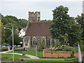
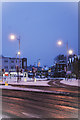
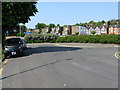
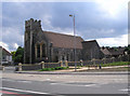

100 photos from this area
Area Information
Key information about the CR5 2SH including its size, population, and administrative classification.
- Area Type
- Postcode
- Area Size
- 8630 m²
- Population
- 1493
- Population Density
- 3725 people/km²
House Prices in CR5 2SH
12
Properties
£66,029
Average Sold Price
£55,000
Lowest Price
£97,475
Highest Price
Showing 12 properties
| Address | Type | Beds | Baths | Last Sale Price | Last Sale Date | |
|---|---|---|---|---|---|---|
| 21 Nineacres Way, Coulsdon, CR5 2SH | house | 2 | - | £55,000 | Dec 2010 | |
| 5 Nineacres Way, Coulsdon, CR5 2SH | Terraced | - | - | £97,475 | Sep 2005 | |
| 13 Nineacres Way, Coulsdon, CR5 2SH | Terraced | - | - | £59,950 | Jul 2002 | |
| 1 Nineacres Way, Coulsdon, CR5 2SH | Terraced | 2 | - | £71,000 | Mar 2000 | |
| 3 Nineacres Way, Coulsdon, CR5 2SH | Terraced | - | - | £57,750 | Apr 1999 | |
| 9 Nineacres Way, Coulsdon, CR5 2SH | house | - | - | £55,000 | Aug 1995 | |
| 17 Nineacres Way, Coulsdon, CR5 2SH | Semi-detached | 2 | - | - | - | |
| Tennis 25M From 15 Nineacres Way 16M From Unnamed Road, Nineacres Way, Coulsdon, CR5 2SH | Leisure | - | - | - | - | |
| 11 Nineacres Way, Coulsdon, CR5 2SH | Terraced | - | - | - | - | |
| 15 Nineacres Way, Coulsdon, CR5 2SH | Semi-detached | 2 | - | - | - |
Page 1 of 2
Energy Efficiency in CR5 2SH
Amenities
Schools
| Rank | School | Type | Entry gender | Ages |
|---|
Explore more schools in this area
Go to Schools tabDemographics
Household Size
Family (3-5 people)
most common
Accommodation Type
Houses
most common
Tenure
57
majority
Ethnic Group
White
most common
Religion
N/A
most common
Household Composition
N/A
most common
Age
47
median
Adults (30-64 years)
most common
Household Deprivation
N/A
with no deprivation
NS-SEC
41
in Lower managerial occupations
Explore more demographic insights in this area
Go to Demographics tabPlanning
Planning Constraints
- Flood RiskPremium
- Ramsar Wetland SitesPremium
- Area of Outstanding Natural BeautyPremium
- Protected Nature ReservePremium
- Protected WoodlandPremium