Area Overview for CR5 2JL
Photos of CR5 2JL
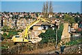
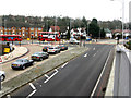
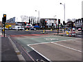
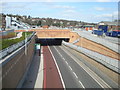


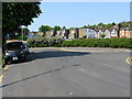

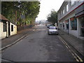


100 photos from this area
Area Information
Key information about the CR5 2JL including its size, population, and administrative classification.
- Area Type
- Postcode
- Area Size
- 1.9 hectares
- Population
- 1758
- Population Density
- 1678 people/km²
House Prices in CR5 2JL
30
Properties
£351,863
Average Sold Price
£79,800
Lowest Price
£560,000
Highest Price
Showing 30 properties
| Address | Type | Beds | Baths | Last Sale Price | Last Sale Date | |
|---|---|---|---|---|---|---|
| 19 Stoats Nest Village, Coulsdon, CR5 2JL | Semi-detached | 4 | 1 | £550,000 | Sep 2025 | |
| 6 Stoats Nest Village, Coulsdon, CR5 2JL | Semi-detached | 5 | 2 | £476,000 | Dec 2024 | |
| 26 Stoats Nest Village, Coulsdon, CR5 2JL | Semi-detached | 2 | 1 | £375,000 | Oct 2024 | |
| 28 Stoats Nest Village, Coulsdon, CR5 2JL | Semi-detached | 2 | 1 | £426,000 | Aug 2024 | |
| 3 Stoats Nest Village, Coulsdon, CR5 2JL | Semi-detached | 3 | 1 | £560,000 | Feb 2024 | |
| 8 Stoats Nest Village, Coulsdon, CR5 2JL | Semi-detached | 3 | 1 | £450,000 | Oct 2023 | |
| 13 Stoats Nest Village, Coulsdon, CR5 2JL | house | - | - | £556,000 | Jun 2022 | |
| 14 Stoats Nest Village, Coulsdon, CR5 2JL | Terraced | 3 | - | £412,500 | Jun 2021 | |
| 25 Stoats Nest Village, Coulsdon, CR5 2JL | house | - | - | £402,000 | Feb 2021 | |
| 11 Stoats Nest Village, Coulsdon, CR5 2JL | Semi-detached | 3 | - | £422,500 | Nov 2016 |
Page 1 of 3
Energy Efficiency in CR5 2JL
Amenities
Schools
| Rank | School | Type | Entry gender | Ages |
|---|
Explore more schools in this area
Go to Schools tabDemographics
Household Size
Family (3-5 people)
most common
Accommodation Type
Houses
most common
Tenure
83
majority
Ethnic Group
White
most common
Religion
N/A
most common
Household Composition
N/A
most common
Age
47
median
Adults (30-64 years)
most common
Household Deprivation
N/A
with no deprivation
NS-SEC
42
in Lower managerial occupations
Explore more demographic insights in this area
Go to Demographics tabPlanning
Planning Constraints
- Flood RiskPremium
- Ramsar Wetland SitesPremium
- Area of Outstanding Natural BeautyPremium
- Protected Nature ReservePremium
- Protected WoodlandPremium