Area Overview for CR5 2BF
Photos of CR5 2BF

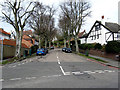
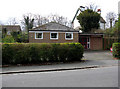
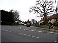
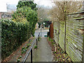
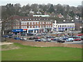
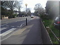
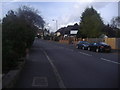
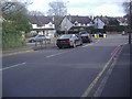
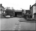

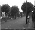
100 photos from this area
Area Information
Key information about the CR5 2BF including its size, population, and administrative classification.
- Area Type
- Postcode
- Area Size
- 1.3 hectares
- Population
- Not available
- Population Density
- Not available
House Prices in CR5 2BF
38
Properties
£378,813
Average Sold Price
£120,000
Lowest Price
£660,000
Highest Price
Showing 38 properties
| Address | Type | Beds | Baths | Last Sale Price | Last Sale Date | |
|---|---|---|---|---|---|---|
| 13 Brighton Road, Coulsdon, CR5 2BF | Semi-detached | 3 | 1 | £520,000 | Feb 2025 | |
| 9 Brighton Road, Coulsdon, CR5 2BF | Retail | 3 | 1 | £525,000 | Mar 2022 | |
| 29 Brighton Road, Coulsdon, CR5 2BF | Semi-detached | 3 | - | £607,000 | Jun 2020 | |
| 5 Brighton Road, Coulsdon, CR5 2BF | Semi-detached | 3 | 1 | £450,000 | Sep 2018 | |
| 53 Brighton Road, Coulsdon, CR5 2BF | house | - | - | £510,000 | Oct 2017 | |
| 31 Brighton Road, Coulsdon, CR5 2BF | house | - | - | £400,000 | Feb 2016 | |
| 39 Brighton Road, Coulsdon, CR5 2BF | house | - | - | £390,000 | Mar 2012 | |
| 47 Brighton Road, Coulsdon, CR5 2BF | Detached | - | - | £355,000 | Jan 2008 | |
| 1 Brighton Road, Coulsdon, CR5 2BF | Detached | 5 | 2 | £660,000 | Nov 2006 | |
| 37 Brighton Road, Coulsdon, CR5 2BF | Detached | 4 | 1 | £370,000 | Sep 2006 |
Page 1 of 4
Energy Efficiency in CR5 2BF
Amenities
Schools
| Rank | School | Type | Entry gender | Ages |
|---|
Explore more schools in this area
Go to Schools tabDemographics
Household Size
Family (3-5 people)
most common
Accommodation Type
Flats
most common
Tenure
60
majority
Ethnic Group
White
most common
Religion
N/A
most common
Household Composition
N/A
most common
Age
47
median
Adults (30-64 years)
most common
Household Deprivation
N/A
with no deprivation
NS-SEC
45
in Lower managerial occupations
Explore more demographic insights in this area
Go to Demographics tabPlanning
Planning Constraints
- Flood RiskPremium
- Ramsar Wetland SitesPremium
- Area of Outstanding Natural BeautyPremium
- Protected Nature ReservePremium
- Protected WoodlandPremium