Area Overview for CR4 8YG
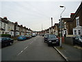
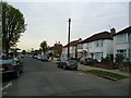
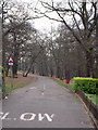
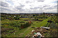
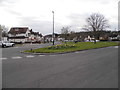
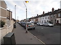
Photos of CR4 8YG


Area Information
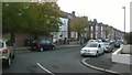
CR4 8YG, a small postcode area in the London Borough of Croydon, is a residential cluster with a population of 1,782. Historically a rural settlement around Thornton Heath Pond, it evolved into a suburban area after the arrival of a railway station in 1862, linking it to London and Croydon. Today, it retains Victorian terraced housing and a quiet, community-focused character. The area lies on the A23, a key route between London and Sussex, and is bordered by Norbury, which has since grown into a distinct suburb. Living here offers proximity to both urban amenities and the remnants of rural heritage. The population is predominantly adults aged 30–64, reflecting a settled, family-oriented community. While the area lacks the density of larger London boroughs, its small size fosters a close-knit environment. Residents benefit from nearby hospitals, schools, and transport links, making it a practical choice for those seeking a balance between suburban tranquillity and city accessibility.
- Area Type
- Postcode
- Area Size
- Not available
- Population
- 1782
- Population Density
- 8870 people/km²
CR4 8YG’s property market is characterised by a 48% home ownership rate, indicating that less than half of properties are owner-occupied, with the remainder likely in the rental market. The area’s accommodation is predominantly houses, many of which are Victorian terraced homes built during the 19th-century transformation from rural outpost to suburb. This housing stock suggests a mix of older properties that may require renovation, appealing to buyers seeking characterful homes. However, the small size of the postcode area and its integration with surrounding suburbs like Norbury mean the market is limited in scale. Buyers should consider the area’s proximity to transport links and amenities, though property options may be constrained by the postcode’s compact nature.
House Prices in CR4 8YG
No properties found in this postcode.
Energy Efficiency in CR4 8YG
Residents of CR4 8YG have access to a range of amenities within practical reach. Retail options include Co-op Thornton, Tesco Thornton, and Iceland Thornton, providing everyday shopping convenience. Public transport is extensive, with rail stations, trams, and ferries ensuring easy travel. The area’s proximity to Mayday University Hospital and historical landmarks like Thornton Heath Pond adds to its practical and cultural appeal. While dining and leisure venues are not explicitly listed, the presence of multiple retail outlets and transport hubs suggests a functional lifestyle. The mix of retail, transport, and healthcare facilities supports a practical, community-focused way of life, with easy access to both suburban and urban resources.
Amenities
Schools
Residents of CR4 8YG have access to St James the Great RC Primary and Nursery School, a primary school with an Ofsted rating of outstanding. This institution provides high-quality early education and is likely a key draw for families. A second entry for the same school suggests its prominence in the area. Additionally, the CACFO UK Education Centre offers independent schooling, providing an alternative for parents seeking non-state education. The mix of state and independent options allows families to choose between free, high-performing public education or fee-paying alternatives. The presence of an outstanding-rated primary school enhances the area’s appeal for households prioritising education, though secondary school options are not specified in the data.
| Rank | School | Type | Entry gender | Ages |
|---|
Explore more schools in this area
Go to Schools tabDemographics
CR4 8YG’s population of 1,782 is predominantly adults aged 30–64, with a median age of 47. This suggests a community of middle-aged residents, many of whom may be in their prime working years. Home ownership stands at 48%, indicating a mix of owner-occupied and rental properties, though the lower percentage suggests a higher proportion of renters. The area’s accommodation is primarily houses, reflecting a traditional suburban layout. The predominant ethnic group is Black, highlighting the area’s demographic diversity. While no specific deprivation data is provided, the age profile and housing stock suggest a stable, working-age population with established roots. The presence of Victorian-era schools and healthcare facilities further supports a community focused on long-term residency and family life.
Household Size
Accommodation Type
Tenure
Ethnic Group
Religion
Household Composition
Age
Household Deprivation
NS-SEC
Explore more demographic insights in this area
Go to Demographics tabPlanning
Planning Constraints
- Flood RiskPremium
- Ramsar Wetland SitesPremium
- Area of Outstanding Natural BeautyPremium
- Protected Nature ReservePremium
- Protected WoodlandPremium