Area Overview for CR4 8XN
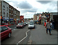
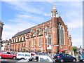
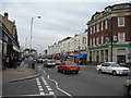
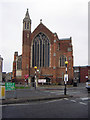
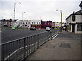
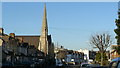
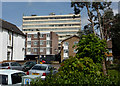
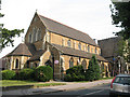
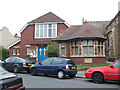
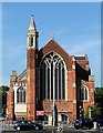
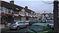
Photos of CR4 8XN

Area Information
Living in CR4 8XN means being part of a small, tightly knit residential cluster in south London, within the London Borough of Croydon. With a population of just 1,410, this area offers a quiet, community-focused lifestyle. The postcode sits in the historic Bensham Manor ward, a district with roots tracing back to the Norman Conquest. Its name, derived from the ancient "Benchesham," reflects the area’s long-standing connection to local history, including the Whitehorse Manor, named after a 14th-century figure. Daily life here is shaped by proximity to amenities like Thornton Heath Recreation Ground, a locally listed park acquired by Croydon Corporation in 1884. The area’s compact size means residents are within practical reach of shops, transport hubs, and green spaces. While it lacks the density of larger urban centres, CR4 8XN provides a balance of residential calm and access to London’s infrastructure, making it appealing for those seeking a manageable, connected lifestyle.
- Area Type
- Postcode
- Area Size
- Not available
- Population
- 1410
- Population Density
- 11605 people/km²
The property market in CR4 8XN is characterised by a 42% home ownership rate, meaning nearly half of properties are owner-occupied, while the remaining 58% are likely rental units. The accommodation type is predominantly flats, which aligns with the area’s compact residential nature and suggests a focus on space-efficient living. This mix of ownership and rental properties indicates a dynamic market, with potential for both long-term investment and short-term tenancy. For buyers, the small size of the area means properties are closely grouped, offering limited scope for expansion but ensuring proximity to amenities. The prevalence of flats may appeal to those seeking affordability or convenience, though the rental market’s strength could influence property values. Given the area’s historical character and proximity to transport, buyers should consider how the housing stock fits into their lifestyle needs, balancing the benefits of a mature community with the constraints of a limited footprint.
House Prices in CR4 8XN
No properties found in this postcode.
Energy Efficiency in CR4 8XN
Daily life in CR4 8XN is enriched by nearby amenities that cater to practical needs and leisure. Retail options include Iceland Thornton, Tesco Thornton, and Sainsburys Crystal, ensuring easy access to groceries and household essentials. For recreation, Thornton Heath Recreation Ground offers a historic park setting, ideal for walks or family activities. The area’s proximity to rail stations, trams, and a ferry pier enhances mobility, allowing residents to explore wider London or enjoy local transport. The presence of multiple retail and transport hubs within practical reach suggests a community designed for convenience, with minimal need to travel far for essentials. The mix of green space and urban infrastructure creates a balanced lifestyle, blending the tranquillity of a small residential area with the vibrancy of nearby services.
Amenities
Schools
The nearest school to CR4 8XN is RHIS School (Incorporating ALTE School), an independent institution. While specific Ofsted ratings are not provided, the presence of an independent school suggests a focus on high-quality education, often associated with smaller class sizes and specialised curricula. The school’s incorporation of ALTE School may indicate a merged educational offering, potentially catering to a range of age groups or academic needs. For families, this school represents a key consideration, as independent schools often require fees and may have selective admissions. The absence of state schools in the data means the educational landscape here is defined by private institutions, which could influence family decisions about relocation or investment. The area’s demographic profile, with a median age of 47, aligns with a community likely prioritising educational outcomes for their children.
| Rank | School | Type | Entry gender | Ages |
|---|
Explore more schools in this area
Go to Schools tabDemographics
CR4 8XN has a median age of 47, with the majority of residents aged between 30 and 64. This suggests a stable, adult-oriented community, likely with established families and professionals. Home ownership rates stand at 42%, indicating a mix of owner-occupied properties and rental units. The predominant accommodation type is flats, reflecting a housing stock suited to smaller households or those prioritising space efficiency. The area’s predominant ethnic group is Black_total, highlighting a specific demographic profile. While deprivation data is not provided, the age distribution and housing types imply a community focused on long-term stability. The presence of independent schools like RHIS School suggests a family-centric environment, where education is a key consideration. The relatively low population density and age range indicate a mature, low-turnover area, with residents likely invested in local amenities and community ties.
Household Size
Accommodation Type
Tenure
Ethnic Group
Religion
Household Composition
Age
Household Deprivation
NS-SEC
Explore more demographic insights in this area
Go to Demographics tabPlanning
Planning Constraints
- Flood RiskPremium
- Ramsar Wetland SitesPremium
- Area of Outstanding Natural BeautyPremium
- Protected Nature ReservePremium
- Protected WoodlandPremium