Area Overview for CR4 4TQ
Photos of CR4 4TQ


Area Information
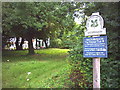
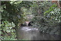
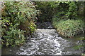
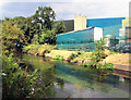
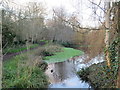
Living in CR4 4TQ means inhabiting a small, densely populated residential cluster within the London Borough of Merton. The area spans 2,564 square metres and is home to 1,779 residents, translating to a population density of 973 people per square kilometre. This compact postcode area is centred around the historic Cricket Green, a Conservation Area since 1969. The green, with its ancient common land origins, has hosted cricket matches since 1685 and remains a focal point for local identity. Daily life here is shaped by its proximity to Mitcham’s Lower Green, a space that blends recreational use with historical significance. The area’s character is defined by its mix of residential properties, community-focused amenities, and easy access to transport networks. While the population is relatively small, the density suggests a tight-knit community. For those seeking a blend of heritage and modern convenience, CR4 4TQ offers a unique slice of London’s suburban landscape, where history and practicality coexist.
- Area Type
- Postcode
- Area Size
- 2564 m²
- Population
- 1779
- Population Density
- 973 people/km²
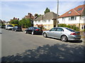
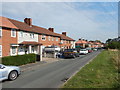
CR4 4TQ’s property market is defined by its 50% home ownership rate, suggesting a balance between owner-occupied homes and rental properties. The area is predominantly composed of houses, which may cater to families or those seeking larger living spaces. Given the small size of the postcode area, the housing stock is likely limited, with properties concentrated around the Cricket Green and adjacent streets. This could mean a competitive market for buyers, particularly for those prioritising proximity to the area’s historical and recreational assets. The presence of houses rather than flats may also influence the appeal of the area, offering potential buyers a contrast to denser urban environments. However, the small footprint of CR4 4TQ means buyers should consider nearby areas for additional options. The mix of ownership and rental properties suggests a stable market, though the lack of detailed data on property prices or recent transactions leaves room for further inquiry.
House Prices in CR4 4TQ
No properties found in this postcode.
Energy Efficiency in CR4 4TQ
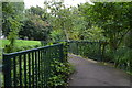
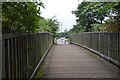
Residents of CR4 4TQ enjoy a range of amenities within walking or short transit distance. Retail options include Sainsburys Sutton, Budgens Carshalton, and The Southern Co-operative Co, providing access to groceries and daily essentials. The nearby ferry piers—Wandsworth Riverside Quarter Pier and Putney Pier—offer connections to London’s waterways, while tram stops like Mitcham Tram Stop provide links to the wider transport network. The Cricket Green itself is a central feature, offering recreational space with historical significance. This blend of practical amenities and green space supports a lifestyle that balances convenience with leisure. The area’s proximity to Mitcham’s Lower Green also suggests opportunities for outdoor activities, though the small postcode size means residents may need to venture slightly further for more diverse options. Overall, the amenities contribute to a functional, community-oriented environment.
Amenities
Schools
Residents of CR4 4TQ have access to three primary schools within practical reach: Cranmer Primary School and St Peter and Paul Catholic Primary School, both rated ‘good’ by Ofsted, and Cranmer County Middle School, which also serves primary education. The presence of two ‘good’-rated schools offers families a choice of educational environments, with one providing a Catholic curriculum. The mix of school types may appeal to parents seeking either state or faith-based education. While no secondary schools are listed, the proximity to Mitcham’s broader infrastructure suggests additional options nearby. The concentration of primary schools in the area reflects its role as a family-oriented neighbourhood, though the absence of detailed data on school capacity or performance beyond Ofsted ratings means further investigation would be necessary for a complete picture.
| Rank | School | Type | Entry gender | Ages |
|---|
Explore more schools in this area
Go to Schools tabDemographics
CR4 4TQ’s population is predominantly middle-aged, with a median age of 47 and the largest age group being adults aged 30–64. This suggests a community skewed towards established families and professionals. Home ownership rates stand at 50%, indicating a balanced mix of owner-occupied and rental properties. The area is characterised by houses rather than flats, which may appeal to those seeking more space or garden access. The predominant ethnic group is White, reflecting broader trends in the London Borough of Merton. The high population density—973 people per square kilometre—means residents share limited space, which can influence local dynamics. While no specific deprivation data is provided, the demographic profile implies a stable, settled community with a focus on long-term residency. This mix of age groups and property types creates a neighbourhood where intergenerational interaction is likely, though the absence of detailed diversity metrics means broader social composition remains less defined.
Household Size
Accommodation Type
Tenure
Ethnic Group
Religion
Household Composition
Age
Household Deprivation
NS-SEC
Explore more demographic insights in this area
Go to Demographics tabPlanning
Planning Constraints
- Flood RiskPremium
- Ramsar Wetland SitesPremium
- Area of Outstanding Natural BeautyPremium
- Protected Nature ReservePremium
- Protected WoodlandPremium