Area Overview for CR4 4JT
Photos of CR4 4JT
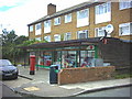
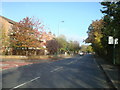
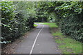
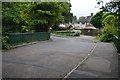
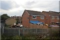
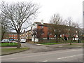
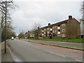
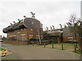
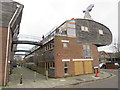
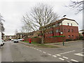
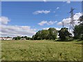
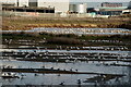
51 photos from this area
Area Information
Key information about the CR4 4JT including its size, population, and administrative classification.
- Area Type
- Postcode
- Area Size
- 7188 m²
- Population
- 2117
- Population Density
- 5242 people/km²
House Prices in CR4 4JT
42
Properties
£328,013
Average Sold Price
£166,000
Lowest Price
£465,000
Highest Price
Showing 42 properties
| Address | Type | Beds | Baths | Last Sale Price | Last Sale Date | |
|---|---|---|---|---|---|---|
| 49 Wood Street, Mitcham Junction, CR4 4JT | Semi-detached | 3 | 1 | £450,000 | Jul 2025 | |
| 3 Wood Street, Mitcham Junction, CR4 4JT | Semi-detached | 2 | 1 | £390,000 | Aug 2024 | |
| 1 Wood Street, Mitcham Junction, CR4 4JT | Maisonette | 2 | 1 | £295,000 | Feb 2024 | |
| 9 Wood Street, Mitcham Junction, CR4 4JT | Terraced | 3 | 2 | £465,000 | Aug 2023 | |
| 21 Wood Street, Mitcham Junction, CR4 4JT | house | - | - | £375,000 | Nov 2021 | |
| 29 Wood Street, Mitcham Junction, CR4 4JT | house | - | - | £414,000 | Sep 2021 | |
| 11 Wood Street, Mitcham Junction, CR4 4JT | Semi-detached | 3 | 1 | £380,000 | Sep 2020 | |
| 13 Wood Street, Mitcham Junction, CR4 4JT | house | - | - | £402,000 | Nov 2019 | |
| 41 Wood Street, Mitcham Junction, CR4 4JT | Semi-detached | 3 | - | £378,000 | Feb 2018 | |
| 37 Wood Street, Mitcham Junction, CR4 4JT | house | - | - | £425,000 | Jan 2018 |
Page 1 of 5
Energy Efficiency in CR4 4JT
Amenities
Schools
| Rank | School | Type | Entry gender | Ages |
|---|
Explore more schools in this area
Go to Schools tabDemographics
Household Size
Family (3-5 people)
most common
Accommodation Type
Houses
most common
Tenure
46
majority
Ethnic Group
White
most common
Religion
N/A
most common
Household Composition
N/A
most common
Age
47
median
Adults (30-64 years)
most common
Household Deprivation
N/A
with no deprivation
NS-SEC
33
in Lower managerial occupations
Explore more demographic insights in this area
Go to Demographics tabPlanning
Planning Constraints
- Flood RiskPremium
- Ramsar Wetland SitesPremium
- Area of Outstanding Natural BeautyPremium
- Protected Nature ReservePremium
- Protected WoodlandPremium