Area Overview for CR4 3RE
Photos of CR4 3RE


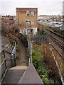
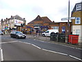
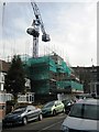
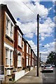


72 photos from this area
Area Information
Key information about the CR4 3RE including its size, population, and administrative classification.
- Area Type
- Postcode
- Area Size
- 5764 m²
- Population
- 1688
- Population Density
- 8894 people/km²
House Prices in CR4 3RE
42
Properties
£187,899
Average Sold Price
£46,200
Lowest Price
£380,000
Highest Price
Showing 42 properties
| Address | Type | Beds | Baths | Last Sale Price | Last Sale Date | |
|---|---|---|---|---|---|---|
| 17 Fairfield Close, Mitcham, CR4 3RE | Flat | 1 | 1 | £245,000 | Aug 2025 | |
| 33 Fairfield Close, Mitcham, CR4 3RE | Flat | 1 | 1 | £275,000 | Aug 2024 | |
| 18 Fairfield Close, Mitcham, CR4 3RE | Flat | - | - | £335,000 | Jul 2024 | |
| 13 Fairfield Close, Mitcham, CR4 3RE | Flat | - | - | £342,500 | Jun 2024 | |
| 37 Fairfield Close, Mitcham, CR4 3RE | Flat | 1 | - | £244,000 | May 2023 | |
| 12 Fairfield Close, Mitcham, CR4 3RE | Flat | - | - | £360,000 | Sep 2022 | |
| 30 Fairfield Close, Mitcham, CR4 3RE | Flat | - | - | £380,000 | Jul 2022 | |
| 14 Fairfield Close, Mitcham, CR4 3RE | Flat | 1 | 1 | £245,000 | Apr 2022 | |
| 42 Fairfield Close, Mitcham, CR4 3RE | Flat | - | - | £215,000 | Jan 2022 | |
| 20 Fairfield Close, Mitcham, CR4 3RE | Flat | 1 | 1 | £222,000 | Nov 2021 |
Page 1 of 5
Energy Efficiency in CR4 3RE
Amenities
Schools
| Rank | School | Type | Entry gender | Ages |
|---|
Explore more schools in this area
Go to Schools tabDemographics
Household Size
Family (3-5 people)
most common
Accommodation Type
Houses
most common
Tenure
43
majority
Ethnic Group
White
most common
Religion
N/A
most common
Household Composition
N/A
most common
Age
47
median
Adults (30-64 years)
most common
Household Deprivation
N/A
with no deprivation
NS-SEC
30
in Lower managerial occupations
Explore more demographic insights in this area
Go to Demographics tabPlanning
Planning Constraints
- Flood RiskPremium
- Ramsar Wetland SitesPremium
- Area of Outstanding Natural BeautyPremium
- Protected Nature ReservePremium
- Protected WoodlandPremium