Area Overview for CR4 3JD
Photos of CR4 3JD


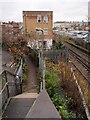
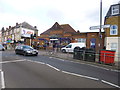
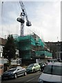
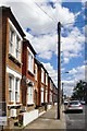


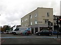
72 photos from this area
Area Information
Key information about the CR4 3JD including its size, population, and administrative classification.
- Area Type
- Postcode
- Area Size
- 1.3 hectares
- Population
- 1672
- Population Density
- 11259 people/km²
House Prices in CR4 3JD
43
Properties
£306,813
Average Sold Price
£99,500
Lowest Price
£620,000
Highest Price
Showing 43 properties
| Address | Type | Beds | Baths | Last Sale Price | Last Sale Date | |
|---|---|---|---|---|---|---|
| 119 Victoria Road, Mitcham, CR4 3JD | house | - | - | £490,000 | May 2025 | |
| 183 Victoria Road, Mitcham, CR4 3JD | Terraced | 3 | 2 | £595,000 | Mar 2025 | |
| 157 Victoria Road, Mitcham, CR4 3JD | Semi-detached | 1 | 2 | £620,000 | Feb 2025 | |
| 111 Victoria Road, Mitcham, CR4 3JD | Terraced | 3 | 2 | £565,000 | Aug 2024 | |
| 139 Victoria Road, Mitcham, CR4 3JD | Semi-detached | 3 | 2 | £540,000 | Mar 2021 | |
| 143 Victoria Road, Mitcham, CR4 3JD | Terraced | 3 | 1 | £455,000 | Jul 2018 | |
| 107 Victoria Road, Mitcham, CR4 3JD | Terraced | 3 | 1 | £438,000 | Jan 2018 | |
| 165 Victoria Road, Mitcham, CR4 3JD | house | - | - | £398,000 | Oct 2015 | |
| 137 Victoria Road, Mitcham, CR4 3JD | house | - | - | £360,000 | Apr 2015 | |
| 117 Victoria Road, Mitcham, CR4 3JD | house | 3 | - | £250,000 | Apr 2013 |
Page 1 of 5
Energy Efficiency in CR4 3JD
Amenities
Schools
| Rank | School | Type | Entry gender | Ages |
|---|
Explore more schools in this area
Go to Schools tabDemographics
Household Size
Family (3-5 people)
most common
Accommodation Type
Houses
most common
Tenure
58
majority
Ethnic Group
White
most common
Religion
N/A
most common
Household Composition
N/A
most common
Age
47
median
Adults (30-64 years)
most common
Household Deprivation
N/A
with no deprivation
NS-SEC
36
in Lower managerial occupations
Explore more demographic insights in this area
Go to Demographics tabPlanning
Planning Constraints
- Flood RiskPremium
- Ramsar Wetland SitesPremium
- Area of Outstanding Natural BeautyPremium
- Protected Nature ReservePremium
- Protected WoodlandPremium