Area Overview for CR4 3AD
Photos of CR4 3AD

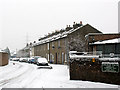
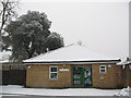
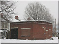

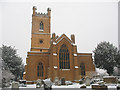
100 photos from this area
Area Information
Key information about the CR4 3AD including its size, population, and administrative classification.
- Area Type
- Postcode
- Area Size
- 4946 m²
- Population
- Not available
- Population Density
- Not available
House Prices in CR4 3AD
19
Properties
£333,200
Average Sold Price
£66,000
Lowest Price
£520,000
Highest Price
Showing 19 properties
| Address | Type | Beds | Baths | Last Sale Price | Last Sale Date | |
|---|---|---|---|---|---|---|
| 7 Glebe Path, Mitcham, CR4 3AD | Terraced | 3 | 1 | £475,000 | Aug 2024 | |
| 19 Glebe Path, Mitcham, CR4 3AD | Terraced | 4 | - | £520,000 | May 2021 | |
| 9 Glebe Path, Mitcham, CR4 3AD | Terraced | 4 | 2 | £450,000 | Jul 2019 | |
| 21 Glebe Path, Mitcham, CR4 3AD | Flat | - | - | £411,000 | Mar 2017 | |
| 15 Glebe Path, Mitcham, CR4 3AD | Terraced | 3 | 2 | £425,000 | Jan 2016 | |
| 17 Glebe Path, Mitcham, CR4 3AD | Terraced | 3 | - | £480,000 | Oct 2015 | |
| 8 Glebe Path, Mitcham, CR4 3AD | house | - | - | £250,000 | Jun 2013 | |
| 12 Glebe Path, Mitcham, CR4 3AD | Terraced | - | - | £175,000 | Sep 2003 | |
| 1 Glebe Path, Mitcham, CR4 3AD | house | 3 | - | £80,000 | Feb 2002 | |
| 10 Glebe Path, Mitcham, CR4 3AD | Terraced | - | - | £66,000 | Apr 1995 |
Page 1 of 2
Energy Efficiency in CR4 3AD
Amenities
Schools
| Rank | School | Type | Entry gender | Ages |
|---|
Explore more schools in this area
Go to Schools tabDemographics
Household Size
Family (3-5 people)
most common
Accommodation Type
Flats
most common
Tenure
31
majority
Ethnic Group
White
most common
Religion
N/A
most common
Household Composition
N/A
most common
Age
47
median
Adults (30-64 years)
most common
Household Deprivation
N/A
with no deprivation
NS-SEC
20
in Lower managerial occupations
Explore more demographic insights in this area
Go to Demographics tabPlanning
Planning Constraints
- Flood RiskPremium
- Ramsar Wetland SitesPremium
- Area of Outstanding Natural BeautyPremium
- Protected Nature ReservePremium
- Protected WoodlandPremium