Area Overview for CR4 2YR
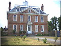
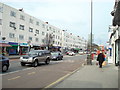
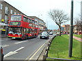
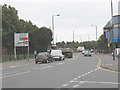
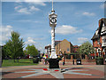
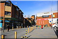
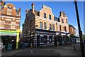
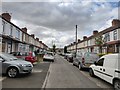
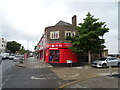
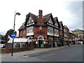
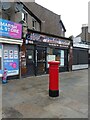
Photos of CR4 2YR

Area Information
CR4 2YR is a small, densely populated residential postcode in England, encompassing 2,566 square metres and home to 1,787 people. Its compact size and high population density of 696,494 people per square kilometre reflect a tightly knit urban community. Situated in the London Borough of Merton, the area is part of Figge’s Marsh Ward, a historically significant electoral district shaped by 18th-century turnpike roads and 19th-century housing. The ward includes Figges Marsh public park, a 25-acre green space at the intersection of London Road and Streatham Road, once a marshland and market garden. Daily life here is defined by proximity to transport hubs like Tooting Station and Mitcham Eastfields, alongside a mix of early 20th-century housing, mid-century council flats, and light industry. The area’s character is shaped by its legacy as a social priority ward, with a focus on community welfare and a notable presence of households with children. Living in CR4 2YR means navigating a compact, urban environment with limited space but rich in historical and practical connectivity.
- Area Type
- Postcode
- Area Size
- 2566 m²
- Population
- 1787
- Population Density
- 19403 people/km²
The property market in CR4 2YR is characterised by a low home ownership rate of 25%, indicating that the majority of residents are likely to be renters rather than homeowners. The accommodation type is predominantly flats, a common feature in densely populated urban areas. This suggests a housing stock that prioritises space efficiency over individual property ownership, typical of areas with limited land availability. For buyers considering this small postcode, the market may present challenges in finding owner-occupied properties, with a stronger emphasis on rental options. The compact size of the area also means that property availability is constrained, potentially limiting choices for those seeking larger homes or private gardens. However, the presence of mid-20th-century council housing and early 20th-century buildings may appeal to buyers interested in historic or affordable housing stock.
House Prices in CR4 2YR
Showing 1 properties
| Address | Type | Beds | Baths | Last Sale Price | Last Sale Date | |
|---|---|---|---|---|---|---|
| Library Accommodation, London Road, Mitcham, CR4 2YR | Flat | - | - | - | - |
Energy Efficiency in CR4 2YR
Residents of CR4 2YR have access to a range of amenities within practical reach. The nearby retail options include Farmfoods Mitcham, Iceland Mitcham, and Lidl Western, providing convenience for grocery shopping. Transport links are robust, with rail stations like Mitcham Eastfields and Tooting, as well as metro stops such as Mitcham Tram Stop. Ferry services connect to Wandsworth Riverside Quarter and Chelsea Harbour, offering water-based travel options. The area also includes Figges Marsh public park, a 25-acre green space ideal for leisure and exercise. While the data does not mention dining or entertainment venues, the presence of multiple retail and transport hubs suggests a functional, urban lifestyle. The compact nature of the area means that amenities are closely clustered, though the lack of detailed information on specific venues leaves room for further exploration.
Amenities
Schools
The nearest school to CR4 2YR is Lavender Lodge School, a special school with an Ofsted rating of ‘good’. This indicates that the area is served by a school catering to students with specific educational needs, which may be a critical consideration for families with children requiring tailored support. The absence of other schools in the data suggests that families may need to travel to nearby wards for additional educational options, such as primary or secondary schools. The presence of a special school highlights the area’s role in providing targeted services, though it also implies that the local school infrastructure is limited to this single institution. For prospective homebuyers, the availability of a ‘good’-rated school is a positive factor, though it may not fully meet the needs of all families.
| Rank | School | Type | Entry gender | Ages |
|---|
Explore more schools in this area
Go to Schools tabDemographics
The community in CR4 2YR has a median age of 47, with the majority of residents aged 30–64. This reflects a mature, working-age population, though the area’s 25% home ownership rate suggests a significant proportion of households are renters. Accommodation is predominantly flats, a common feature in urban areas with limited space. The predominant ethnic group is Black residents, highlighting the area’s demographic diversity. The high population density of 696,494 people per square kilometre indicates a compact, possibly overburdened infrastructure, though this is offset by proximity to amenities. The presence of households with children, combined with the area’s designation as a priority ward for social concerns, suggests a focus on community support systems. While the data does not specify deprivation levels, the mix of council housing and rental flats implies a balance between affordability and potential strain on public services.
Household Size
Accommodation Type
Tenure
Ethnic Group
Religion
Household Composition
Age
Household Deprivation
NS-SEC
Explore more demographic insights in this area
Go to Demographics tabPlanning
Planning Constraints
- Flood RiskPremium
- Ramsar Wetland SitesPremium
- Area of Outstanding Natural BeautyPremium
- Protected Nature ReservePremium
- Protected WoodlandPremium