Area Overview for CR4 2HR
Photos of CR4 2HR
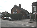
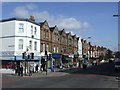
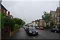
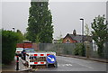
98 photos from this area
Area Information
Key information about the CR4 2HR including its size, population, and administrative classification.
- Area Type
- Postcode
- Area Size
- 1.1 hectares
- Population
- Not available
- Population Density
- Not available
House Prices in CR4 2HR
29
Properties
£231,496
Average Sold Price
£94,000
Lowest Price
£521,000
Highest Price
Showing 29 properties
| Address | Type | Beds | Baths | Last Sale Price | Last Sale Date | |
|---|---|---|---|---|---|---|
| 86 Hill Road, Mitcham, CR4 2HR | Terraced | 3 | 1 | £455,000 | Mar 2021 | |
| 102 Hill Road, Mitcham, CR4 2HR | Terraced | 4 | 1 | £521,000 | Mar 2018 | |
| 94 Hill Road, Mitcham, CR4 2HR | house | - | - | £473,000 | Jan 2017 | |
| 84 Hill Road, Mitcham, CR4 2HR | Terraced | 6 | - | £285,000 | Mar 2012 | |
| 82 Hill Road, Mitcham, CR4 2HR | house | 6 | - | £220,000 | Aug 2011 | |
| 96 Hill Road, Mitcham, CR4 2HR | Terraced | 3 | 1 | £236,000 | Sep 2006 | |
| 78 Hill Road, Mitcham, CR4 2HR | Terraced | - | - | £171,000 | Jul 2002 | |
| 104A Hill Road, Mitcham, CR4 2HR | Flat | - | 1 | £180,000 | Nov 2001 | |
| 104B Hill Road, Mitcham, CR4 2HR | house | - | - | £180,000 | Nov 2001 | |
| 68 Hill Road, Mitcham, CR4 2HR | Terraced | - | - | £109,000 | Dec 1999 |
Page 1 of 3
Energy Efficiency in CR4 2HR
Amenities
Schools
| Rank | School | Type | Entry gender | Ages |
|---|
Explore more schools in this area
Go to Schools tabDemographics
Household Size
Family (3-5 people)
most common
Accommodation Type
Houses
most common
Tenure
61
majority
Ethnic Group
White
most common
Religion
N/A
most common
Household Composition
N/A
most common
Age
47
median
Adults (30-64 years)
most common
Household Deprivation
N/A
with no deprivation
NS-SEC
35
in Lower managerial occupations
Explore more demographic insights in this area
Go to Demographics tabPlanning
Planning Constraints
- Flood RiskPremium
- Ramsar Wetland SitesPremium
- Area of Outstanding Natural BeautyPremium
- Protected Nature ReservePremium
- Protected WoodlandPremium