Area Overview for CR4 2GG
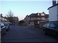
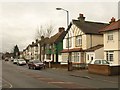
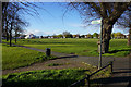
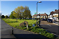
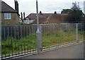
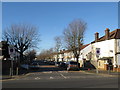
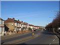
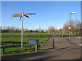
Photos of CR4 2GG
Area Information
GR4 2GG represents a specific residential cluster within the Graveney Ward of the London Borough of Wandsworth. This postcode covers an area of just 748 square metres, indicating a very dense urban setting. The location houses a population of 2,272 people, creating a tightly knit neighbourhood with limited space for expansion. Residents here live in a historic context defined by the River Graveney to the north and the A217 London Road to the south and west. The district forms a triangular area alongside the railway line to the east, which was among the first parts of old Mitcham to urbanise in the late 19th century. The name derives from the de Gravenel family, who held significant landholdings in the 12th and 13th centuries. Living in CR4 2GG means accessing a location that has historical links to Chertsey Abbey and proximity to St Nicholas Church. The area functions as a compact residential estate rather than a sprawling suburb, concentrating its residents in a defined geographic zone. This density suggests a community where neighbours are likely close-knit due to the physical constraints of the land. The postcode serves as a gateway to the broader Tooting Graveney area, blending historic boundaries with modern living requirements.
- Area Type
- Postcode
- Area Size
- 748 m²
- Population
- 2272
- Population Density
- 14316 people/km²
Homes in CR4 2GG are primarily arranged as houses rather than flats, defining the physical character of the street frontage. The home ownership figure of 44 per cent reveals a significant rental component within the market alongside private owners. This balance indicates a diverse property market where both long-term residents and tenants reside. Buyers looking at this small area will find a stock dominated by detached or semi-detached houses rather than high-density apartment blocks. The low area size of 748 square metres constrains the number of available properties, potentially increasing competition for larger family homes. Investors may consider the mix of ownership types when evaluating potential rental yields or long-term appreciation. The historic nature of Graveney Ward contributes to the architectural style and potential value of the housing stock. Properties here benefit from being within the boundary that was among the first to urbanise in the late 19th century, adding historical significance to the modern market. The presence of both owners and renters suggests a stable environment for flipping properties or finding a tenancy. Buyers should prepare for a tight market where the limited number of houses competes against national rental demand.
House Prices in CR4 2GG
Showing 2 properties
| Address | Type | Beds | Baths | Last Sale Price | Last Sale Date | |
|---|---|---|---|---|---|---|
| 1 Stepney Close, Mitcham, CR4 2GG | Bungalow | - | - | - | - | |
| 3 Stepney Close, Mitcham, CR4 2GG | Bungalow | - | - | - | - |
Energy Efficiency in CR4 2GG
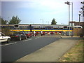
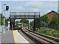
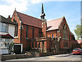
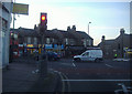
Living in CR4 2GG places you within easy reach of several retail outlets and transport hubs. Lidl Streatham Road, Tesco Mitcham, and Farmfoods Mitcham offer everyday shopping needs within practical distance. Residents can catch trains at Mitcham Eastfields Station, Tooting Station, or Streatham Common for commutes across the network. The tram system connects you to Colliers Wood Station, Mitcham Tram Stop, and Belgrave Walk Tram Stop for quick internal travel. Ferry access from Plantation Wharf Pier, Wandsworth Riverside Quarter Pier, and Chelsea Harbour Pier adds a unique dimension to local leisure options. You can also reach Victoria Coach Station and Green Line Coach Station via bus networks for intercity travel. The area lies near the River Graveney, offering historic boundaries and potential green space alongside the urban layout. St Nicholas Church and Hill House, built in 1784 on manor land, stand as notable local features reflecting the area's heritage. The combination of supermarkets, railway lines, tram stops, and ferry piers creates a highly convenient lifestyle hub. Daily errands require minimal travel time given the proximity of Lidl and Tesco to the residential cluster.
Amenities
Schools
Gorringe Park Middle School sits near CR4 2GG and serves as the primary educational facility for the immediate vicinity. This school operates under the primary education category, although the name includes 'Middle School,' which suggests a specific local designation or older naming convention consistent with the borough's history. Families living in this postcode have access to this single named institution for their primary education needs. The presence of one school within the data set indicates reliance on nearby facilities for early education. Parents considering schools near CR4 2GG must evaluate Gorringe Park Middle School as the main option for primary-aged children. The school's location aligns with the residential concentration in the Graveney Ward, ensuring short travel distances for local students. Educational history in the area dates back to parish registers beginning in 1555, reflecting a long tradition of schooling in the wider region. While the data lists only one primary school, residents likely have access to a range of secondary options further down the A217 London Road or via the railway line. The concentration of educational resources within the ward supports families seeking stability in range and commute times for school runs.
| Rank | School | Type | Entry gender | Ages |
|---|
Explore more schools in this area
Go to Schools tabDemographics
The community within CR4 2GG reflects a mature demographic profile with a median age of 47 years. Adults between the ages of 30 and 64 constitute the most common age range in this postcode area. The population data indicates a stable adult population, suggesting families and established households dominate the local scene. Homeownership stands at exactly 44 per cent, meaning slightly more than half of the residents rent their properties. Houses form the primary accommodation type, distinguishing this zone from areas dominated by flats or apartments. The predominant ethnic group is White, which shapes the cultural makeup of the neighbourhood. With a population density calculated at 3037495 people per square kilometre, the area supports a high concentration of people within a small footprint. This density impacts the feel of daily life, creating an environment where residents interact frequently within the limited residential space. The age profile suggests fewer young children and fewer retirees compared to older or younger average neighbourhoods. Consequently, local services and social events likely cater to a working-age adult population with specific needs.
Household Size
Accommodation Type
Tenure
Ethnic Group
Religion
Household Composition
Age
Household Deprivation
NS-SEC
Explore more demographic insights in this area
Go to Demographics tabPlanning
Planning Constraints
- Flood RiskPremium
- Ramsar Wetland SitesPremium
- Area of Outstanding Natural BeautyPremium
- Protected Nature ReservePremium
- Protected WoodlandPremium