Area Overview for CR4 1XA
Photos of CR4 1XA
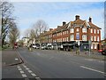
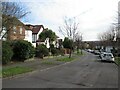
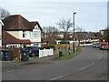
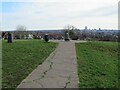
90 photos from this area
Area Information
Key information about the CR4 1XA including its size, population, and administrative classification.
- Area Type
- Postcode
- Area Size
- 5310 m²
- Population
- Not available
- Population Density
- Not available
House Prices in CR4 1XA
35
Properties
£204,627
Average Sold Price
£49,950
Lowest Price
£400,000
Highest Price
Showing 35 properties
| Address | Type | Beds | Baths | Last Sale Price | Last Sale Date | |
|---|---|---|---|---|---|---|
| 12 Brecon Close, Mitcham, CR4 1XA | Detached | 3 | 1 | £362,500 | Jan 2025 | |
| 34 Brecon Close, Mitcham, CR4 1XA | Flat | - | - | £185,000 | Nov 2024 | |
| 13 Brecon Close, Mitcham, CR4 1XA | Terraced | 3 | 1 | £400,000 | Dec 2023 | |
| 17 Brecon Close, Mitcham, CR4 1XA | Flat | 1 | 1 | £185,000 | Jun 2022 | |
| 14 Brecon Close, Mitcham, CR4 1XA | house | 3 | - | £287,000 | Sep 2017 | |
| 5 Brecon Close, Mitcham, CR4 1XA | Terraced | 3 | - | £275,000 | Mar 2016 | |
| 16 Brecon Close, Mitcham, CR4 1XA | Terraced | 3 | 1 | £180,000 | Aug 2012 | |
| 24 Brecon Close, Mitcham, CR4 1XA | Semi-detached | 3 | 1 | £224,000 | Apr 2008 | |
| 15 Brecon Close, Mitcham, CR4 1XA | Terraced | - | - | £225,000 | Apr 2008 | |
| 2 Brecon Close, Mitcham, CR4 1XA | Flat | 3 | 1 | £173,000 | Dec 2006 |
Page 1 of 4
Energy Efficiency in CR4 1XA
Amenities
Schools
| Rank | School | Type | Entry gender | Ages |
|---|
Explore more schools in this area
Go to Schools tabDemographics
Household Size
Family (3-5 people)
most common
Accommodation Type
Houses
most common
Tenure
64
majority
Ethnic Group
black_total
most common
Religion
N/A
most common
Household Composition
N/A
most common
Age
47
median
Adults (30-64 years)
most common
Household Deprivation
N/A
with no deprivation
NS-SEC
25
in Lower managerial occupations
Explore more demographic insights in this area
Go to Demographics tabPlanning
Planning Constraints
- Flood RiskPremium
- Ramsar Wetland SitesPremium
- Area of Outstanding Natural BeautyPremium
- Protected Nature ReservePremium
- Protected WoodlandPremium