Area Overview for CR4 1QT
Photos of CR4 1QT
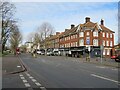
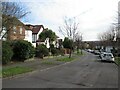
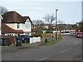
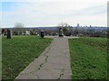
90 photos from this area
Area Information
Key information about the CR4 1QT including its size, population, and administrative classification.
- Area Type
- Postcode
- Area Size
- 1.0 hectares
- Population
- 1702
- Population Density
- 13508 people/km²
House Prices in CR4 1QT
54
Properties
£208,377
Average Sold Price
£70,000
Lowest Price
£400,000
Highest Price
Showing 54 properties
| Address | Type | Beds | Baths | Last Sale Price | Last Sale Date | |
|---|---|---|---|---|---|---|
| 102 Berkshire Way, Mitcham, CR4 1QT | Semi-detached | 2 | 1 | £375,000 | Jan 2025 | |
| 62 Berkshire Way, Mitcham, CR4 1QT | Semi-detached | 3 | 1 | £380,000 | Oct 2024 | |
| 16 Berkshire Way, Mitcham, CR4 1QT | Semi-detached | 3 | 1 | £400,000 | Jul 2023 | |
| 64 Berkshire Way, Mitcham, CR4 1QT | Terraced | 3 | 2 | £375,000 | Apr 2023 | |
| 46 Berkshire Way, Mitcham, CR4 1QT | Flat | - | - | £205,000 | Oct 2020 | |
| 94 Berkshire Way, Mitcham, CR4 1QT | Semi-detached | 2 | - | £320,000 | Jul 2017 | |
| 98 Berkshire Way, Mitcham, CR4 1QT | Semi-detached | 1 | 1 | £210,000 | May 2016 | |
| 104 Berkshire Way, Mitcham, CR4 1QT | house | - | - | £145,390 | Aug 2015 | |
| 82 Berkshire Way, Mitcham, CR4 1QT | house | - | - | £174,000 | Dec 2010 | |
| 100 Berkshire Way, Mitcham, CR4 1QT | house | - | - | £129,000 | Jul 2009 |
Page 1 of 6
Energy Efficiency in CR4 1QT
Amenities
Schools
| Rank | School | Type | Entry gender | Ages |
|---|
Explore more schools in this area
Go to Schools tabDemographics
Household Size
Family (3-5 people)
most common
Accommodation Type
Houses
most common
Tenure
42
majority
Ethnic Group
White
most common
Religion
N/A
most common
Household Composition
N/A
most common
Age
47
median
Adults (30-64 years)
most common
Household Deprivation
N/A
with no deprivation
NS-SEC
21
in Lower managerial occupations
Explore more demographic insights in this area
Go to Demographics tabPlanning
Planning Constraints
- Flood RiskPremium
- Ramsar Wetland SitesPremium
- Area of Outstanding Natural BeautyPremium
- Protected Nature ReservePremium
- Protected WoodlandPremium