Area Overview for CR3 0DB
Photos of CR3 0DB
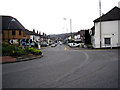
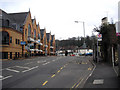
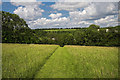
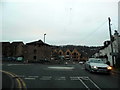

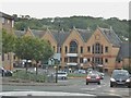
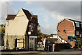
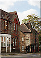
87 photos from this area
Area Information
Key information about the CR3 0DB including its size, population, and administrative classification.
- Area Type
- Postcode
- Area Size
- 3.9 hectares
- Population
- Not available
- Population Density
- Not available
House Prices in CR3 0DB
12
Properties
£386,333
Average Sold Price
£140,000
Lowest Price
£665,000
Highest Price
Showing 12 properties
| Address | Type | Beds | Baths | Last Sale Price | Last Sale Date | |
|---|---|---|---|---|---|---|
| 18 Hilltop Road, Whyteleafe, CR3 0DB | Retail | 3 | 1 | £632,500 | Aug 2022 | |
| 2 Hilltop Road, Whyteleafe, CR3 0DB | Bungalow | 3 | 1 | £665,000 | Apr 2021 | |
| 24 Hilltop Road, Whyteleafe, CR3 0DB | Detached | 4 | 1 | £615,000 | Jul 2016 | |
| 16 Hilltop Road, Whyteleafe, CR3 0DB | Bungalow | 2 | - | £345,000 | Nov 2014 | |
| 22 Hilltop Road, Whyteleafe, CR3 0DB | Detached | - | - | £421,000 | Aug 2011 | |
| 6 Hilltop Road, Whyteleafe, CR3 0DB | Detached | 3 | 2 | £250,000 | Jun 2009 | |
| 12 Hilltop Road, Whyteleafe, CR3 0DB | Detached | - | - | £250,000 | Dec 2002 | |
| 4 Hilltop Road, Whyteleafe, CR3 0DB | Detached | - | - | £158,500 | Jun 1997 | |
| 20 Hilltop Road, Whyteleafe, CR3 0DB | Detached | - | - | £140,000 | Apr 1996 | |
| 8 Hilltop Road, Whyteleafe, CR3 0DB | Detached | - | - | - | - |
Page 1 of 2
Energy Efficiency in CR3 0DB
Amenities
Schools
| Rank | School | Type | Entry gender | Ages |
|---|
Explore more schools in this area
Go to Schools tabDemographics
Household Size
Family (3-5 people)
most common
Accommodation Type
Houses
most common
Tenure
78
majority
Ethnic Group
White
most common
Religion
N/A
most common
Household Composition
N/A
most common
Age
47
median
Adults (30-64 years)
most common
Household Deprivation
N/A
with no deprivation
NS-SEC
42
in Lower managerial occupations
Explore more demographic insights in this area
Go to Demographics tabPlanning
Planning Constraints
- Flood RiskPremium
- Ramsar Wetland SitesPremium
- Area of Outstanding Natural BeautyPremium
- Protected Nature ReservePremium
- Protected WoodlandPremium