Area Overview for CR2 9DE
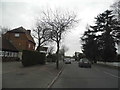
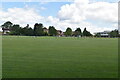
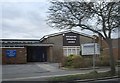
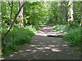
Photos of CR2 9DE
Area Information
Living in CR2 9DE means residing in a compact residential cluster covering just 1.3 hectares. This specific postcode holds a population of 1,633 people within a tightly packed environment. The location sits firmly within the South London context, closely associated with the historic ward of Sanderstead in the London Borough of Croydon. You will find yourself in an area where historical roots run deep, linking back to a church mentioned in Duke Elfred's will as far back as 871. The land has transitioned from farmland to dense housing over the last century, creating a neighbourhood with a distinct residential focus. Residents here enjoy immediate access to local landmarks like All Saints Churchyard, a Grade 1 historic building with archaeological significance. The community benefits from practical transport links, including rail services at Whyteleafe and Upper Warlingham, alongside tram stops on the Croydon tram network. Despite its small footprint, the area offers a complete living experience with nearby retail options and green infrastructure. The high population density of 127,252 people per square kilometre indicates a vibrant, established locality rather than a sprawling development. You are buying into a settled environment where daily life revolves around established neighbourhood routines and strong local connections. The community in CR2 9DE is defined by a mature and stable population profile. The median age stands at 47 years, with adults aged between 30 and 64 years forming the most common age range. This demographic structure suggests a household environment dominated by families, couples, and those in mid-life. Home ownership is exceptionally high, with 90% of properties owned by their occupants. This figure indicates a neighbourhood where residents have made significant long-term investments in their properties. The predominant accommodation type consists of houses, aligning with the high ownership statistic and the mature nature of the residents. White residents form the predominant ethnic group within this cluster. The data presents a clear picture of a settled community with low turnover and strong ties to the local area. There is very little evidence of landlord tenure or short-term renting within this specific postcode. The high proportion of owner-occupied homes often correlates with greater community stability and engagement in local neighbourhood affairs. Buyers looking for an established community where residents put down deep roots will find this demographic profile appealing. The age distribution supports a quiet, family-oriented atmosphere rather than a transient or student-heavy environment. The property market in CR2 9DE is characterised by a near-total dominance of private ownership. With home ownership reaching 90%, this area functions as a traditional owner-occupied sector rather than a rental market. All available data points to houses as the predominant accommodation type, meaning you will not find blocks of flats or apartments within this specific postcode cluster. The 1.3-hectare footprint supports a limited volume of properties, creating a niche market for those specifically seeking homes in this exact location. The high ownership rate of 90% suggests that most transactions here involve long-term residents moving between properties rather than investors seeking rental yields. This structure typically leads to stable property values driven by family replacement rather than speculative flipping. The lack of rental stock means the local economy relies heavily on owner-occupiers injecting wealth into local businesses. If you are considering buying, you are entering a market where duration of ownership is generally very long. The 1633 residents across this small area imply a close-knit neighbourhood where property changes may be visible and discussed within the community. There is no data suggesting significant new developments, reinforcing the status of this area as a mature, established residential zone within the broader Croydon landscape. Families residing in CR2 9DE have direct access to quality education facilities immediately within their neighbourhood. Atwood Primary School stands as the primary educational option listed for this postcode. It holds a 'good' Ofsted rating, placing it in the upper quartile of performance across the country. This rating provides assurance for parents seeking a school with strong standards in teaching and leadership. While the data does not list secondary schools in the immediate vicinity, the presence of a well-rated primary institution like Atwood Primary School indicates that younger children are catered for locally. This single named school suggests a self-contained educational catchment for the younger demographic until secondary transition. For those prioritising school location, this primary choice is the central focus for the local education infrastructure. The 'good' rating is a concrete metric that families can verify when comparing options. You do not need to look far for primary education, as Atwood Primary School sits directly in the immediate catchment area. This focus on local provision supports the family-oriented demographic established in the area's overall profile. Digital connectivity in CR2 9DE is defined by robust performance across both fixed and wireless networks. The broadband score reaches 92 out of 100, classified as excellent quality fixed broadband. This places your connection among the highest tier available in the UK, ensuring reliable speeds for streaming, working from home, or multiple device usage. Mobile coverage scores 85 out of 100, also representing a good to excellent standard for 4G and 5G networks. These figures mean you can expect minimal disruption to remote working or digital entertainment. For daily commuting, physical transport links are positioned within practical reach. You have access to five nearby rail stations, including Whyteleafe and Upper Warlingham, along with five metro tram stops at Gravel Hill and Coombe Lane. Two airports, Biggin Hill and London Biggin Hill Airport, are located nearby for aviation needs. This digital and physical connectivity blends to support a lifestyle where remote work is viable and physical commute times remain manageable via train or tram. The combination of excellent home internet and accessible public transport nodes ensures residents are not isolated from the wider region. Daily life in CR2 9DE is supported by a cluster of nearby amenities within practical reach. Residents benefit from five retail locations, including major supermarkets such as Waitrose Sanderstead, Co-op Hamsey, and Cook Sanderstead. These venues provide comprehensive shopping needs from fresh groceries to household essentials. For leisure and travel, the transport network is extensive with five rail stations and five tram stops offering rapid connections to central London. The presence of two airports, London Biggin Hill Airport and Biggin Hill Airport, adds to the region's connectivity profile for business or private travel. While the immediate 1.3-hectare area focuses on housing, the surrounding network of five retail outlets ensures you never need to travel far for daily provisions. The proximity to Sanderstead High Street and local hamlets like Hamsey integrates the small postcode into a larger, functional shopping ecosystem. There are no listed parks or leisure centres in the immediate named data, but the strong retail and transport fabric compensates for this. Your lifestyle revolves around the convenience of these five retail sites and the efficiency of the rail and tram links. The 1633 residents form a compact community that relies on these established local services for their weekly routines. Safety and environmental factors in CR2 9DE present an overwhelmingly positive profile for prospective residents. The area holds a safety score of 90 out of 100, indicating a low risk of crime and significantly below-average crime rates compared to national figures. This statistical reality translates to a secure environment for walking, cycling, or community activities at any time of day. Environmental planning constraints are fully cleared, with a pass rating across all major categories. There is zero registered flood risk, meaning you can live without concern for water-related property damage. The area contains no Ramsar wetland sites, Areas of Outstanding Natural Beauty, protected nature reserves, or protected woodland. This clearance removes potential planning restrictions that often arise in environmentally sensitive zones. The absence of these constraints simplifies the building and development history of the neighbourhood, ensuring stability for current owners. With no flood risk and no environmental protections limiting property use, the neighbourhood stands as a straightforward, safe choice for long-term residence. The crime record, the lack of flood risk, and the clear planning status create a secure foundation for family life in this South London location. Who typically lives in CR2 9DE and what is the community feel like?The community is mature and settled, with a median age of 47 years and adults aged 30 to 64 years forming the largest demographic group. Home ownership stands at 90%, indicating a neighbourhood of long-term residents rather than transient populations. The area is predominantly composed of houses, creating a family-oriented atmosphere with deep local roots. What schools are available for children living in CR2 9DE?Atwood Primary School serves the local educational needs and holds a 'good' Ofsted rating. This is the only primary school listed in the immediate vicinity, providing a proven choice of education for young families without needing to look far beyond the neighbourhood boundaries. How good are the transport and internet connections for working from home?Digital connectivity is excellent, with a broadband score of 92/100 and mobile coverage at 85/100, ensuring reliable remote working facilities. For physical travel, residents have access to five rail stations and five tram stops, including Whyteleafe and Upper Warlingham, alongside connections to Biggin Hill Airport for occasional travel. Is CR2 9DE a safe place to live regarding crime and environmental risks?The area scores highly on safety with a crime risk score of 90/100, placing crime rates well below the national average. Environmentally, there is zero flood risk and no protected land constraints such as woodlands or nature reserves, ensuring a stable property environment without planning restrictions.
- Area Type
- Postcode
- Area Size
- 1.3 hectares
- Population
- Not available
- Population Density
- Not available
The property market in CR2 9DE is characterised by a near-total dominance of private ownership. With home ownership reaching 90%, this area functions as a traditional owner-occupied sector rather than a rental market. All available data points to houses as the predominant accommodation type, meaning you will not find blocks of flats or apartments within this specific postcode cluster. The 1.3-hectare footprint supports a limited volume of properties, creating a niche market for those specifically seeking homes in this exact location. The high ownership rate of 90% suggests that most transactions here involve long-term residents moving between properties rather than investors seeking rental yields. This structure typically leads to stable property values driven by family replacement rather than speculative flipping. The lack of rental stock means the local economy relies heavily on owner-occupiers injecting wealth into local businesses. If you are considering buying, you are entering a market where duration of ownership is generally very long. The 1633 residents across this small area imply a close-knit neighbourhood where property changes may be visible and discussed within the community. There is no data suggesting significant new developments, reinforcing the status of this area as a mature, established residential zone within the broader Croydon landscape. Families residing in CR2 9DE have direct access to quality education facilities immediately within their neighbourhood. Atwood Primary School stands as the primary educational option listed for this postcode. It holds a 'good' Ofsted rating, placing it in the upper quartile of performance across the country. This rating provides assurance for parents seeking a school with strong standards in teaching and leadership. While the data does not list secondary schools in the immediate vicinity, the presence of a well-rated primary institution like Atwood Primary School indicates that younger children are catered for locally. This single named school suggests a self-contained educational catchment for the younger demographic until secondary transition. For those prioritising school location, this primary choice is the central focus for the local education infrastructure. The 'good' rating is a concrete metric that families can verify when comparing options. You do not need to look far for primary education, as Atwood Primary School sits directly in the immediate catchment area. This focus on local provision supports the family-oriented demographic established in the area's overall profile. Digital connectivity in CR2 9DE is defined by robust performance across both fixed and wireless networks. The broadband score reaches 92 out of 100, classified as excellent quality fixed broadband. This places your connection among the highest tier available in the UK, ensuring reliable speeds for streaming, working from home, or multiple device usage. Mobile coverage scores 85 out of 100, also representing a good to excellent standard for 4G and 5G networks. These figures mean you can expect minimal disruption to remote working or digital entertainment. For daily commuting, physical transport links are positioned within practical reach. You have access to five nearby rail stations, including Whyteleafe and Upper Warlingham, along with five metro tram stops at Gravel Hill and Coombe Lane. Two airports, Biggin Hill and London Biggin Hill Airport, are located nearby for aviation needs. This digital and physical connectivity blends to support a lifestyle where remote work is viable and physical commute times remain manageable via train or tram. The combination of excellent home internet and accessible public transport nodes ensures residents are not isolated from the wider region. Daily life in CR2 9DE is supported by a cluster of nearby amenities within practical reach. Residents benefit from five retail locations, including major supermarkets such as Waitrose Sanderstead, Co-op Hamsey, and Cook Sanderstead. These venues provide comprehensive shopping needs from fresh groceries to household essentials. For leisure and travel, the transport network is extensive with five rail stations and five tram stops offering rapid connections to central London. The presence of two airports, London Biggin Hill Airport and Biggin Hill Airport, adds to the region's connectivity profile for business or private travel. While the immediate 1.3-hectare area focuses on housing, the surrounding network of five retail outlets ensures you never need to travel far for daily provisions. The proximity to Sanderstead High Street and local hamlets like Hamsey integrates the small postcode into a larger, functional shopping ecosystem. There are no listed parks or leisure centres in the immediate named data, but the strong retail and transport fabric compensates for this. Your lifestyle revolves around the convenience of these five retail sites and the efficiency of the rail and tram links. The 1633 residents form a compact community that relies on these established local services for their weekly routines. Safety and environmental factors in CR2 9DE present an overwhelmingly positive profile for prospective residents. The area holds a safety score of 90 out of 100, indicating a low risk of crime and significantly below-average crime rates compared to national figures. This statistical reality translates to a secure environment for walking, cycling, or community activities at any time of day. Environmental planning constraints are fully cleared, with a pass rating across all major categories. There is zero registered flood risk, meaning you can live without concern for water-related property damage. The area contains no Ramsar wetland sites, Areas of Outstanding Natural Beauty, protected nature reserves, or protected woodland. This clearance removes potential planning restrictions that often arise in environmentally sensitive zones. The absence of these constraints simplifies the building and development history of the neighbourhood, ensuring stability for current owners. With no flood risk and no environmental protections limiting property use, the neighbourhood stands as a straightforward, safe choice for long-term residence. The crime record, the lack of flood risk, and the clear planning status create a secure foundation for family life in this South London location. Who typically lives in CR2 9DE and what is the community feel like?The community is mature and settled, with a median age of 47 years and adults aged 30 to 64 years forming the largest demographic group. Home ownership stands at 90%, indicating a neighbourhood of long-term residents rather than transient populations. The area is predominantly composed of houses, creating a family-oriented atmosphere with deep local roots. What schools are available for children living in CR2 9DE?Atwood Primary School serves the local educational needs and holds a 'good' Ofsted rating. This is the only primary school listed in the immediate vicinity, providing a proven choice of education for young families without needing to look far beyond the neighbourhood boundaries. How good are the transport and internet connections for working from home?Digital connectivity is excellent, with a broadband score of 92/100 and mobile coverage at 85/100, ensuring reliable remote working facilities. For physical travel, residents have access to five rail stations and five tram stops, including Whyteleafe and Upper Warlingham, alongside connections to Biggin Hill Airport for occasional travel. Is CR2 9DE a safe place to live regarding crime and environmental risks?The area scores highly on safety with a crime risk score of 90/100, placing crime rates well below the national average. Environmentally, there is zero flood risk and no protected land constraints such as woodlands or nature reserves, ensuring a stable property environment without planning restrictions.
House Prices in CR2 9DE
Showing 39 properties
| Address | Type | Beds | Baths | Last Sale Price | Last Sale Date | |
|---|---|---|---|---|---|---|
| 207 Limpsfield Road, South Croydon, CR2 9DE | house | 3 | - | £505,000 | Jan 2022 | |
| 205 Limpsfield Road, South Croydon, CR2 9DE | Semi-detached | 3 | 1 | £515,500 | Sep 2021 | |
| 235 Limpsfield Road, South Croydon, CR2 9DE | Terraced | 3 | - | £410,000 | Jun 2021 | |
| 213 Limpsfield Road, South Croydon, CR2 9DE | Terraced | 4 | 2 | £555,000 | Feb 2021 | |
| 199 Limpsfield Road, South Croydon, CR2 9DE | house | - | - | £435,000 | Aug 2019 | |
| 195 Limpsfield Road, South Croydon, CR2 9DE | Terraced | 3 | 1 | £395,000 | May 2019 | |
| 217 Limpsfield Road, South Croydon, CR2 9DE | Terraced | 3 | 1 | £363,000 | Mar 2016 | |
| 227 Limpsfield Road, South Croydon, CR2 9DE | Terraced | 2 | 1 | £340,000 | Nov 2015 | |
| 247 Limpsfield Road, South Croydon, CR2 9DE | Terraced | 3 | - | £340,000 | Nov 2015 | |
| 229 Limpsfield Road, South Croydon, CR2 9DE | Terraced | 3 | - | £273,000 | Jan 2014 |
Energy Efficiency in CR2 9DE
Daily life in CR2 9DE is supported by a cluster of nearby amenities within practical reach. Residents benefit from five retail locations, including major supermarkets such as Waitrose Sanderstead, Co-op Hamsey, and Cook Sanderstead. These venues provide comprehensive shopping needs from fresh groceries to household essentials. For leisure and travel, the transport network is extensive with five rail stations and five tram stops offering rapid connections to central London. The presence of two airports, London Biggin Hill Airport and Biggin Hill Airport, adds to the region's connectivity profile for business or private travel. While the immediate 1.3-hectare area focuses on housing, the surrounding network of five retail outlets ensures you never need to travel far for daily provisions. The proximity to Sanderstead High Street and local hamlets like Hamsey integrates the small postcode into a larger, functional shopping ecosystem. There are no listed parks or leisure centres in the immediate named data, but the strong retail and transport fabric compensates for this. Your lifestyle revolves around the convenience of these five retail sites and the efficiency of the rail and tram links. The 1633 residents form a compact community that relies on these established local services for their weekly routines. Safety and environmental factors in CR2 9DE present an overwhelmingly positive profile for prospective residents. The area holds a safety score of 90 out of 100, indicating a low risk of crime and significantly below-average crime rates compared to national figures. This statistical reality translates to a secure environment for walking, cycling, or community activities at any time of day. Environmental planning constraints are fully cleared, with a pass rating across all major categories. There is zero registered flood risk, meaning you can live without concern for water-related property damage. The area contains no Ramsar wetland sites, Areas of Outstanding Natural Beauty, protected nature reserves, or protected woodland. This clearance removes potential planning restrictions that often arise in environmentally sensitive zones. The absence of these constraints simplifies the building and development history of the neighbourhood, ensuring stability for current owners. With no flood risk and no environmental protections limiting property use, the neighbourhood stands as a straightforward, safe choice for long-term residence. The crime record, the lack of flood risk, and the clear planning status create a secure foundation for family life in this South London location. Who typically lives in CR2 9DE and what is the community feel like?The community is mature and settled, with a median age of 47 years and adults aged 30 to 64 years forming the largest demographic group. Home ownership stands at 90%, indicating a neighbourhood of long-term residents rather than transient populations. The area is predominantly composed of houses, creating a family-oriented atmosphere with deep local roots. What schools are available for children living in CR2 9DE?Atwood Primary School serves the local educational needs and holds a 'good' Ofsted rating. This is the only primary school listed in the immediate vicinity, providing a proven choice of education for young families without needing to look far beyond the neighbourhood boundaries. How good are the transport and internet connections for working from home?Digital connectivity is excellent, with a broadband score of 92/100 and mobile coverage at 85/100, ensuring reliable remote working facilities. For physical travel, residents have access to five rail stations and five tram stops, including Whyteleafe and Upper Warlingham, alongside connections to Biggin Hill Airport for occasional travel. Is CR2 9DE a safe place to live regarding crime and environmental risks?The area scores highly on safety with a crime risk score of 90/100, placing crime rates well below the national average. Environmentally, there is zero flood risk and no protected land constraints such as woodlands or nature reserves, ensuring a stable property environment without planning restrictions.
Amenities
Schools
Families residing in CR2 9DE have direct access to quality education facilities immediately within their neighbourhood. Atwood Primary School stands as the primary educational option listed for this postcode. It holds a 'good' Ofsted rating, placing it in the upper quartile of performance across the country. This rating provides assurance for parents seeking a school with strong standards in teaching and leadership. While the data does not list secondary schools in the immediate vicinity, the presence of a well-rated primary institution like Atwood Primary School indicates that younger children are catered for locally. This single named school suggests a self-contained educational catchment for the younger demographic until secondary transition. For those prioritising school location, this primary choice is the central focus for the local education infrastructure. The 'good' rating is a concrete metric that families can verify when comparing options. You do not need to look far for primary education, as Atwood Primary School sits directly in the immediate catchment area. This focus on local provision supports the family-oriented demographic established in the area's overall profile. Digital connectivity in CR2 9DE is defined by robust performance across both fixed and wireless networks. The broadband score reaches 92 out of 100, classified as excellent quality fixed broadband. This places your connection among the highest tier available in the UK, ensuring reliable speeds for streaming, working from home, or multiple device usage. Mobile coverage scores 85 out of 100, also representing a good to excellent standard for 4G and 5G networks. These figures mean you can expect minimal disruption to remote working or digital entertainment. For daily commuting, physical transport links are positioned within practical reach. You have access to five nearby rail stations, including Whyteleafe and Upper Warlingham, along with five metro tram stops at Gravel Hill and Coombe Lane. Two airports, Biggin Hill and London Biggin Hill Airport, are located nearby for aviation needs. This digital and physical connectivity blends to support a lifestyle where remote work is viable and physical commute times remain manageable via train or tram. The combination of excellent home internet and accessible public transport nodes ensures residents are not isolated from the wider region. Daily life in CR2 9DE is supported by a cluster of nearby amenities within practical reach. Residents benefit from five retail locations, including major supermarkets such as Waitrose Sanderstead, Co-op Hamsey, and Cook Sanderstead. These venues provide comprehensive shopping needs from fresh groceries to household essentials. For leisure and travel, the transport network is extensive with five rail stations and five tram stops offering rapid connections to central London. The presence of two airports, London Biggin Hill Airport and Biggin Hill Airport, adds to the region's connectivity profile for business or private travel. While the immediate 1.3-hectare area focuses on housing, the surrounding network of five retail outlets ensures you never need to travel far for daily provisions. The proximity to Sanderstead High Street and local hamlets like Hamsey integrates the small postcode into a larger, functional shopping ecosystem. There are no listed parks or leisure centres in the immediate named data, but the strong retail and transport fabric compensates for this. Your lifestyle revolves around the convenience of these five retail sites and the efficiency of the rail and tram links. The 1633 residents form a compact community that relies on these established local services for their weekly routines. Safety and environmental factors in CR2 9DE present an overwhelmingly positive profile for prospective residents. The area holds a safety score of 90 out of 100, indicating a low risk of crime and significantly below-average crime rates compared to national figures. This statistical reality translates to a secure environment for walking, cycling, or community activities at any time of day. Environmental planning constraints are fully cleared, with a pass rating across all major categories. There is zero registered flood risk, meaning you can live without concern for water-related property damage. The area contains no Ramsar wetland sites, Areas of Outstanding Natural Beauty, protected nature reserves, or protected woodland. This clearance removes potential planning restrictions that often arise in environmentally sensitive zones. The absence of these constraints simplifies the building and development history of the neighbourhood, ensuring stability for current owners. With no flood risk and no environmental protections limiting property use, the neighbourhood stands as a straightforward, safe choice for long-term residence. The crime record, the lack of flood risk, and the clear planning status create a secure foundation for family life in this South London location. Who typically lives in CR2 9DE and what is the community feel like?The community is mature and settled, with a median age of 47 years and adults aged 30 to 64 years forming the largest demographic group. Home ownership stands at 90%, indicating a neighbourhood of long-term residents rather than transient populations. The area is predominantly composed of houses, creating a family-oriented atmosphere with deep local roots. What schools are available for children living in CR2 9DE?Atwood Primary School serves the local educational needs and holds a 'good' Ofsted rating. This is the only primary school listed in the immediate vicinity, providing a proven choice of education for young families without needing to look far beyond the neighbourhood boundaries. How good are the transport and internet connections for working from home?Digital connectivity is excellent, with a broadband score of 92/100 and mobile coverage at 85/100, ensuring reliable remote working facilities. For physical travel, residents have access to five rail stations and five tram stops, including Whyteleafe and Upper Warlingham, alongside connections to Biggin Hill Airport for occasional travel. Is CR2 9DE a safe place to live regarding crime and environmental risks?The area scores highly on safety with a crime risk score of 90/100, placing crime rates well below the national average. Environmentally, there is zero flood risk and no protected land constraints such as woodlands or nature reserves, ensuring a stable property environment without planning restrictions.
| Rank | School | Type | Entry gender | Ages |
|---|
Explore more schools in this area
Go to Schools tabDemographics
The community in CR2 9DE is defined by a mature and stable population profile. The median age stands at 47 years, with adults aged between 30 and 64 years forming the most common age range. This demographic structure suggests a household environment dominated by families, couples, and those in mid-life. Home ownership is exceptionally high, with 90% of properties owned by their occupants. This figure indicates a neighbourhood where residents have made significant long-term investments in their properties. The predominant accommodation type consists of houses, aligning with the high ownership statistic and the mature nature of the residents. White residents form the predominant ethnic group within this cluster. The data presents a clear picture of a settled community with low turnover and strong ties to the local area. There is very little evidence of landlord tenure or short-term renting within this specific postcode. The high proportion of owner-occupied homes often correlates with greater community stability and engagement in local neighbourhood affairs. Buyers looking for an established community where residents put down deep roots will find this demographic profile appealing. The age distribution supports a quiet, family-oriented atmosphere rather than a transient or student-heavy environment. The property market in CR2 9DE is characterised by a near-total dominance of private ownership. With home ownership reaching 90%, this area functions as a traditional owner-occupied sector rather than a rental market. All available data points to houses as the predominant accommodation type, meaning you will not find blocks of flats or apartments within this specific postcode cluster. The 1.3-hectare footprint supports a limited volume of properties, creating a niche market for those specifically seeking homes in this exact location. The high ownership rate of 90% suggests that most transactions here involve long-term residents moving between properties rather than investors seeking rental yields. This structure typically leads to stable property values driven by family replacement rather than speculative flipping. The lack of rental stock means the local economy relies heavily on owner-occupiers injecting wealth into local businesses. If you are considering buying, you are entering a market where duration of ownership is generally very long. The 1633 residents across this small area imply a close-knit neighbourhood where property changes may be visible and discussed within the community. There is no data suggesting significant new developments, reinforcing the status of this area as a mature, established residential zone within the broader Croydon landscape. Families residing in CR2 9DE have direct access to quality education facilities immediately within their neighbourhood. Atwood Primary School stands as the primary educational option listed for this postcode. It holds a 'good' Ofsted rating, placing it in the upper quartile of performance across the country. This rating provides assurance for parents seeking a school with strong standards in teaching and leadership. While the data does not list secondary schools in the immediate vicinity, the presence of a well-rated primary institution like Atwood Primary School indicates that younger children are catered for locally. This single named school suggests a self-contained educational catchment for the younger demographic until secondary transition. For those prioritising school location, this primary choice is the central focus for the local education infrastructure. The 'good' rating is a concrete metric that families can verify when comparing options. You do not need to look far for primary education, as Atwood Primary School sits directly in the immediate catchment area. This focus on local provision supports the family-oriented demographic established in the area's overall profile. Digital connectivity in CR2 9DE is defined by robust performance across both fixed and wireless networks. The broadband score reaches 92 out of 100, classified as excellent quality fixed broadband. This places your connection among the highest tier available in the UK, ensuring reliable speeds for streaming, working from home, or multiple device usage. Mobile coverage scores 85 out of 100, also representing a good to excellent standard for 4G and 5G networks. These figures mean you can expect minimal disruption to remote working or digital entertainment. For daily commuting, physical transport links are positioned within practical reach. You have access to five nearby rail stations, including Whyteleafe and Upper Warlingham, along with five metro tram stops at Gravel Hill and Coombe Lane. Two airports, Biggin Hill and London Biggin Hill Airport, are located nearby for aviation needs. This digital and physical connectivity blends to support a lifestyle where remote work is viable and physical commute times remain manageable via train or tram. The combination of excellent home internet and accessible public transport nodes ensures residents are not isolated from the wider region. Daily life in CR2 9DE is supported by a cluster of nearby amenities within practical reach. Residents benefit from five retail locations, including major supermarkets such as Waitrose Sanderstead, Co-op Hamsey, and Cook Sanderstead. These venues provide comprehensive shopping needs from fresh groceries to household essentials. For leisure and travel, the transport network is extensive with five rail stations and five tram stops offering rapid connections to central London. The presence of two airports, London Biggin Hill Airport and Biggin Hill Airport, adds to the region's connectivity profile for business or private travel. While the immediate 1.3-hectare area focuses on housing, the surrounding network of five retail outlets ensures you never need to travel far for daily provisions. The proximity to Sanderstead High Street and local hamlets like Hamsey integrates the small postcode into a larger, functional shopping ecosystem. There are no listed parks or leisure centres in the immediate named data, but the strong retail and transport fabric compensates for this. Your lifestyle revolves around the convenience of these five retail sites and the efficiency of the rail and tram links. The 1633 residents form a compact community that relies on these established local services for their weekly routines. Safety and environmental factors in CR2 9DE present an overwhelmingly positive profile for prospective residents. The area holds a safety score of 90 out of 100, indicating a low risk of crime and significantly below-average crime rates compared to national figures. This statistical reality translates to a secure environment for walking, cycling, or community activities at any time of day. Environmental planning constraints are fully cleared, with a pass rating across all major categories. There is zero registered flood risk, meaning you can live without concern for water-related property damage. The area contains no Ramsar wetland sites, Areas of Outstanding Natural Beauty, protected nature reserves, or protected woodland. This clearance removes potential planning restrictions that often arise in environmentally sensitive zones. The absence of these constraints simplifies the building and development history of the neighbourhood, ensuring stability for current owners. With no flood risk and no environmental protections limiting property use, the neighbourhood stands as a straightforward, safe choice for long-term residence. The crime record, the lack of flood risk, and the clear planning status create a secure foundation for family life in this South London location. Who typically lives in CR2 9DE and what is the community feel like?The community is mature and settled, with a median age of 47 years and adults aged 30 to 64 years forming the largest demographic group. Home ownership stands at 90%, indicating a neighbourhood of long-term residents rather than transient populations. The area is predominantly composed of houses, creating a family-oriented atmosphere with deep local roots. What schools are available for children living in CR2 9DE?Atwood Primary School serves the local educational needs and holds a 'good' Ofsted rating. This is the only primary school listed in the immediate vicinity, providing a proven choice of education for young families without needing to look far beyond the neighbourhood boundaries. How good are the transport and internet connections for working from home?Digital connectivity is excellent, with a broadband score of 92/100 and mobile coverage at 85/100, ensuring reliable remote working facilities. For physical travel, residents have access to five rail stations and five tram stops, including Whyteleafe and Upper Warlingham, alongside connections to Biggin Hill Airport for occasional travel. Is CR2 9DE a safe place to live regarding crime and environmental risks?The area scores highly on safety with a crime risk score of 90/100, placing crime rates well below the national average. Environmentally, there is zero flood risk and no protected land constraints such as woodlands or nature reserves, ensuring a stable property environment without planning restrictions.
Household Size
Accommodation Type
Tenure
Ethnic Group
Religion
Household Composition
Age
Household Deprivation
NS-SEC
Explore more demographic insights in this area
Go to Demographics tabPlanning
Planning Constraints
- Flood RiskPremium
- Ramsar Wetland SitesPremium
- Area of Outstanding Natural BeautyPremium
- Protected Nature ReservePremium
- Protected WoodlandPremium