Area Overview for CR2 8RW
Photos of CR2 8RW
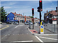
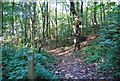
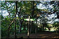
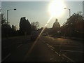
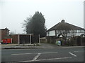
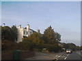
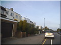
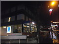
61 photos from this area
Area Information
Key information about the CR2 8RW including its size, population, and administrative classification.
- Area Type
- Postcode
- Area Size
- 9115 m²
- Population
- 1347
- Population Density
- 4398 people/km²
House Prices in CR2 8RW
26
Properties
£315,050
Average Sold Price
£86,000
Lowest Price
£580,000
Highest Price
Showing 26 properties
| Address | Type | Beds | Baths | Last Sale Price | Last Sale Date | |
|---|---|---|---|---|---|---|
| 35 Elmpark Gardens, South Croydon, CR2 8RW | Semi-detached | 3 | 1 | £496,000 | Sep 2023 | |
| 43 Elmpark Gardens, South Croydon, CR2 8RW | Retail | 3 | 1 | £580,000 | Oct 2022 | |
| 13 Elmpark Gardens, South Croydon, CR2 8RW | Terraced | 3 | 1 | £360,000 | Feb 2021 | |
| 31 Elmpark Gardens, South Croydon, CR2 8RW | house | 3 | 1 | £430,000 | Oct 2020 | |
| 19 Elmpark Gardens, South Croydon, CR2 8RW | Terraced | 3 | - | £400,000 | Oct 2019 | |
| 45 Elmpark Gardens, South Croydon, CR2 8RW | Semi-detached | 3 | 1 | £425,000 | Jul 2017 | |
| 47 Elmpark Gardens, South Croydon, CR2 8RW | house | - | - | £520,000 | Jan 2017 | |
| 11 Elmpark Gardens, South Croydon, CR2 8RW | house | 3 | 1 | £420,000 | Oct 2016 | |
| 3 Elmpark Gardens, South Croydon, CR2 8RW | Terraced | 3 | - | £370,000 | Sep 2016 | |
| 7 Elmpark Gardens, South Croydon, CR2 8RW | Terraced | 3 | 1 | £350,000 | Mar 2016 |
Page 1 of 3
Energy Efficiency in CR2 8RW
Amenities
Schools
| Rank | School | Type | Entry gender | Ages |
|---|
Explore more schools in this area
Go to Schools tabDemographics
Household Size
Family (3-5 people)
most common
Accommodation Type
Houses
most common
Tenure
86
majority
Ethnic Group
White
most common
Religion
N/A
most common
Household Composition
N/A
most common
Age
47
median
Adults (30-64 years)
most common
Household Deprivation
N/A
with no deprivation
NS-SEC
36
in Lower managerial occupations
Explore more demographic insights in this area
Go to Demographics tabPlanning
Planning Constraints
- Flood RiskPremium
- Ramsar Wetland SitesPremium
- Area of Outstanding Natural BeautyPremium
- Protected Nature ReservePremium
- Protected WoodlandPremium