Area Overview for CR2 7EP
Photos of CR2 7EP

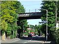
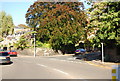
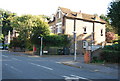
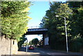
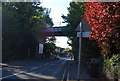
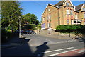
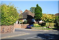
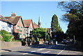

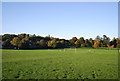
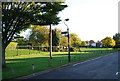
100 photos from this area
Area Information
Key information about the CR2 7EP including its size, population, and administrative classification.
- Area Type
- Postcode
- Area Size
- 7466 m²
- Population
- 1621
- Population Density
- 1915 people/km²
House Prices in CR2 7EP
35
Properties
£240,576
Average Sold Price
£45,000
Lowest Price
£355,000
Highest Price
Showing 35 properties
| Address | Type | Beds | Baths | Last Sale Price | Last Sale Date | |
|---|---|---|---|---|---|---|
| 106 Campden Road, South Croydon, CR2 7EP | Maisonette | 2 | 1 | £310,000 | Sep 2023 | |
| 70 Campden Road, South Croydon, CR2 7EP | Flat | - | - | £332,500 | Jun 2023 | |
| 82 Campden Road, South Croydon, CR2 7EP | Maisonette | 2 | 1 | £310,000 | May 2023 | |
| 56 Campden Road, South Croydon, CR2 7EP | Maisonette | 2 | 1 | £355,000 | Dec 2022 | |
| 86 Campden Road, South Croydon, CR2 7EP | Flat | - | - | £309,957 | Nov 2022 | |
| 64 Campden Road, South Croydon, CR2 7EP | Maisonette | 2 | 1 | £340,000 | Jul 2022 | |
| 100 Campden Road, South Croydon, CR2 7EP | Flat | 2 | 1 | £300,000 | Mar 2022 | |
| 114 Campden Road, South Croydon, CR2 7EP | Flat | 2 | 1 | £317,000 | Jan 2022 | |
| 62 Campden Road, South Croydon, CR2 7EP | Maisonette | 2 | 1 | £325,000 | Feb 2021 | |
| 88 Campden Road, South Croydon, CR2 7EP | Maisonette | 2 | 1 | £285,000 | Dec 2020 |
Page 1 of 4
Energy Efficiency in CR2 7EP
Amenities
Schools
| Rank | School | Type | Entry gender | Ages |
|---|
Explore more schools in this area
Go to Schools tabDemographics
Household Size
Two person
most common
Accommodation Type
Houses
most common
Tenure
75
majority
Ethnic Group
White
most common
Religion
N/A
most common
Household Composition
N/A
most common
Age
47
median
Adults (30-64 years)
most common
Household Deprivation
N/A
with no deprivation
NS-SEC
53
in Lower managerial occupations
Explore more demographic insights in this area
Go to Demographics tabPlanning
Planning Constraints
- Flood RiskPremium
- Ramsar Wetland SitesPremium
- Area of Outstanding Natural BeautyPremium
- Protected Nature ReservePremium
- Protected WoodlandPremium