Area Overview for CR2 7DB
Photos of CR2 7DB
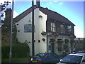
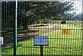
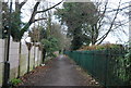
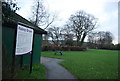
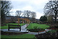
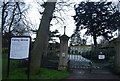
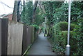
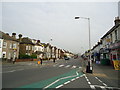
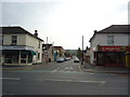
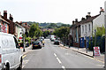
91 photos from this area
Area Information
Key information about the CR2 7DB including its size, population, and administrative classification.
- Area Type
- Postcode
- Area Size
- 9894 m²
- Population
- 1536
- Population Density
- 9815 people/km²
House Prices in CR2 7DB
47
Properties
£263,933
Average Sold Price
£50,000
Lowest Price
£588,000
Highest Price
Showing 47 properties
| Address | Type | Beds | Baths | Last Sale Price | Last Sale Date | |
|---|---|---|---|---|---|---|
| 61 Sussex Road, South Croydon, CR2 7DB | house | 2 | 1 | £408,000 | Nov 2025 | |
| 53 Sussex Road, South Croydon, CR2 7DB | Terraced | 2 | 1 | £395,000 | Dec 2024 | |
| 27 Sussex Road, South Croydon, CR2 7DB | Terraced | 2 | 1 | £415,000 | Jun 2023 | |
| 11 Sussex Road, South Croydon, CR2 7DB | Terraced | 3 | 2 | £450,000 | Dec 2022 | |
| 51 Sussex Road, South Croydon, CR2 7DB | Terraced | 2 | 1 | £337,000 | Sep 2021 | |
| 67 Sussex Road, South Croydon, CR2 7DB | Semi-detached | 3 | 1 | £368,500 | Aug 2021 | |
| 39 Sussex Road, South Croydon, CR2 7DB | house | - | - | £346,000 | Jun 2021 | |
| 55 Sussex Road, South Croydon, CR2 7DB | Terraced | 2 | 1 | £425,000 | Oct 2019 | |
| 41 Sussex Road, South Croydon, CR2 7DB | house | 3 | 1 | £365,000 | Jan 2019 | |
| 71 Sussex Road, South Croydon, CR2 7DB | Terraced | 2 | 1 | £320,000 | Jun 2018 |
Page 1 of 5
Energy Efficiency in CR2 7DB
Amenities
Schools
| Rank | School | Type | Entry gender | Ages |
|---|
Explore more schools in this area
Go to Schools tabDemographics
Household Size
Two person
most common
Accommodation Type
Houses
most common
Tenure
46
majority
Ethnic Group
White
most common
Religion
N/A
most common
Household Composition
N/A
most common
Age
47
median
Adults (30-64 years)
most common
Household Deprivation
N/A
with no deprivation
NS-SEC
42
in Lower managerial occupations
Explore more demographic insights in this area
Go to Demographics tabPlanning
Planning Constraints
- Flood RiskPremium
- Ramsar Wetland SitesPremium
- Area of Outstanding Natural BeautyPremium
- Protected Nature ReservePremium
- Protected WoodlandPremium