Area Overview for CR2 6YY
Photos of CR2 6YY

Area Information
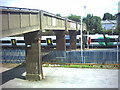
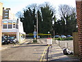
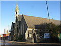
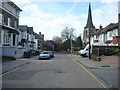
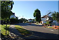
CR2 6YY is a small residential postcode in the London Borough of Croydon, situated at the southern edge of the city. With a population of 1,536, it is a compact area characterised by its historic roots and modern connectivity. The postcode lies within South Croydon, a ward that developed in the 19th century as a residential suburb from the ancient manors of Croham and Haling. Today, it balances green spaces like Croham Hurst—a 34-hectare woodland—with accessible transport links and amenities. Residents benefit from proximity to South Croydon Station, which connects to central London and beyond, while nearby trams and buses offer flexible commuting options. The area’s compact size means daily life is walkable, with shops, schools, and open spaces within easy reach. Its blend of historic charm and practical infrastructure makes it appealing to those seeking a quieter lifestyle without sacrificing convenience.
- Area Type
- Postcode
- Area Size
- Not available
- Population
- 1536
- Population Density
- 9815 people/km²
CR2 6YY is predominantly a house-based area, with 46% of residents owning their homes. This suggests a mix of owner-occupied properties and rental stock, though the exact proportion of rental homes is not specified. The focus on houses rather than flats or apartments may appeal to those prioritising space and private gardens. Given the postcode’s small size, the housing stock is limited, meaning buyers may need to consider nearby areas for a broader selection. The 46% home ownership rate also indicates a significant portion of the market is rental-focused, potentially offering opportunities for investors or those seeking short-term lets. For buyers, the area’s compact nature means proximity to amenities is a key selling point, though competition for properties may be higher due to its desirability.
House Prices in CR2 6YY
No properties found in this postcode.
Energy Efficiency in CR2 6YY
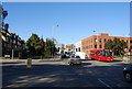
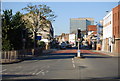
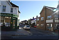
CR2 6YY offers a blend of convenience and green space, with amenities within practical reach. Retail options include major supermarkets like Tesco and Sainsburys, as well as the Co-op, ensuring easy access to groceries and daily essentials. The area’s transport links—rail, tram, and road—facilitate quick travel to central London or nearby suburbs. Nearby Croham Hurst, a 34-hectare woodland, provides a peaceful retreat for walking, jogging, or relaxation. The historic Croham Manor Road conservation area adds character, while local schools and community hubs support family life. The presence of multiple transport options and retail outlets means residents can enjoy both urban convenience and natural surroundings, making daily life efficient and enjoyable.
Amenities
Schools
The nearest school to CR2 6YY is Harris Primary Academy Haling Park, a primary school with an Ofsted rating of outstanding. This high rating reflects strong educational standards and effective teaching, making it a key draw for families. While the data does not list secondary schools, the presence of a top-rated primary suggests a focus on early education. The school’s location within practical reach of residents underscores the area’s appeal to households prioritising quality schooling. Families may also benefit from nearby institutions like Whitgift School, though this is not explicitly detailed in the data. The availability of an outstanding primary school enhances the area’s attractiveness, particularly for those seeking a stable educational environment for young children.
| Rank | School | Type | Entry gender | Ages |
|---|
Explore more schools in this area
Go to Schools tabDemographics
The median age in CR2 6YY is 47, with the most common age range being adults aged 30–64. This suggests a community of established professionals and families, rather than a younger or elderly demographic. Home ownership stands at 46%, indicating that nearly half of residents rent their homes, which may reflect the area’s mix of private and rental properties. The predominant accommodation type is houses, aligning with the postcode’s residential character. The majority of the population identifies as White, though specific data on diversity is not provided. The age profile implies a stable, long-term resident base, with fewer transient populations. This demographic structure supports a community-oriented environment, where local amenities and schools cater to a mix of household types, from single occupants to families.
Household Size
Accommodation Type
Tenure
Ethnic Group
Religion
Household Composition
Age
Household Deprivation
NS-SEC
Explore more demographic insights in this area
Go to Demographics tabPlanning
Planning Constraints
- Flood RiskPremium
- Ramsar Wetland SitesPremium
- Area of Outstanding Natural BeautyPremium
- Protected Nature ReservePremium
- Protected WoodlandPremium