Area Overview for CR2 6NY
Photos of CR2 6NY
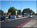
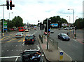
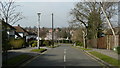
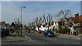
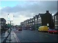
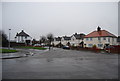
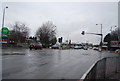
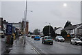
95 photos from this area
Area Information
Key information about the CR2 6NY including its size, population, and administrative classification.
- Area Type
- Postcode
- Area Size
- 5485 m²
- Population
- Not available
- Population Density
- Not available
House Prices in CR2 6NY
37
Properties
£198,185
Average Sold Price
£66,395
Lowest Price
£315,000
Highest Price
Showing 37 properties
| Address | Type | Beds | Baths | Last Sale Price | Last Sale Date | |
|---|---|---|---|---|---|---|
| 50 Waldronhyrst, South Croydon, CR2 6NY | Flat | 2 | 1 | £285,000 | Jan 2025 | |
| 60 Waldronhyrst, South Croydon, CR2 6NY | Flat | - | - | £255,000 | Dec 2024 | |
| 4 Waldronhyrst, South Croydon, CR2 6NY | Flat | 2 | 1 | £286,000 | Dec 2022 | |
| 52 Waldronhyrst, South Croydon, CR2 6NY | Flat | - | - | £276,000 | Jun 2022 | |
| 48 Waldronhyrst, South Croydon, CR2 6NY | Flat | - | - | £315,000 | Dec 2020 | |
| 44 Waldronhyrst, South Croydon, CR2 6NY | Flat | - | - | £242,000 | Oct 2019 | |
| 2 Waldronhyrst, South Croydon, CR2 6NY | Flat | 4 | - | £295,000 | Nov 2018 | |
| 10 Waldronhyrst, South Croydon, CR2 6NY | Flat | - | - | £240,000 | May 2018 | |
| 20 Waldronhyrst, South Croydon, CR2 6NY | Flat | 2 | 1 | £290,000 | Sep 2017 | |
| 8 Waldronhyrst, South Croydon, CR2 6NY | Flat | - | - | £270,000 | Mar 2016 |
Page 1 of 4
Energy Efficiency in CR2 6NY
Amenities
Schools
| Rank | School | Type | Entry gender | Ages |
|---|
Explore more schools in this area
Go to Schools tabDemographics
Household Size
One person
most common
Accommodation Type
Flats
most common
Tenure
48
majority
Ethnic Group
White
most common
Religion
N/A
most common
Household Composition
N/A
most common
Age
47
median
Adults (30-64 years)
most common
Household Deprivation
N/A
with no deprivation
NS-SEC
33
in Lower managerial occupations
Explore more demographic insights in this area
Go to Demographics tabPlanning
Planning Constraints
- Flood RiskPremium
- Ramsar Wetland SitesPremium
- Area of Outstanding Natural BeautyPremium
- Protected Nature ReservePremium
- Protected WoodlandPremium