Area Overview for CR2 6NS
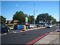
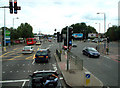
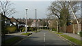
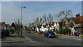
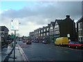
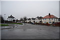
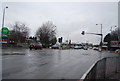
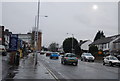
Photos of CR2 6NS
Area Information
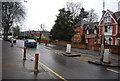
CR2 6NS defines a compact residential cluster within the wider Waddon neighbourhood of Croydon. This specific postcode covers 4600 square metres of densely occupied space, home to 1758 residents. The location sits at the western end of Croydon town, bordering the London Borough of Sutton. The area carries historic significance, tracing its origins to a manor first recorded in the twelfth century. The name derives from Old English roots referring to a hill where woad grows. Life in this small sector is shaped by its position near Waddon railway station, which opened in 1863 on the London to Epsom branch line. Residents benefit from proximity to the former Croydon Airport site, now a commercial area. The postcode area offers direct access to the River Wandle and Wandle Park, opened in 1890. Living in CR2 6NS means engaging with a community that has deep industrial roots, including historical sites like the Waddon Hotel and the adjacent Waddon Ponds. The environment combines modern connectivity with heritage features like the historic Hare and Hounds pub, first opened in 1773. Daily life centres around the Purley Way (A23) and local council housing estates built between the wars.
- Area Type
- Postcode
- Area Size
- 4600 m²
- Population
- Not available
- Population Density
- Not available
The housing stock in CR2 6NS is dominated by flats. This accommodation type suits the high density of 382161 people per square kilometre found within this 4600 square metre zone. Approximately 48% of homes here are owner-occupied, while the remainder are likely rented properties. This split indicates a mixture of local families who have stayed through different life stages and newcomers attracted by the location. Prospective buyers looking at CR2 6NS should expect a compact market. The area is part of the Waddon ward, a historic manor with roots in the twelfth century. The property landscape mirrors the wider South Croydon and Waddon estate dynamics. You will find homes near key landmarks like Waddon railway station and the Purley Way (A23). The presence of council housing estates, built inter-war on Mitcham Road and Waddon, influences the street character. Ownership patterns suggest stability, as nearly half the residents hold their titles. The flat-based construction offers lower barriers to entry compared to detached houses elsewhere in Croydon. This housing type aligns with the needs of the predominant 30 to 64-year-old age group. Buyers must consider that plots are small, so elevations and shared walls are standard in this postcode.
House Prices in CR2 6NS
Showing 5 properties
| Address | Type | Beds | Baths | Last Sale Price | Last Sale Date | |
|---|---|---|---|---|---|---|
| Haling Park Care Home, 46 Bramley Hill, South Croydon, CR2 6NS | Retirement | - | - | £12,950,000 | Jun 2021 | |
| 40 Bramley Hill, South Croydon, CR2 6NS | Detached | 3 | 1 | £428,500 | Aug 2015 | |
| 40A Bramley Hill, South Croydon, CR2 6NS | Detached | 4 | 2 | - | - | |
| Trees, 40B Bramley Hill, South Croydon, CR2 6NS | Detached | - | - | - | - | |
| Bramley Hall Brethren, 40C Bramley Hill, South Croydon, CR2 6NS | community_day_centre | - | - | - | - |
Energy Efficiency in CR2 6NS
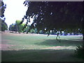
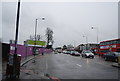
Access to amenities within reach of CR2 6NS is strong and varied. You have five retail outlets nearby, including Tesco Croydon, Co-op London, and Sainsburys Croydon. These shops provide daily necessities within a short walk. Transport links are equally dense, with five rail stations and five tram stops accessible. South Croydon Station, Waddon, and East Croydon Railway Station offer fast train connections to central London. For leisure, residents can reach Wandle Park and various tram stops such as the Church Street Tram Stop and Wandle Park Tram Stop. The historic Hare and Hounds pub, opened in 1773, offers evening dining or drinks. The area also features anthropological interest with the former Waddon Court Estate and mills on the River Wandle. Waddon Ponds remain a protected historic site. Shopping habits can centre on the Stafford Parade, dating from 1928, while historical culture is rooted in the Waddon Hotel and gasworks history. Life here blends 19th-century industrial heritage with modern shopping conveniences.
Amenities
Schools
Whitgift School stands as the notable independent school nearest to CR2 6NS. This institution serves the educational needs of families residing in the area. The school offers a private education option within close reach of the residential cluster. When considering living in CR2 6NS, families have this key independent provider nearby. The independent nature of Whitgift School typically implies a distinct curriculum and fee-based structure. The presence of a well-regarded independent school alongside the wider catchment areas of Croydon provides choice for residents. You do not have a comprehensive list of state schools in the immediate data, focusing solely on Whitgift School as the primary named facility. This lack of other specific state listings suggests that local families rely heavily on this single independent option or seek education elsewhere in the borough. The school's independent status means it operates outside the standard state system, offering an alternative approach to secondary education.
| Rank | School | Type | Entry gender | Ages |
|---|
Explore more schools in this area
Go to Schools tabDemographics
The community in CR2 6NS reflects a population with a median age of 47 years. Adults between 30 and 64 years represent the most common age range. This demographic skew indicates a settlement often favoured by established residents or those seeking stability rather than a transient student market. Approximately 48% of households are owner-occupiers, suggesting a balanced market between buyers and renters. The predominant ethnic group is White, aligning with the broader profile of many historic Croydon wards. Accommodation in this specific postcode is primarily flats. This housing preference fits the high population density, recorded at 382161 people per square kilometre. Such density is typical for inner London wards where planning constraints limit ground-floor expansion. The high concentration of residents in a 4600 square metre area creates a close-knit living environment. However, this density means spaces are shared and noise levels can reflect city central dynamics. The age profile suggests a need for amenities catering to mature adults, such as healthcare access or quieter green spaces nearby. The mix of ownership types provides flexibility for different household structures.
Household Size
Accommodation Type
Tenure
Ethnic Group
Religion
Household Composition
Age
Household Deprivation
NS-SEC
Explore more demographic insights in this area
Go to Demographics tabPlanning
Planning Constraints
- Flood RiskPremium
- Ramsar Wetland SitesPremium
- Area of Outstanding Natural BeautyPremium
- Protected Nature ReservePremium
- Protected WoodlandPremium