Area Overview for CR2 6JT
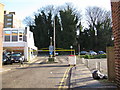
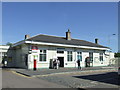
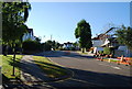
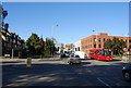
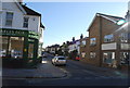
Photos of CR2 6JT


Area Information
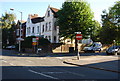
CR2 6JT represents a tightly knit residential cluster on the southern edge of London, situated within the historic county of Surrey. This specific postcode covers an area of just 3304 square metres, hosting a population of 1536 people. The location is defined by its intimate scale and residential focus, offering a sense of place that differs from the broader sprawl of the London Borough of Croydon. While the area lies south of central Croydon, it draws strength from its historic roots. South Croydon emerged as a distinct suburb in the 19th century, developing from the ancient manors of Croham and Haling. The Whitgift Foundation purchased land in this region in 1601, establishing a legacy that continues to influence the neighbourhood today. You will find yourself living in a space that balances modern convenience with deep historical character. The area is part of a ward that saw significant changes, including wartime bombing and subsequent rebuilding, adding layers to its community story. Residents here benefit from proximity to open spaces like Croham Hurst, a 34-hectare woodland area acquired in 1901. The small footprint of CR2 6JT ensures that daily life revolves around local convenience rather than distant commutes. You are close to the historic Croham Manor Road conservation area, adding architectural interest to your surroundings. This postcode is ideal for those seeking a defined residential environment within a larger borough structure.
- Area Type
- Postcode
- Area Size
- 3304 m²
- Population
- 1536
- Population Density
- 9815 people/km²
The property market within CR2 6JT is defined by its specific housing stock and ownership patterns. Houses dominate the area, reflecting a preference for detached or semi-detached living over high-rise flats. Approximately 46% of residents own their homes outright or with a mortgage, suggesting a strong property market rooted in long-term residence rather than short-term letting. This high proportion of owner-occupiers typically results in well-maintained properties and a stable neighbourhood fabric. When you look for homes in this postcode, you are likely to find established residences rather than new builds. The small geographic size of the area means that property choices are limited but curated. This concentration of houses appeals to buyers who value space and privacy over the density of city living. The accommodation type data confirms that you will not find an apartment-heavy environment here; instead, the architecture supports families and couples seeking a house in the suburbs. This market structure often leads to competitive pricing for those wishing to move into the area, as owners tend to protect the value of their properties. The restrictions on new development in such small, established clusters can maintain property values over time. Buyers should approach this market with an understanding that inventory moves slower in owner-occupied zones, but the assets held tend to be high quality.
House Prices in CR2 6JT
Showing 30 properties
| Address | Type | Beds | Baths | Last Sale Price | Last Sale Date | |
|---|---|---|---|---|---|---|
| 21 Wilson Close, South Croydon, CR2 6JT | Flat | - | - | - | - | |
| 1 Wilson Close, South Croydon, CR2 6JT | Flat | - | - | - | - | |
| 5 Wilson Close, South Croydon, CR2 6JT | Flat | - | - | - | - | |
| 4 Wilson Close, South Croydon, CR2 6JT | Flat | - | - | - | - | |
| 16 Wilson Close, South Croydon, CR2 6JT | Flat | - | - | - | - | |
| 17 Wilson Close, South Croydon, CR2 6JT | Flat | - | - | - | - | |
| 6 Wilson Close, South Croydon, CR2 6JT | Flat | - | - | - | - | |
| 25 Wilson Close, South Croydon, CR2 6JT | Flat | - | - | - | - | |
| 7 Wilson Close, South Croydon, CR2 6JT | Flat | - | - | - | - | |
| 13 Wilson Close, South Croydon, CR2 6JT | Flat | - | - | - | - |
Energy Efficiency in CR2 6JT
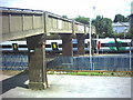
Living in CR2 6JT places you within practical reach of several key amenities. For retail needs, you are close to Tesco Croydon, Sainsburys Croydon, and the Co-op London. These major supermarkets ensure you can find essential groceries and household goods without needing to travel far. Transport links are equally convenient, with five rail options nearby including South Croydon Station and East Croydon Railway Station. These stations provide vital connections for commuters heading into Greater London. Additionally, five metro stops such as Lloyd Park Tram Stop and George Street Tram Stop offer alternative routing. Two airports, Biggin Hill Airport and London Biggin Hill Airport, are located in the neighbourhood, serving both private and commercial aviation needs. Access to Croham Hurst offers a 34-hectare space for walking and enjoying nature without leaving the area. The historic Whitgift School is linked to the local heritage, and you can explore the Croham Manor Road conservation area for architectural interest. This blend of retail giants and historic sites creates a balanced lifestyle where convenience and culture coexist.
Amenities
Schools
Families considering CR2 6JT have access to a specific selection of educational facilities. Harris Primary Academy Haling Park is the notable primary school nearest to this postcode. This institution holds an outstanding Ofsted rating, a distinction that reflects its high standard of education and safeguarding. While there are no secondary schools explicitly listed in the immediate vicinity of this specific postcode, the presence of an outstanding primary school is a significant benefit. You may need to look beyond this immediate cluster for secondary education options, but the foundation for early learning is clearly secure. The mix of school types in the wider area means you have a clear starting point for your children, but planning ahead for secondary placement is advisable. The outstanding rating of Harris Primary Academy Haling Park makes it a key advantage for families settling in CR2 6JT.
| Rank | School | Type | Entry gender | Ages |
|---|
Explore more schools in this area
Go to Schools tabDemographics
The community in CR2 6JT is characterised by a mature demographic profile. The median age across this postal sector is 47 years, indicating a population dominated by adults between 30 and 64 years of age. This age profile suggests a neighbourhood where residents are likely further along in their careers or raising families. Home ownership stands at 46%, creating a mixed but substantial owner-occupied market. The predominant form of accommodation consists of houses, which aligns with the ownership figures and appeals to those seeking traditional living arrangements. The ethnic makeup is predominantly White, reflecting the established nature of the local community. You can expect a stable environment where long-term residents form the backbone of daily life. These demographic facts indicate a quiet, settled atmosphere rather than a transient or rapidly developing zone. The concentration of households of this age group often correlates with lower crime rates and community cohesion, though local data identifies a medium crime risk. The housing stock is primarily occupied by families and individuals in their prime earning or retirement years. This concentration of adult residents creates a calm residential environment where the focus remains on stability and established neighbourhood ties rather than rapid turnover or student influx.
Household Size
Accommodation Type
Tenure
Ethnic Group
Religion
Household Composition
Age
Household Deprivation
NS-SEC
Explore more demographic insights in this area
Go to Demographics tabPlanning
Planning Constraints
- Flood RiskPremium
- Ramsar Wetland SitesPremium
- Area of Outstanding Natural BeautyPremium
- Protected Nature ReservePremium
- Protected WoodlandPremium