Area Overview for CR2 6FA
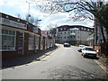
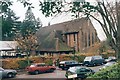
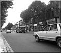
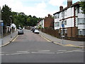
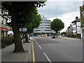
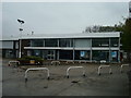
Photos of CR2 6FA

Area Information
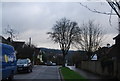
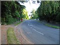
Living in CR2 6FA offers a distinct experience within the London Borough of Croydon, situated as part of the Purley Oaks and Riddlesdown electoral ward. This specific postcode covers a small residential cluster measuring just 973 square metres, yet it serves a population of 1,530 individuals. The location lies approximately 11.7 miles south of Charing Cross, bordering areas such as Purley, Sanderstead, Waddon, Kenley, Coulsdon, and Woodcote. Historically part of Surrey until 1965 when the London Government Act transferred control to Croydon, the ward was formally reorganised in 2018.你将在这里找到 proximity to key landmarks including Riddlesdown Common, which features woodland managed by Croydon Council and the John Whitgift Foundation. As per the Croydon Local Plan 2018, the wider area falls within an Archaeological Priority Area. Daily life here is defined by access to five railway stations, five tram stops, two airports, and major retailers like Costco Croydon. While the physical footprint is compact, the definition of neighbourhood extends well beyond the immediate cluster to include the broader Purley postal district. Residents benefit from a setting that blends residential convenience with access to significant transport hubs and green spaces. Shopping options include Tesco Sanderstead and Sainsburys Purley, ensuring practical needs are met without extensive travel.
- Area Type
- Postcode
- Area Size
- 973 m²
- Population
- Not available
- Population Density
- Not available
The property market in CR2 6FA reflects a stable, owner-occupied environment. With 60 per cent home ownership, the area is less reliant on the rental sector compared to many parts of London. The predominant accommodation type is houses, aligning with the statistic that this postcode covers a small residential cluster within a broader historical ward. This housing mix suggests a landscape of detached or semi-detached homes rather than high-density flats. Buyers considering this area will find it geared towards those wishing to purchase a house rather than navigate the competitive flat market often found in central Croydon. The fact that this postcode is a small cluster within the larger Purley Oaks and Riddlesdown ward implies that supply may be limited in terms of specific listings for the exact CR2 6FA code, although the whole ward offers access to a larger stock of houses. The high rate of owner occupation often indicates steadier property values compared to rental-heavy zones. Potential buyers should expect a market characterised by established estates. The accommodation type data confirms a focus on traditional housing forms, appealing to those who prefer garden space and standalone structures over urban sociability or high-rise living.
House Prices in CR2 6FA
Showing 9 properties
Energy Efficiency in CR2 6FA
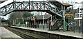
Residents of CR2 6FA enjoy convenient access to a variety of amenities within practical reach. Retail options include five locations, with notable venues such as Tesco Sanderstead, Sainsburys Purley, and Costco Croydon available for grocery and household needs. Transport links are extensive, featuring five railway stations and five tram stops, ensuring mobility across the borough. Aviation proximity is another lifestyle factor, with two airports located nearby, including London Biggin Hill Airport and Biggin Hill Airport. Green space is accessible through Riddlesdown Common, a woodland area managed by Croydon Council and the John Whitgift Foundation. The area borders Purley, Sanderstead, Waddon, Kenley, Coulsdon, and Woodcote, providing a wide residential hinterland. Dining and leisure facilities are supported by these retail and transport nodes. While the postcode itself is small, the lifestyle it affords is backed by the surrounding infrastructure of the Purley Oaks and Riddlesdown ward.
Amenities
Schools
Families living in or near CR2 6FA have access to two named institutions in the immediate vicinity. The Croydon and District Education Trust (Cadet) operates as an independent school, offering a private education option. Nearby, the Croydon & District Education Trust also functions as an independent school. Both facilities cater to families seeking private education within the Croydon area. There are no state-maintained schools listed directly adjacent to this specific postcode cluster in the provided information. This absence indicates that local families may look further afield for state education or rely heavily on the independent sector. The presence of two independent institutions suggests an area where cost is a secondary consideration to educational philosophy for some parents. Potential homebuyers must plan their schooling strategy carefully given the exclusive nature of the listed options. These schools serve the wider neighbourhood but represent the only formal educational entries for this location.
| Rank | School | Type | Entry gender | Ages |
|---|
Explore more schools in this area
Go to Schools tabDemographics
The community in CR2 6FA is defined by a mature demographic structure. The median age stands at 47 years, with the most common age range being adults aged 30 to 64 years. This concentration of working-age adults suggests a neighbourhood often favoured by those seeking stability over rapid urban growth. Home ownership is prevalent, accounting for 60 per cent of households in this cluster. This statistic indicates a established residential environment where many residents have purchased local properties rather than renting. The predominant accommodation type consists of houses, reinforcing the suburban character of the ward. Demographically, the area is predominantly White. These figures describe a settled community where long-term residents likely play a significant role in the local dynamic. The high home ownership rate correlates with the prevalence of houses, pointing towards a market driven by family homes or period properties. The concentration of adults between 30 and 64 years suggests that schools and child-centric facilities are important considerations for potential buyers, even if the immediate family unit leans towards having older children or none at all. The demographic profile reflects a neighbourhood that has taken shape over decades rather than developing rapidly in the last five years.
Household Size
Accommodation Type
Tenure
Ethnic Group
Religion
Household Composition
Age
Household Deprivation
NS-SEC
Explore more demographic insights in this area
Go to Demographics tabPlanning
Planning Constraints
- Flood RiskPremium
- Ramsar Wetland SitesPremium
- Area of Outstanding Natural BeautyPremium
- Protected Nature ReservePremium
- Protected WoodlandPremium