Area Overview for CR2 6EH
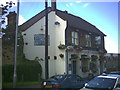
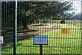
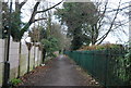
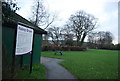
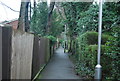
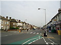
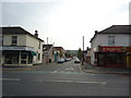
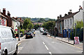
Photos of CR2 6EH
Area Information
The postcode cluster CR2 6EH represents a compact residential zone covering just over three thousand square metres. This small footprint houses a population of 1,721 people, creating a tightly knit environment where neighbours are often familiar to one another. The area sits within the London Borough of Croydon, historically linked to the ancient manors of Croham and Haling. While the immediate postcode is small, it connects to the broader South Croydon narrative, a ward that developed as a 19th-century suburb from land purchased by the Whitgift Foundation in 1601. Residents benefit from the local history of this region, which includes the nearby Croham Hurst woodland and the historic Whitgift School established in 1596. Living in South Croydon offers a blend of suburban tranquility and access to the city's infrastructure. The density of 555,887 people per square kilometre reflects the concentrated nature of this specific cluster, ensuring that essential services and community spaces are within a short walk. This location balances the quiet feel of a small residential group with the practical advantages of being situated on London's southern edge, offering a home for those seeking a defined community rather than a sprawling district.
- Area Type
- Postcode
- Area Size
- 3096 m²
- Population
- 1721
- Population Density
- 8857 people/km²
The property market in CR2 6EH is defined by a significant existing owner base. Sixty per cent of residents own their homes, creating a stable market with fewer transient tenants compared to rental hubs. This high ownership rate typically means lower property turnover and established local networks. The primary accommodation type consists of houses, which aligns with the designation of the area as a residential cluster covering 3,096 square metres. Prospective buyers looking at homes in CR2 6EH should anticipate encountering traditional house structures rather than high-rise developments. This housing stock reflects the area's development from land in the ancient manors of Croham and Haling. The dominance of houses supports a lifestyle centred around private gardens and character properties. Owners in this postcode benefit from a stable investment environment where long-term residents are the norm. The market here is less volatile than areas driven by pure rental yields. When assessing the value of properties in this small cluster, the prevalence of house ownership ensures that selling dynamics depend more on local estate agent activity than on widespread tenant displacement.
House Prices in CR2 6EH
Showing 16 properties
| Address | Type | Beds | Baths | Last Sale Price | Last Sale Date | |
|---|---|---|---|---|---|---|
| 169 Brighton Road, South Croydon, CR2 6EH | Terraced | 3 | 1 | £428,000 | May 2025 | |
| 163 Brighton Road, South Croydon, CR2 6EH | Maisonette | 2 | 1 | £356,000 | Jul 2021 | |
| 165 Brighton Road, South Croydon, CR2 6EH | Terraced | 3 | 1 | £403,000 | Nov 2016 | |
| 161 Brighton Road, South Croydon, CR2 6EH | Flat | - | - | £116,500 | Feb 2008 | |
| 171A BRIGHTON ROAD, South Croydon, CR2 6EH | Flat | 2 | - | £142,000 | May 2002 | |
| 147A Brighton Road, South Croydon, CR2 6EH | Flat | - | - | - | - | |
| 171 Brighton Road, South Croydon, CR2 6EH | retail_financial | - | - | - | - | |
| First Floor Flat, 173 Brighton Road, South Croydon, CR2 6EH | Flat | - | - | - | - | |
| Ground Floor Flat, 151 Brighton Road, South Croydon, CR2 6EH | Flat | - | - | - | - | |
| First Floor Flat, 151 Brighton Road, South Croydon, CR2 6EH | Flat | - | - | - | - |
Energy Efficiency in CR2 6EH
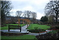
Daily life in CR2 6EH is supported by a convenient array of amenities within practical reach. Five supermarket options serve the retail needs of locals, including Sainsburys Croydon, Tesco Croydon, and Co-op London. These venues are located near South Croydon Station, ensuring shoppers have multiple choices for groceries. Transport enthusiasts will find five rail options nearby, connecting South Croydon, Sanderstead, and Purley Oaks. The tram system adds further flexibility with stops at Lloyd Park, George Street, and Church Street. For leisure and aviation, two airports, Biggin Hill Airport and London Biggin Hill Airport, sit close by for those requiring flight access. The area benefits from the historic presence of Croham Hurst, a 34-hectare woodland area acquired in 1901. This open space offers a natural retreat for walks and relaxation near the conservation area of Croham Manor Road. The historic South Croydon bus garage, opened in 1916, continues to operate TfL services, reinforcing the area's transport legacy. Shopping, dining, and leisure activities are accessible with minimal travel time. Residents can walk to supermarkets or catch a tram to explore wider London.
Amenities
Schools
| Rank | School | Type | Entry gender | Ages |
|---|
Explore more schools in this area
Go to Schools tabDemographics
Community analysis of CR2 6EH reveals a mature and stable neighbourhood. The median age stands at 47 years, with the most common age range falling between 30 and 64 years. This demographic profile suggests an area dominated by families and individuals in their mid-life years. Home ownership is a strong feature of this community, with 60% of residents owning their property outright and paying off mortgages. The remaining 40% likely consist of tenants, buy-to-land investors, or those still acquiring their first homes. The predominant ethnic group is White, reflecting the traditional demographic makeup of this part of Croydon. Homes in this postcode primarily consist of houses, which aligns with the older residential character of the South Croydon area. This housing stock contrasts with high-density flats found near the city centre. The age distribution and high ownership rate indicate low turnover and long-term settled residents. These figures suggest a community where neighbours interact frequently and local institutions have deep roots. Adults in the 30 to 64 bracket form the backbone of this population, driving demand for family-sized homes and gardening spaces.
Household Size
Accommodation Type
Tenure
Ethnic Group
Religion
Household Composition
Age
Household Deprivation
NS-SEC
Explore more demographic insights in this area
Go to Demographics tabPlanning
Planning Constraints
- Flood RiskPremium
- Ramsar Wetland SitesPremium
- Area of Outstanding Natural BeautyPremium
- Protected Nature ReservePremium
- Protected WoodlandPremium